MessMate Farm
Vic, Australia
22/12/24 04:08:00
Lightning stats as provided by
Blitzortung, with contributions
from the detector at this site.
| Stats from the local unit | |
|
|
Local - Myblitzortung |
|
|
Local - Antenna Signals |
| Stats from other units | |
|
|
gerbolds Signals |
|
|
vk2hims Signals |
| Parent sites | |
|
|
Blitzortung.org |
|
|
LightningMaps.org |
Environmental stats as provided by
an A3 monitor from uRADMonitor.
"Gamma radiation, formaldehyde, CO2,
tVOC Air quality +temperature,
barometric pressure, air humidity,
and a laser scattering sensor for
PM2.5 particulate matter.
| Local Environmental Stats | |
|
|
Local - uRADMonitor |
| Offsite Environmental Stats | |
|
|
Remote - @ Beelbangerau |
|
Remote - @ Delungra |
| Stats from uRADMonitor site | |
|
|
uRAD Dashboard |
|
|
uRAD Graphs |
Seismology stats as provided by
a Raspberry Shake unit.
"From local tremors, traffic rumbling by,
fracking & quarry explosions
and perhaps nuclear testing?
AND...
the BIG earthquakes from half a world away!
| Local Shake Stats | |
|
|
Local - MyShake |
|
|
Main - This station AM.RC98F |
| Other Stations | |
|
|
Local - RAA90 |
|
|
Main - Tasmanian station AM.RAA90 |


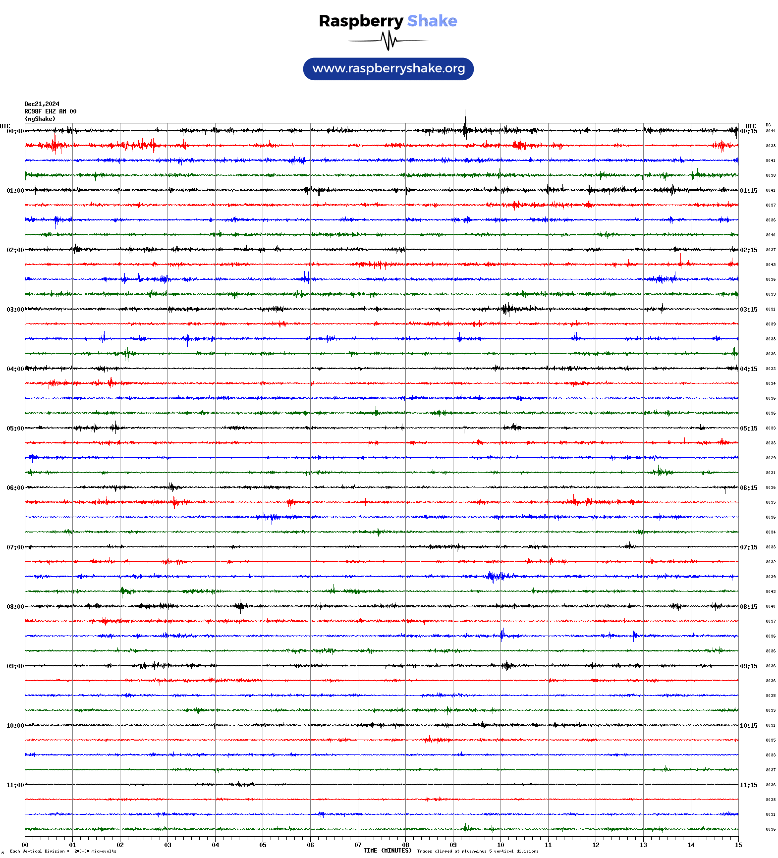
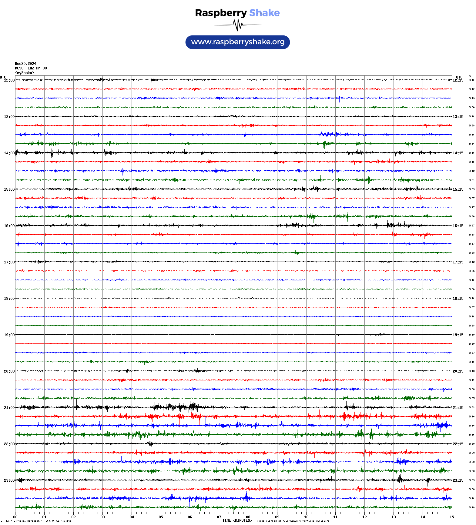
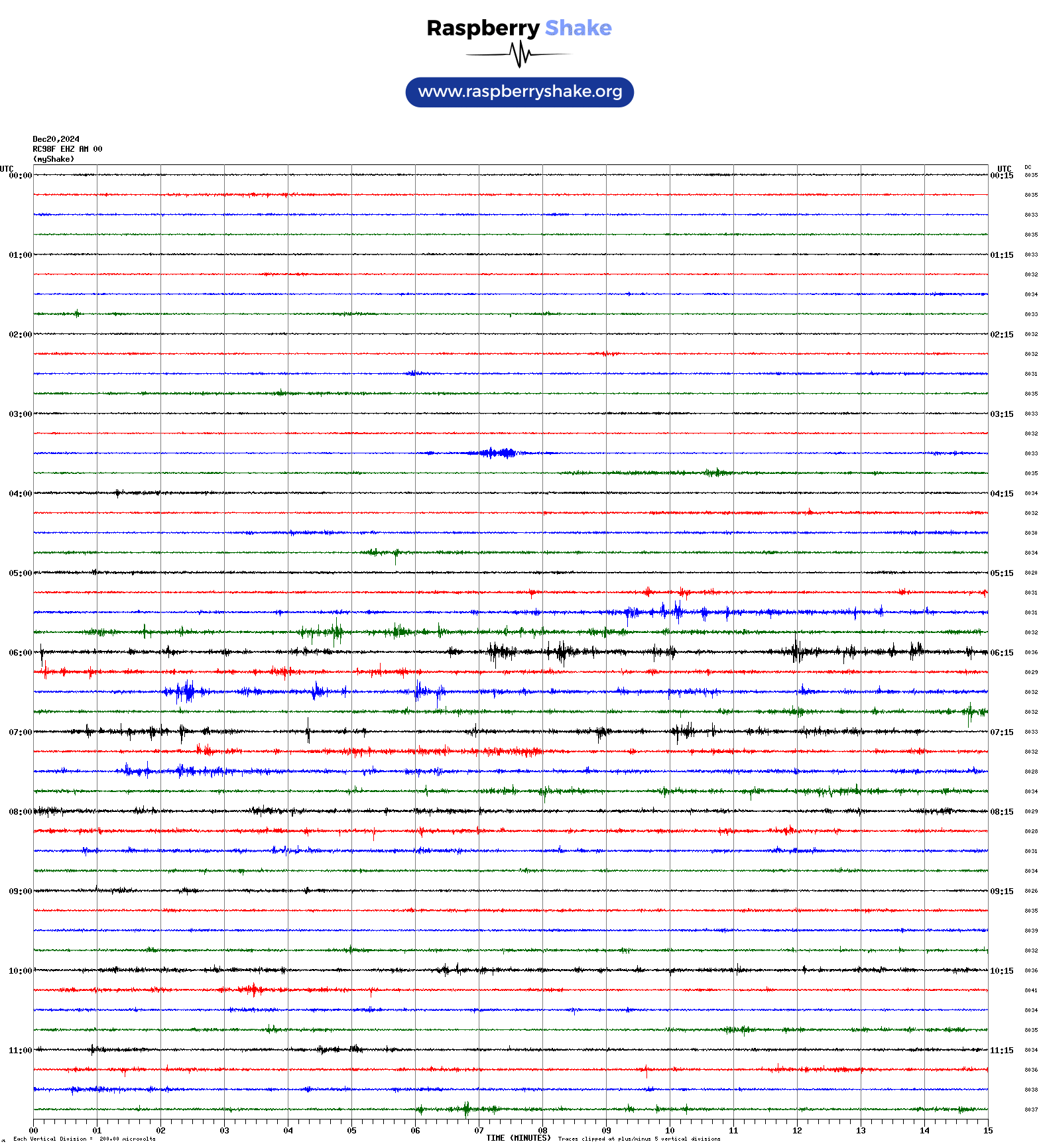
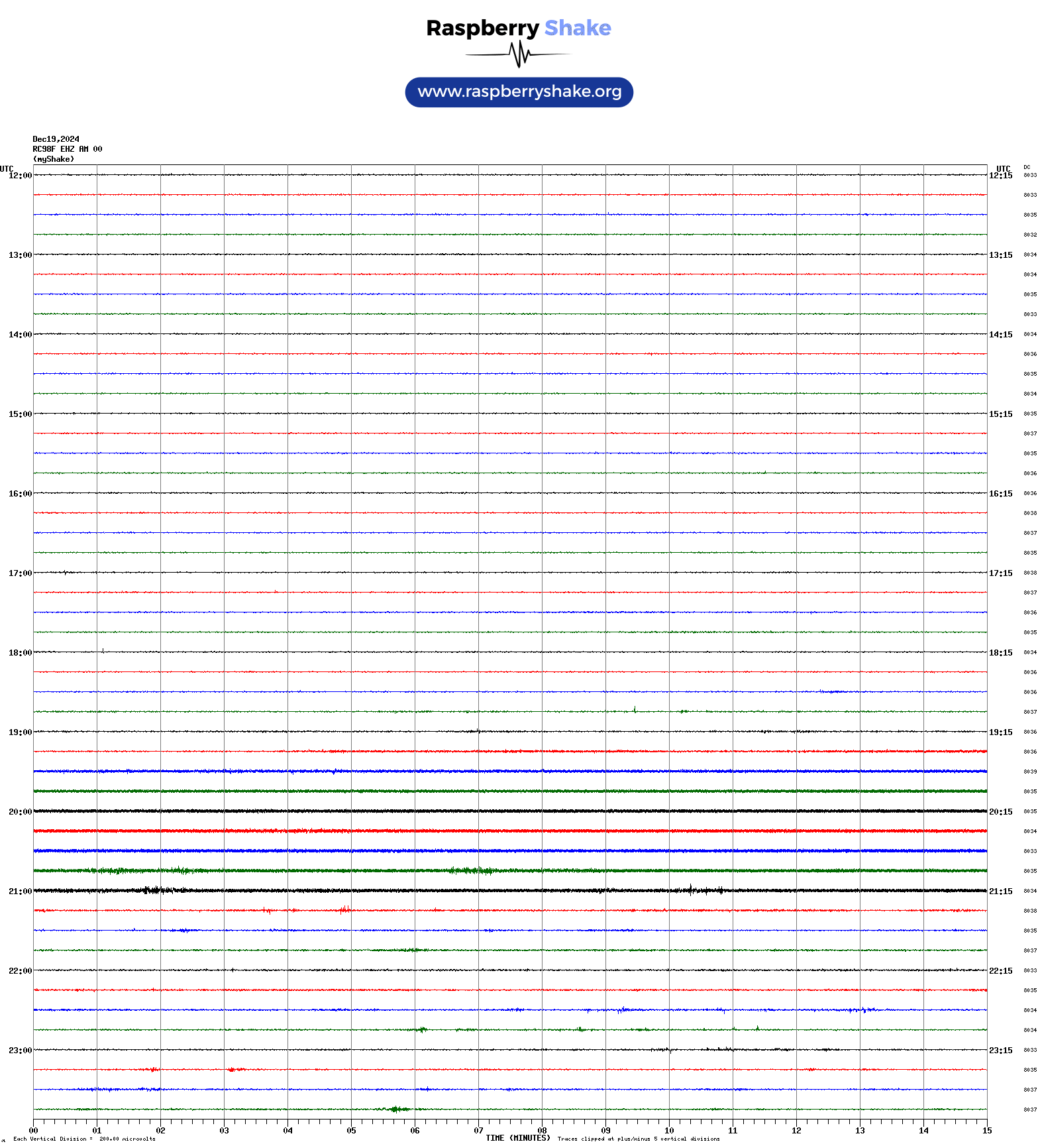
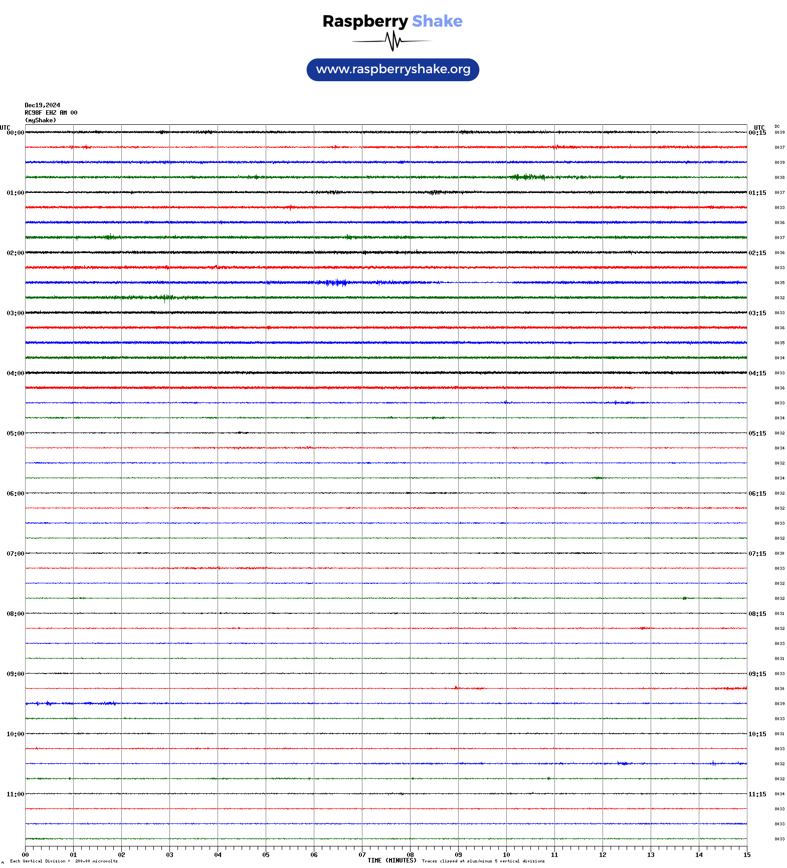
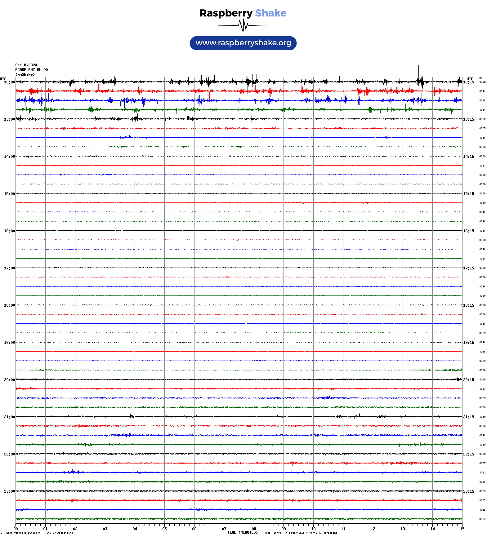
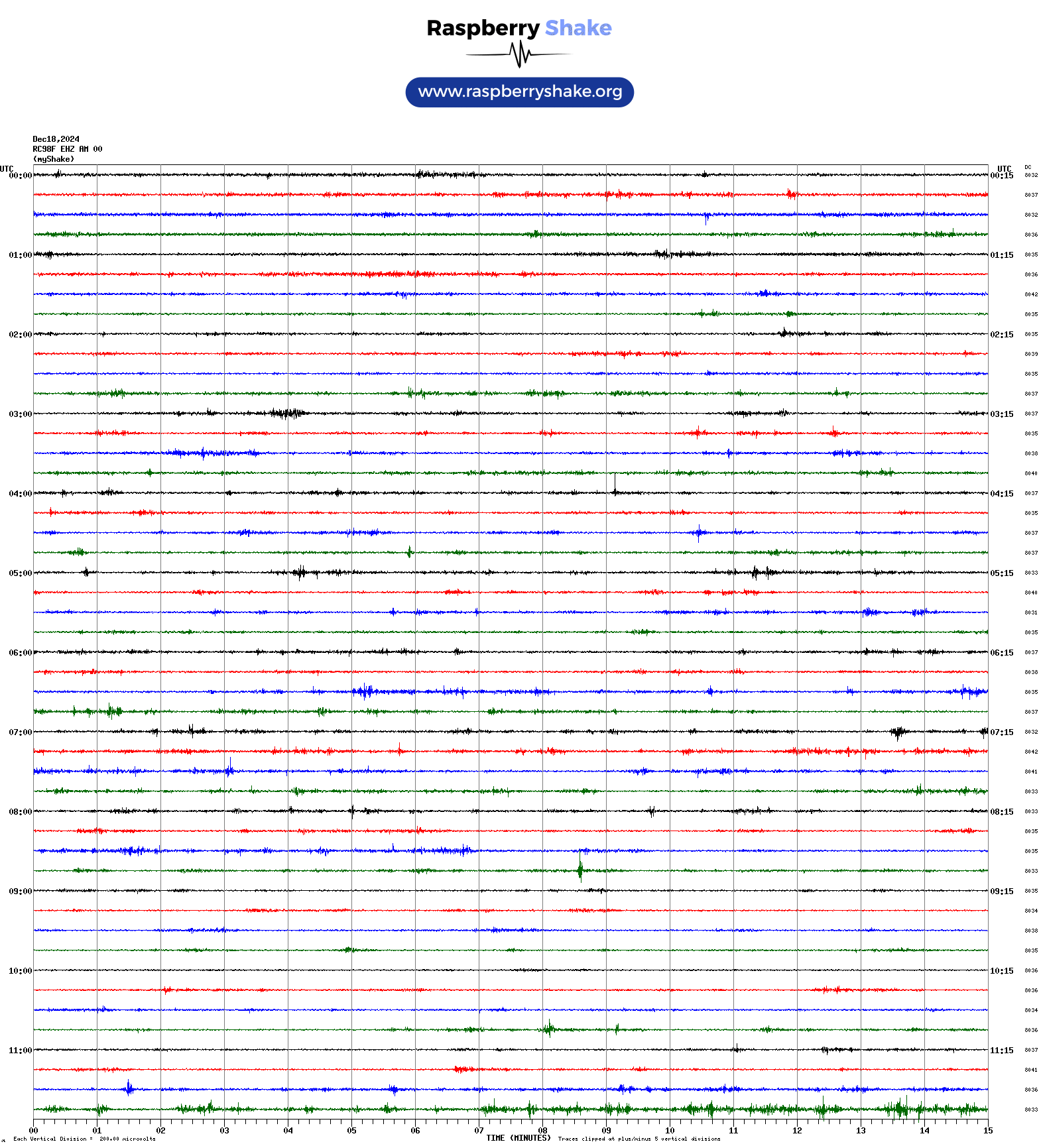
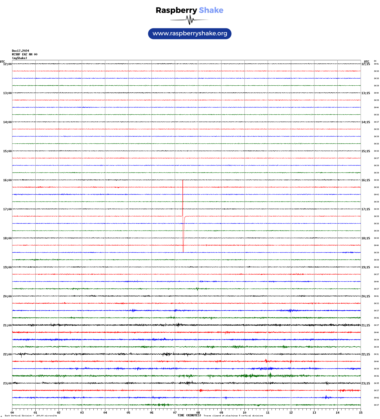
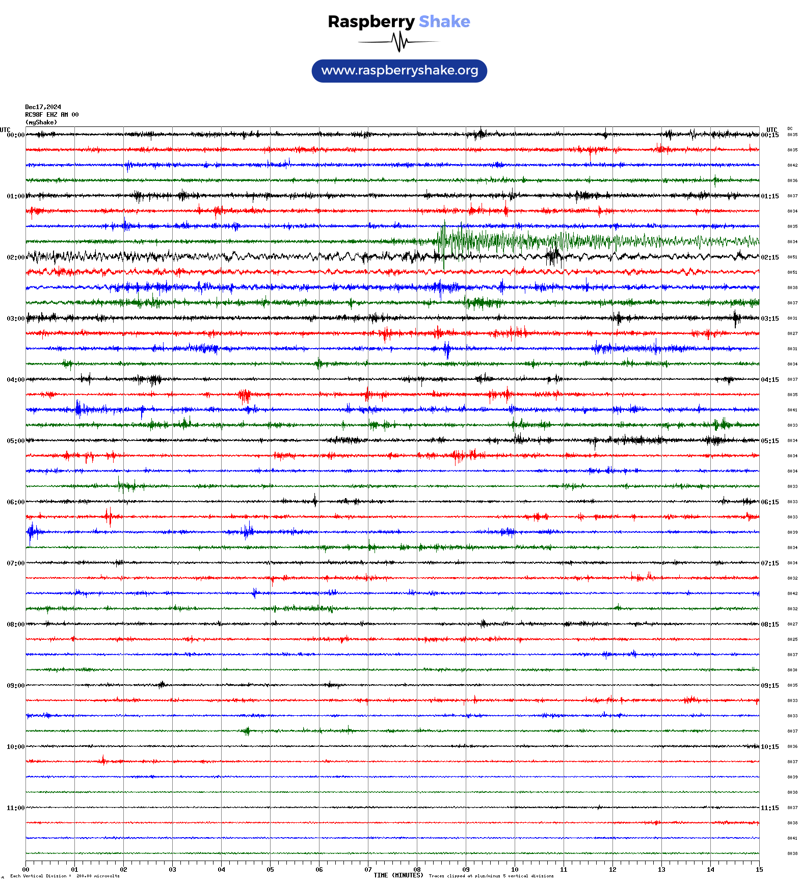
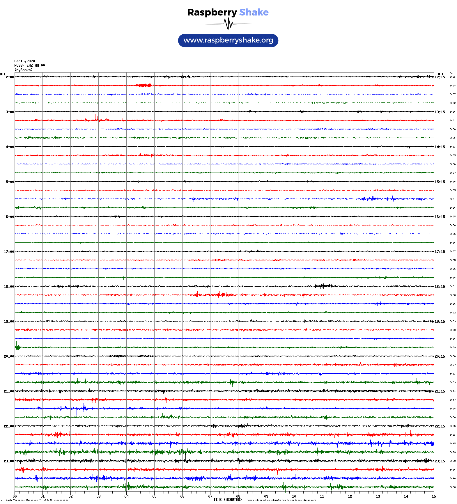
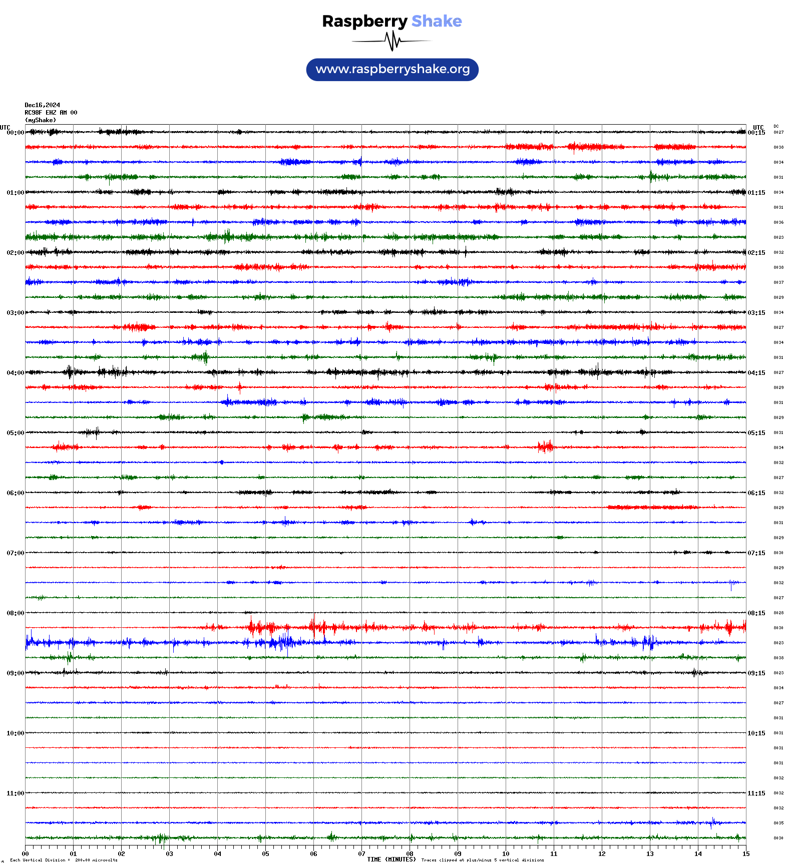
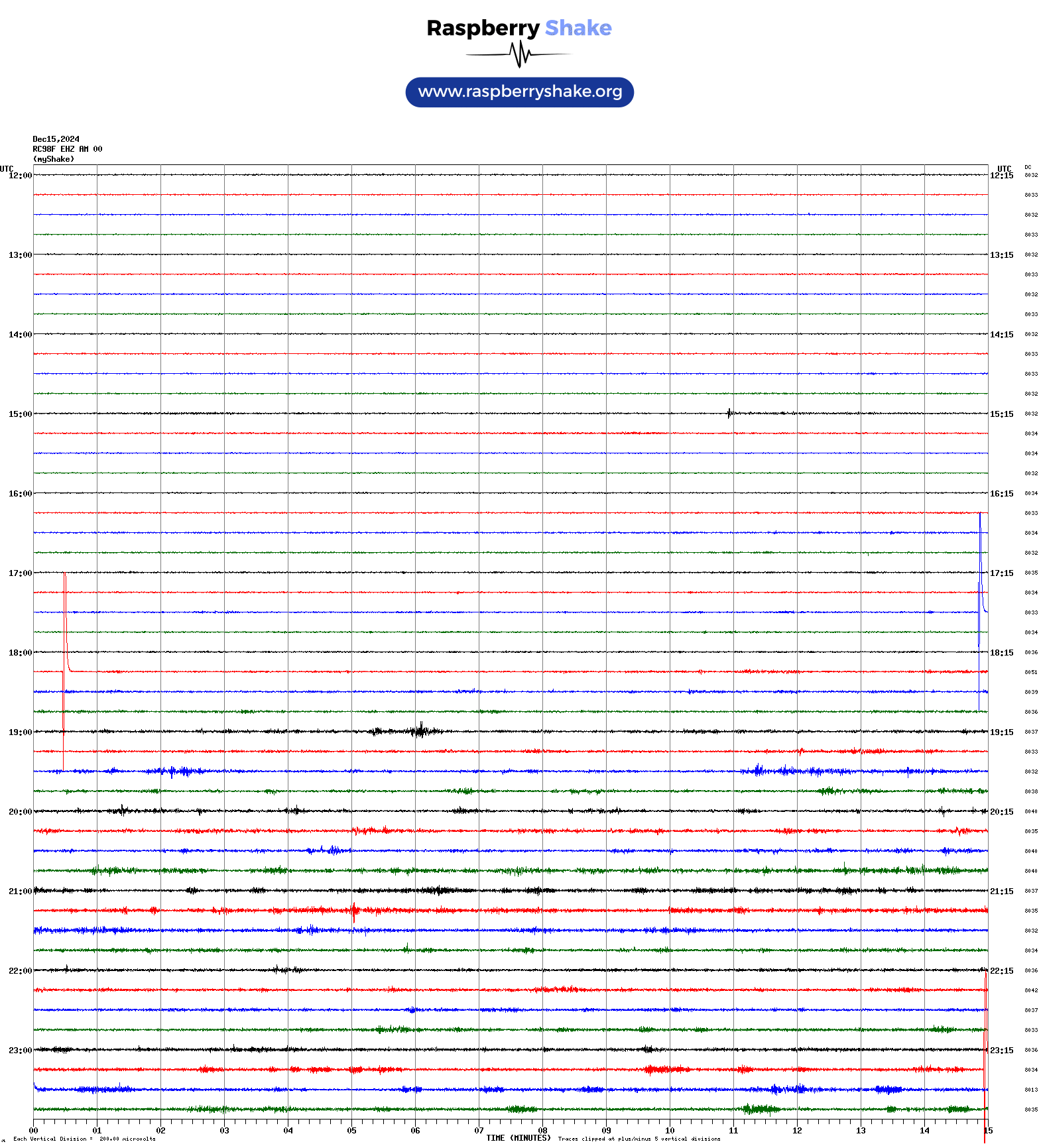
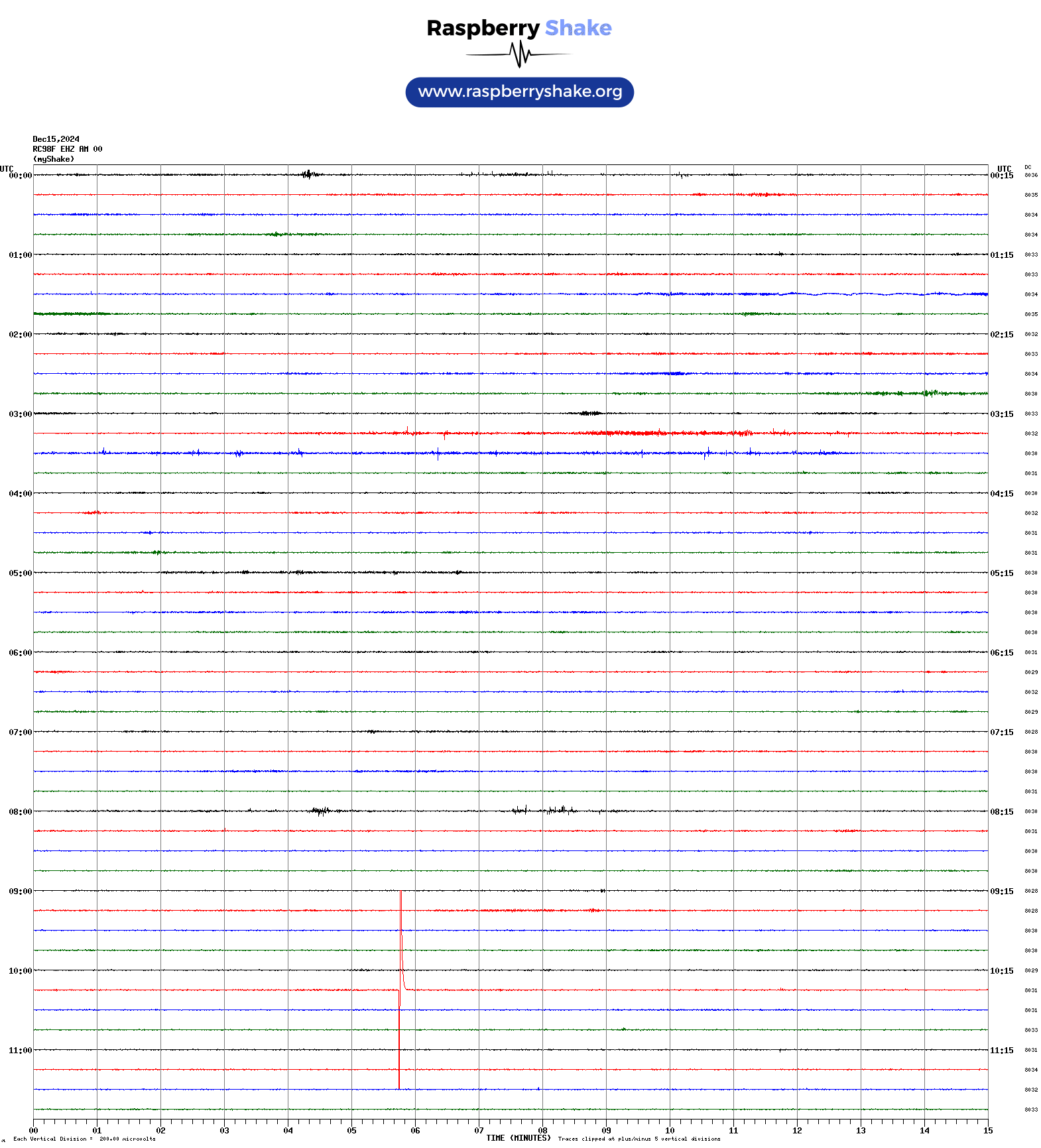
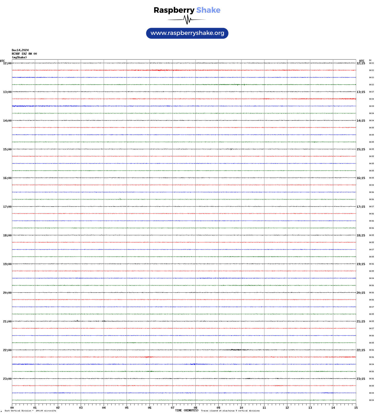
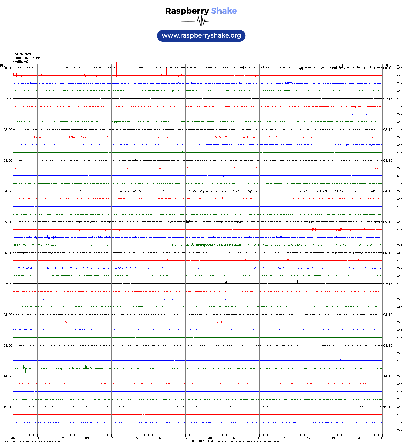
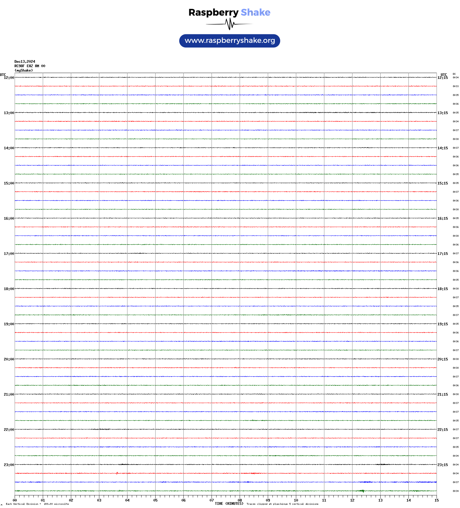
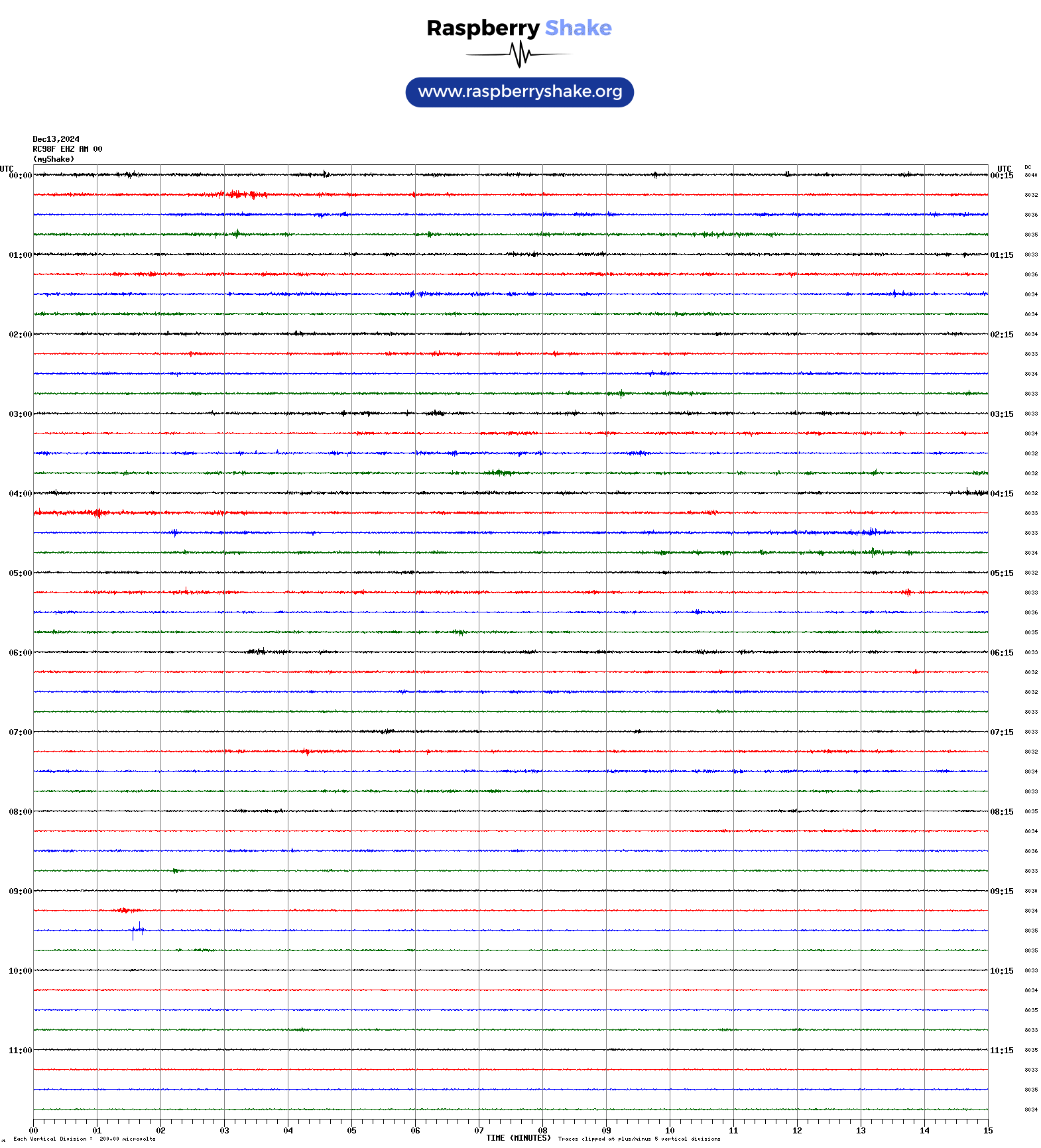
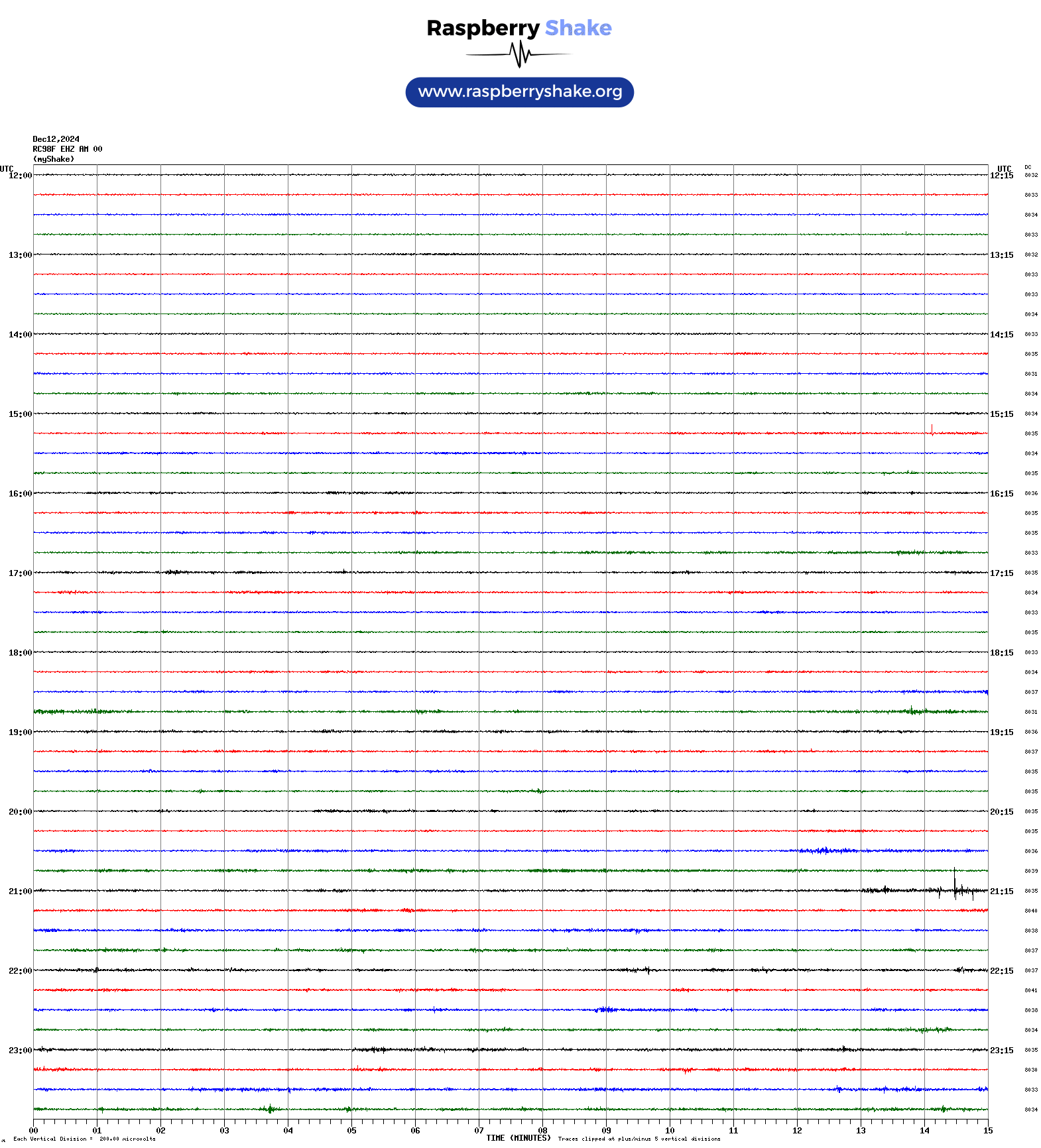
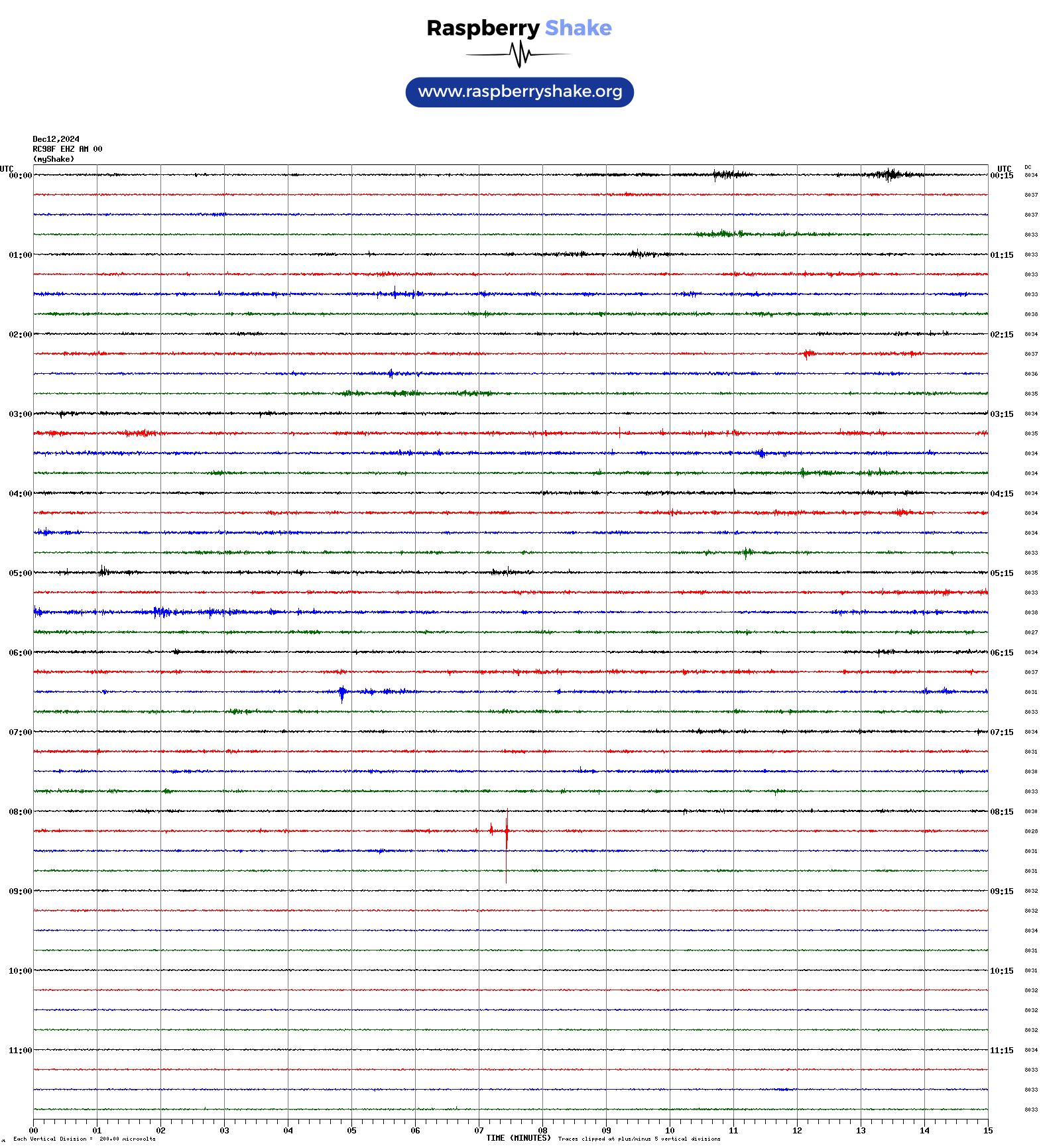
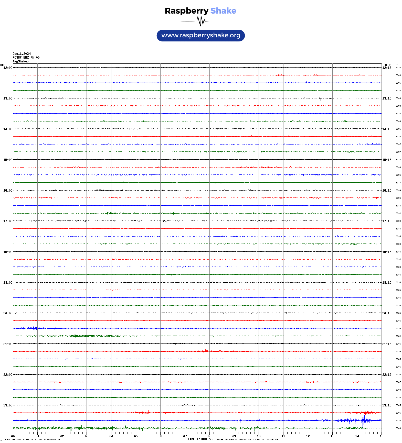
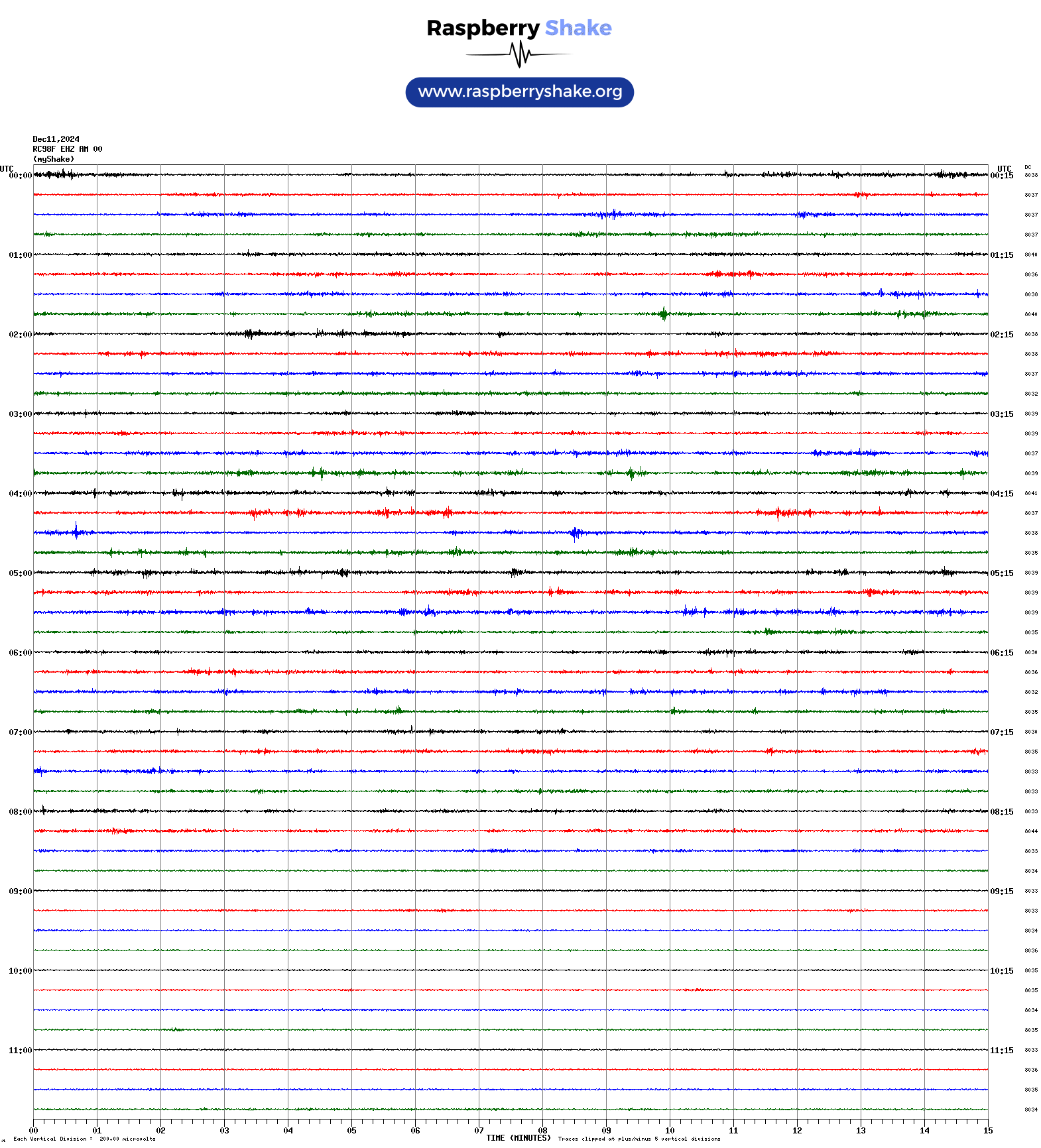
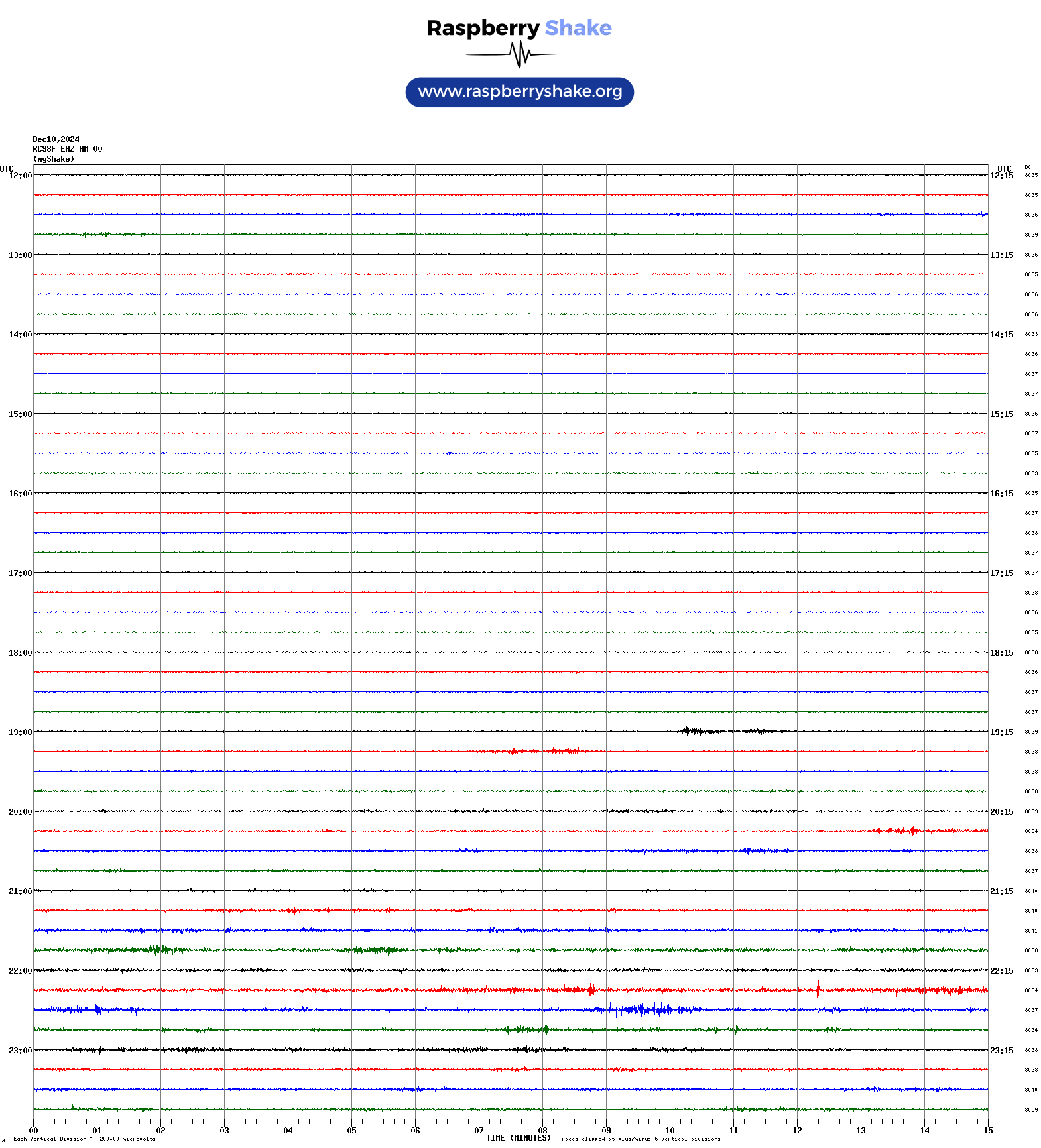
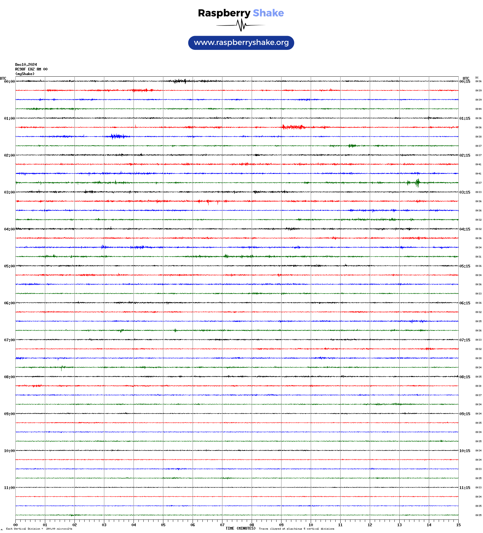
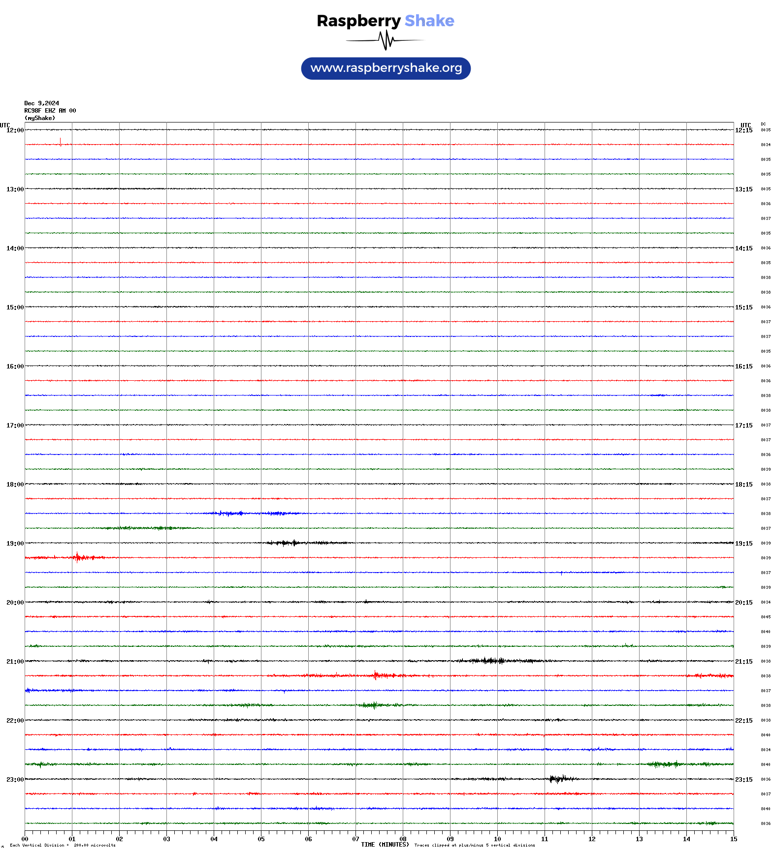
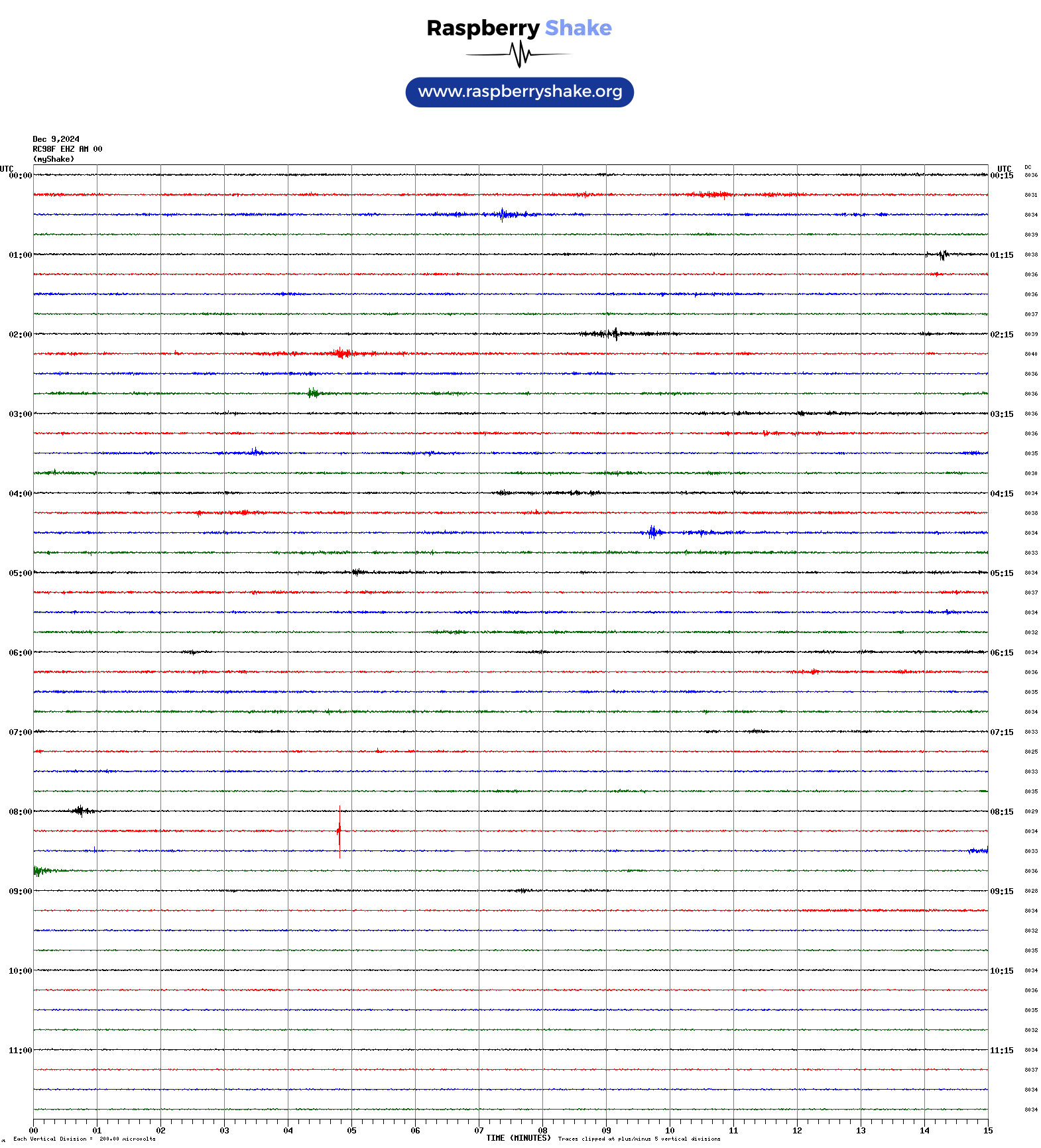
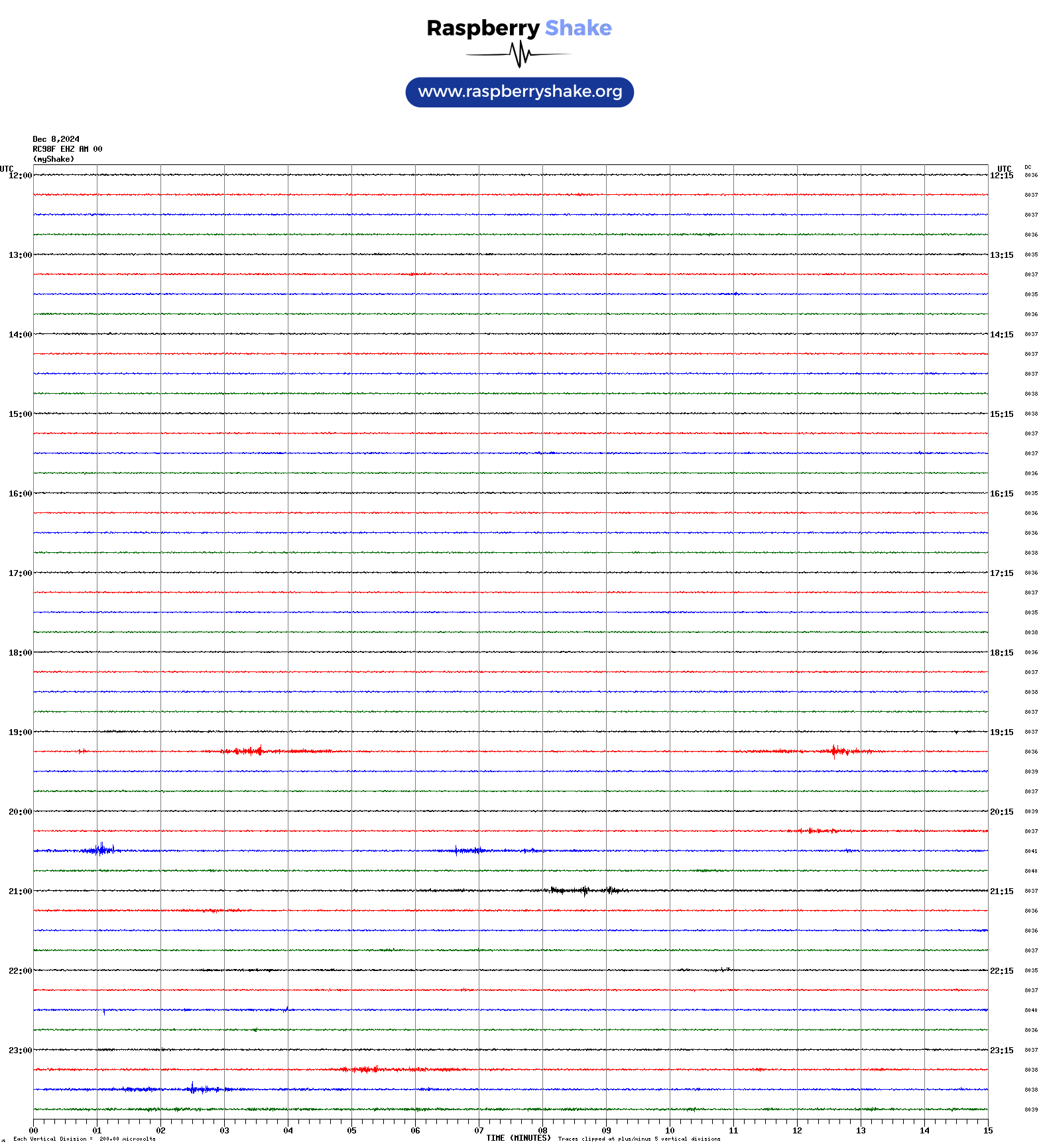
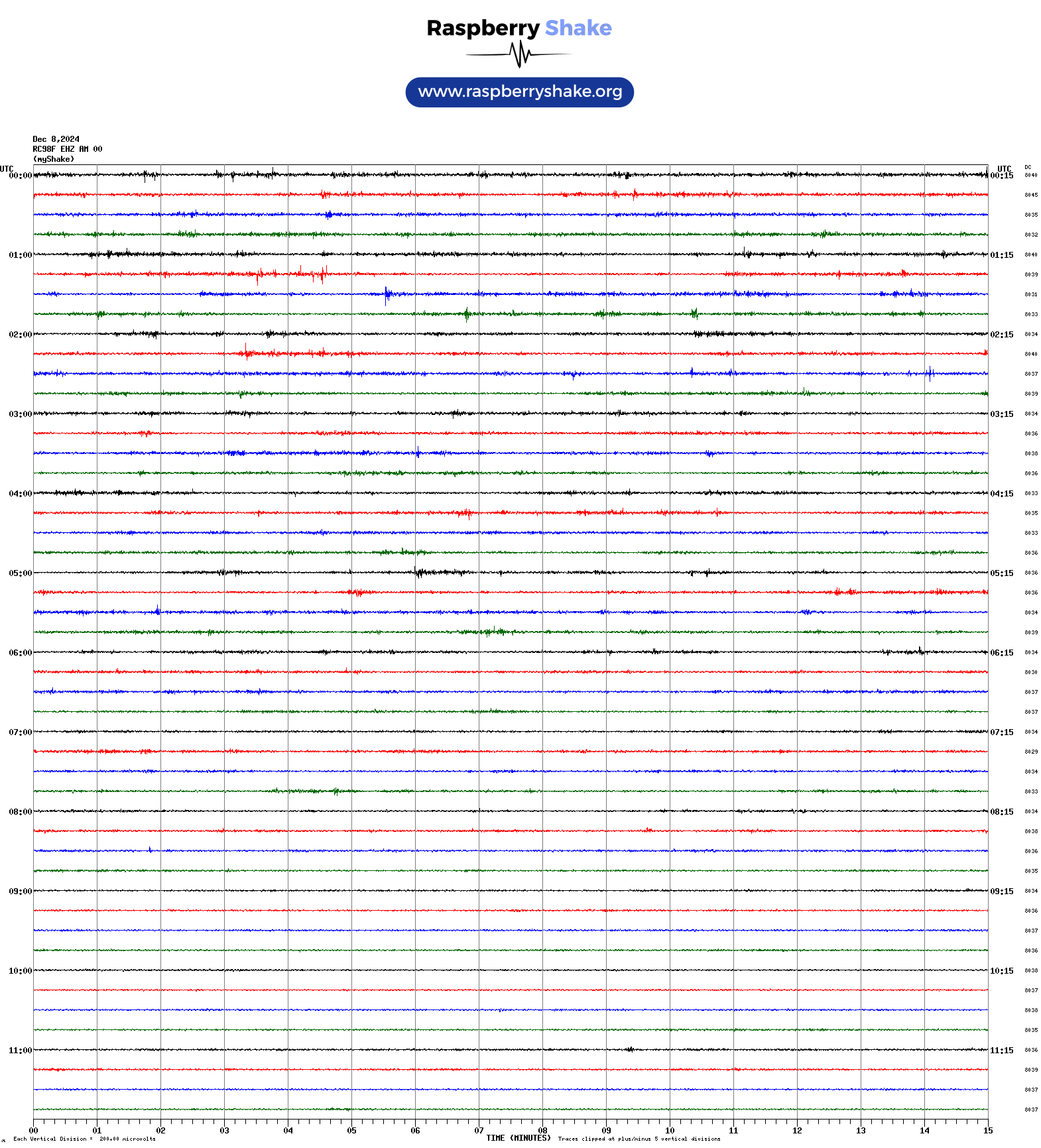
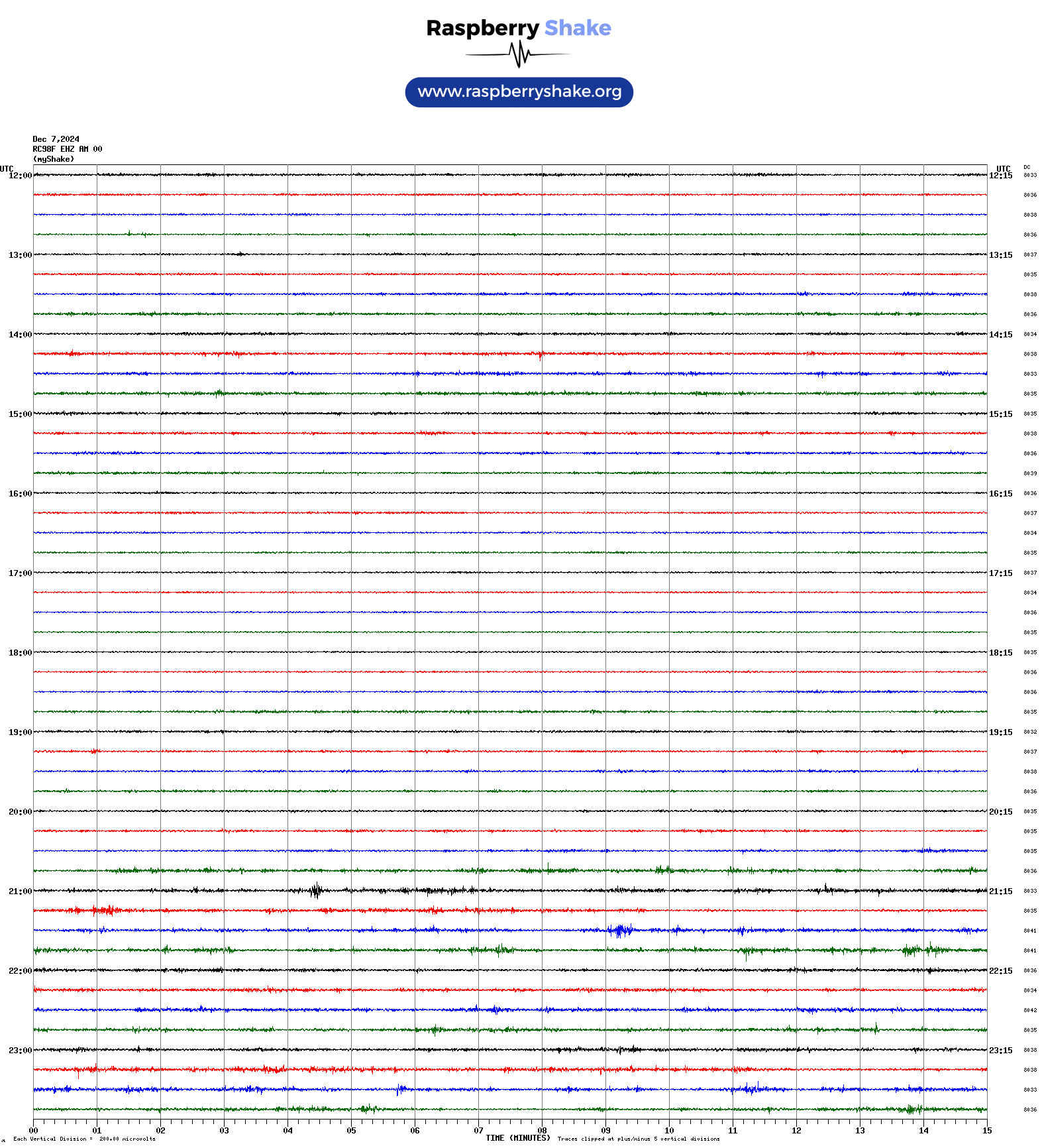
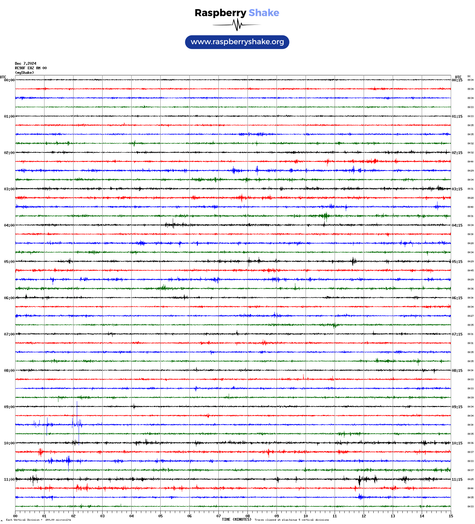
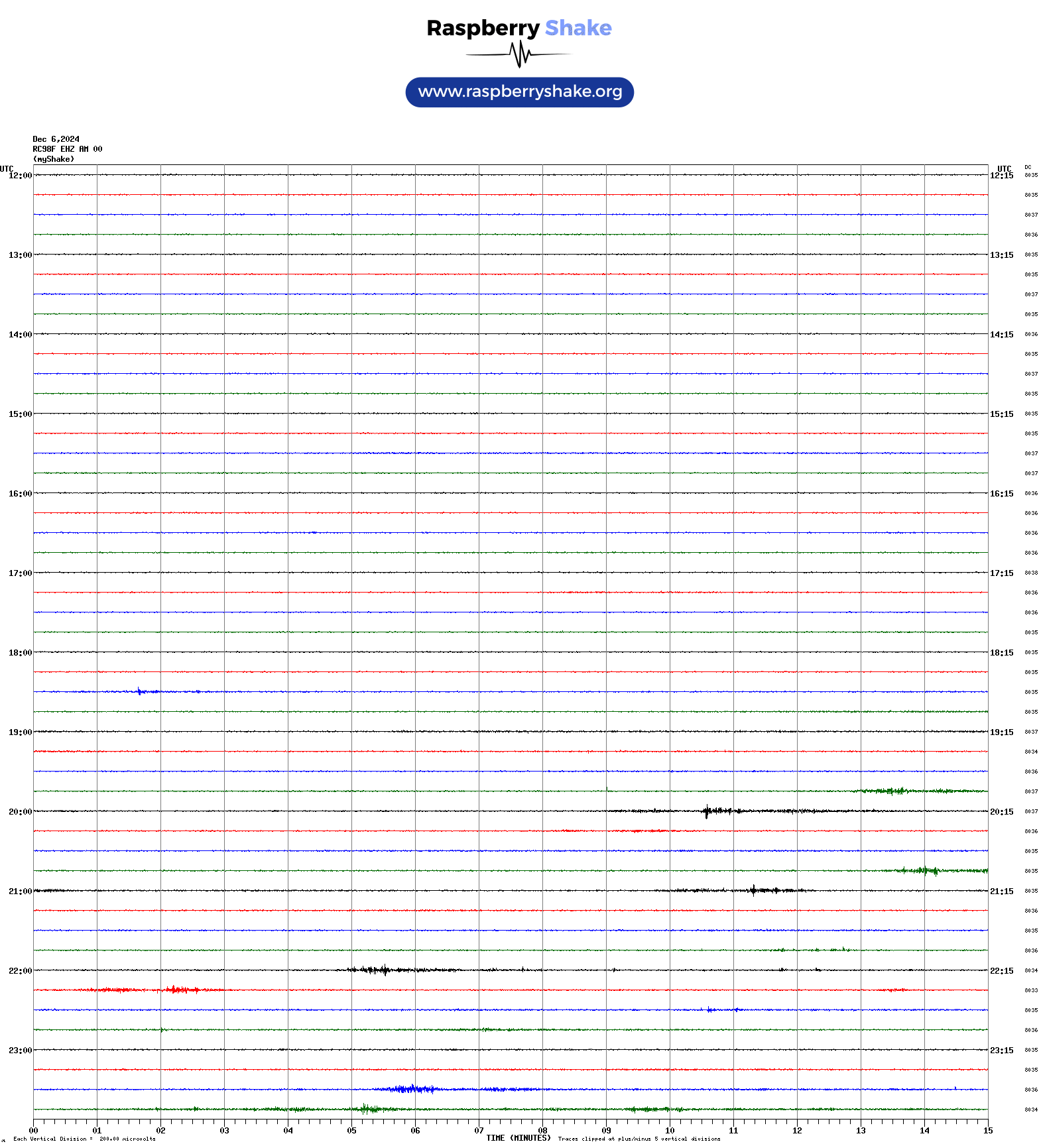
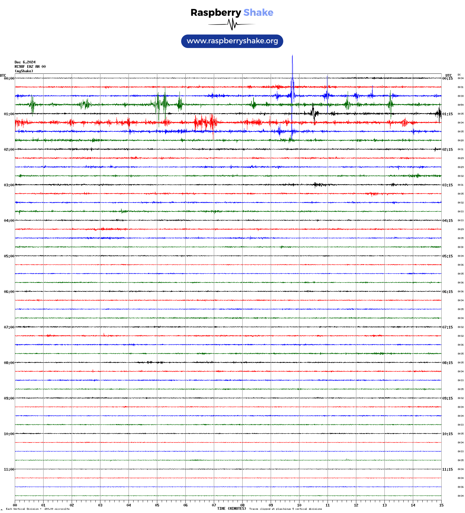
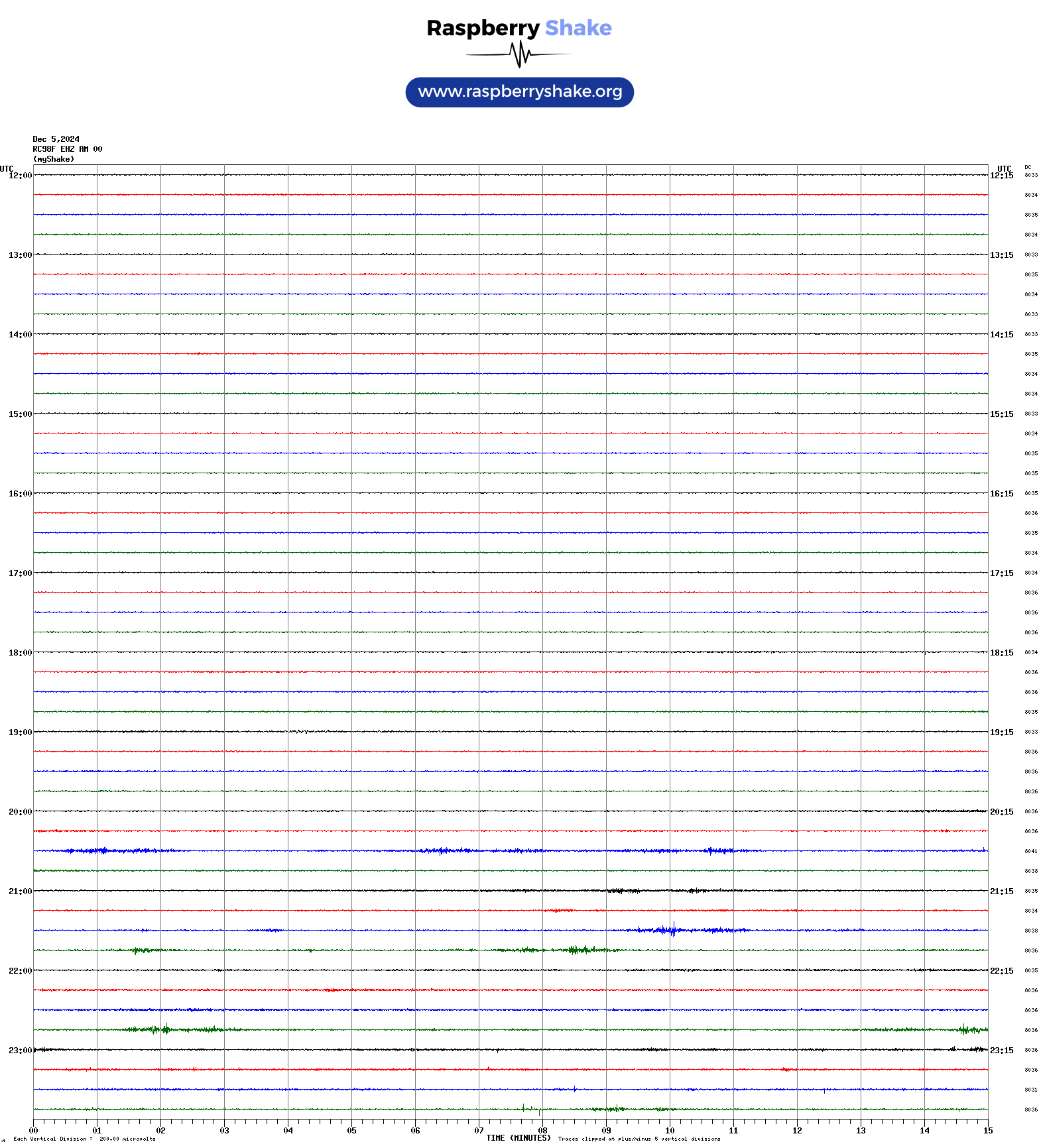
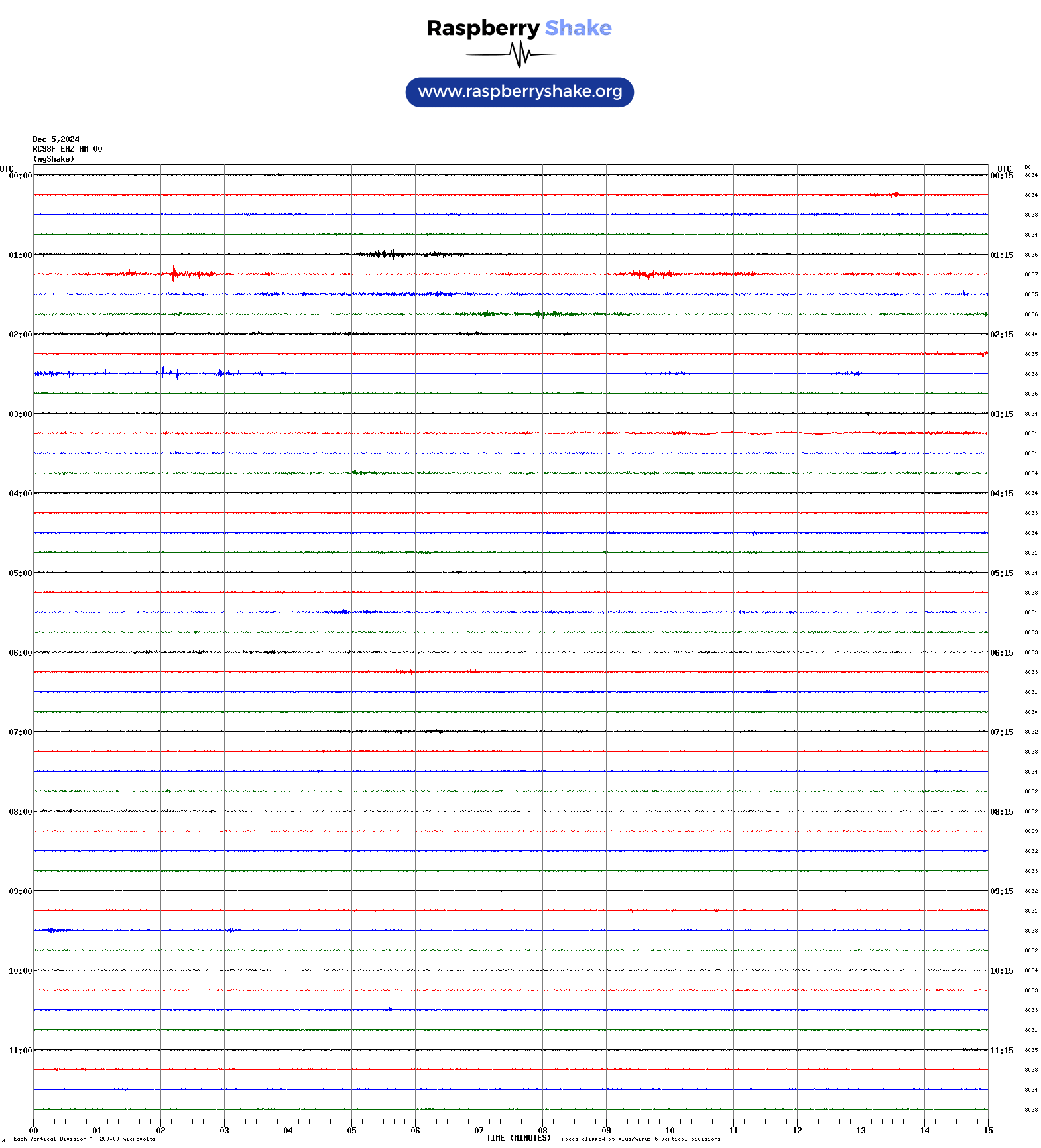
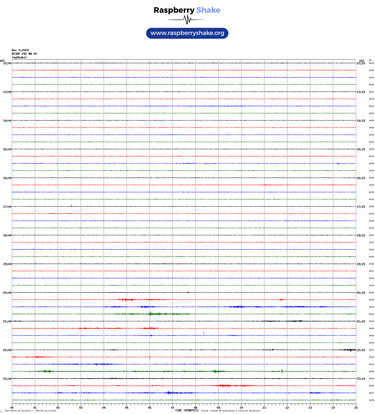
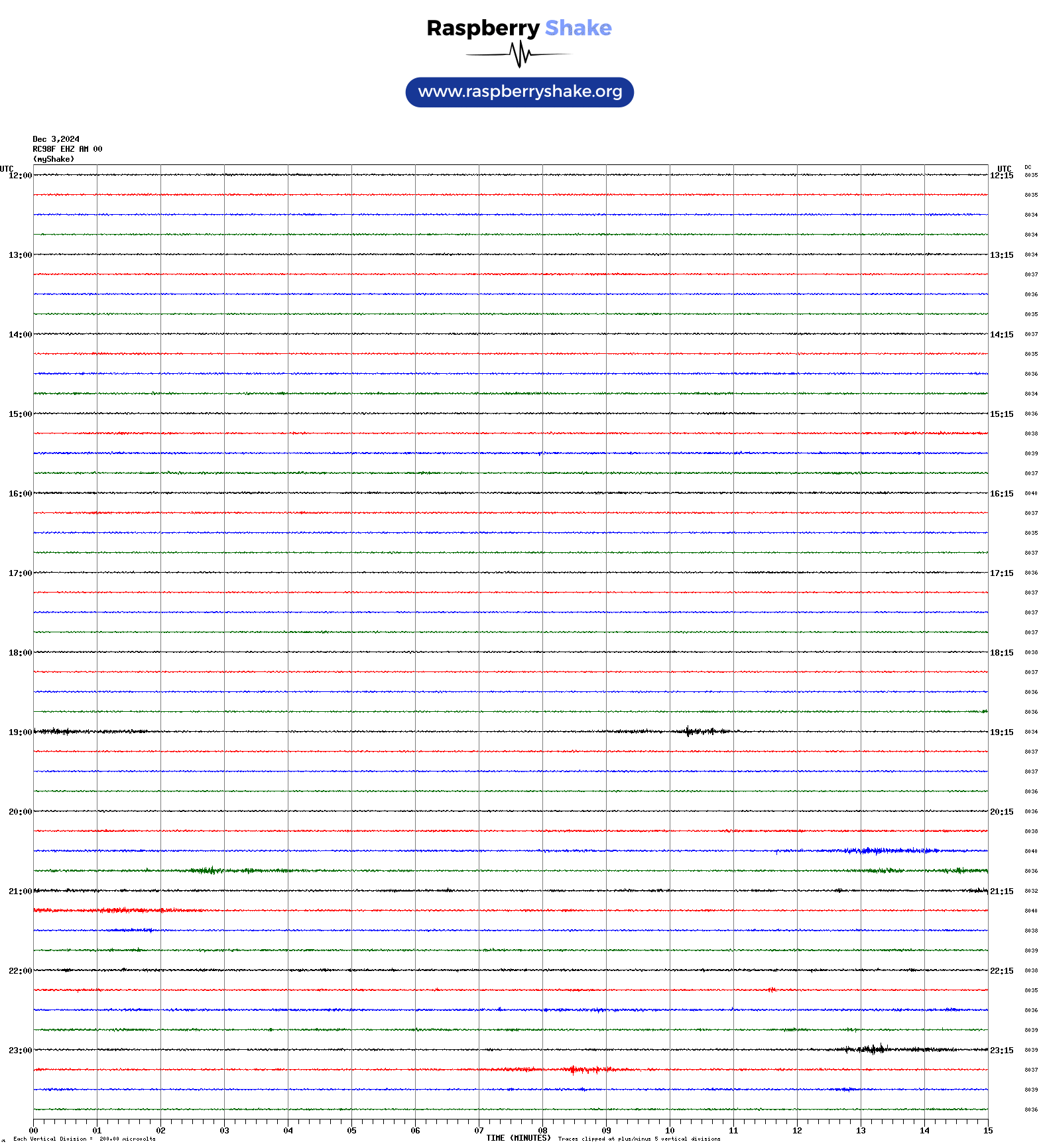
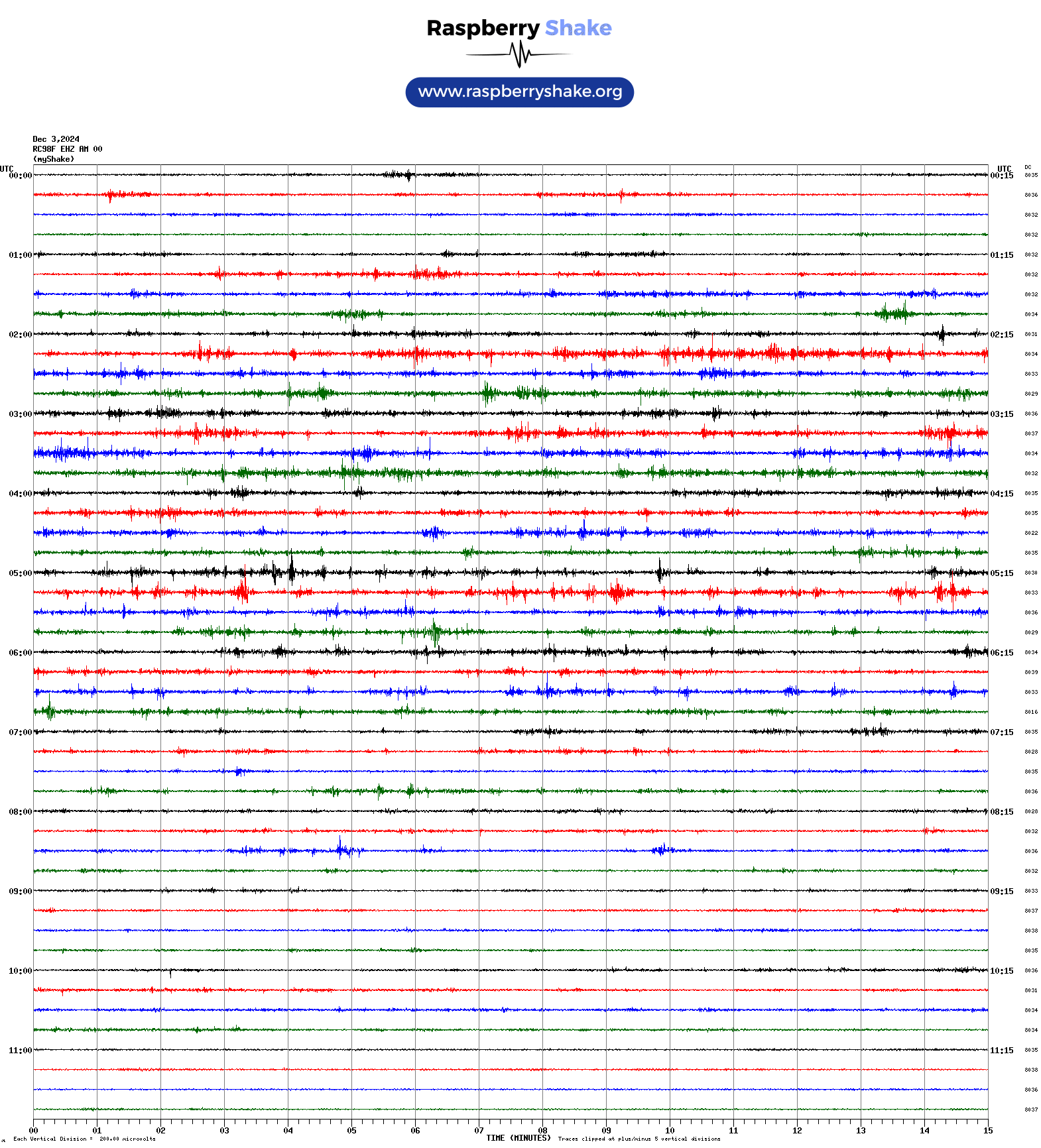
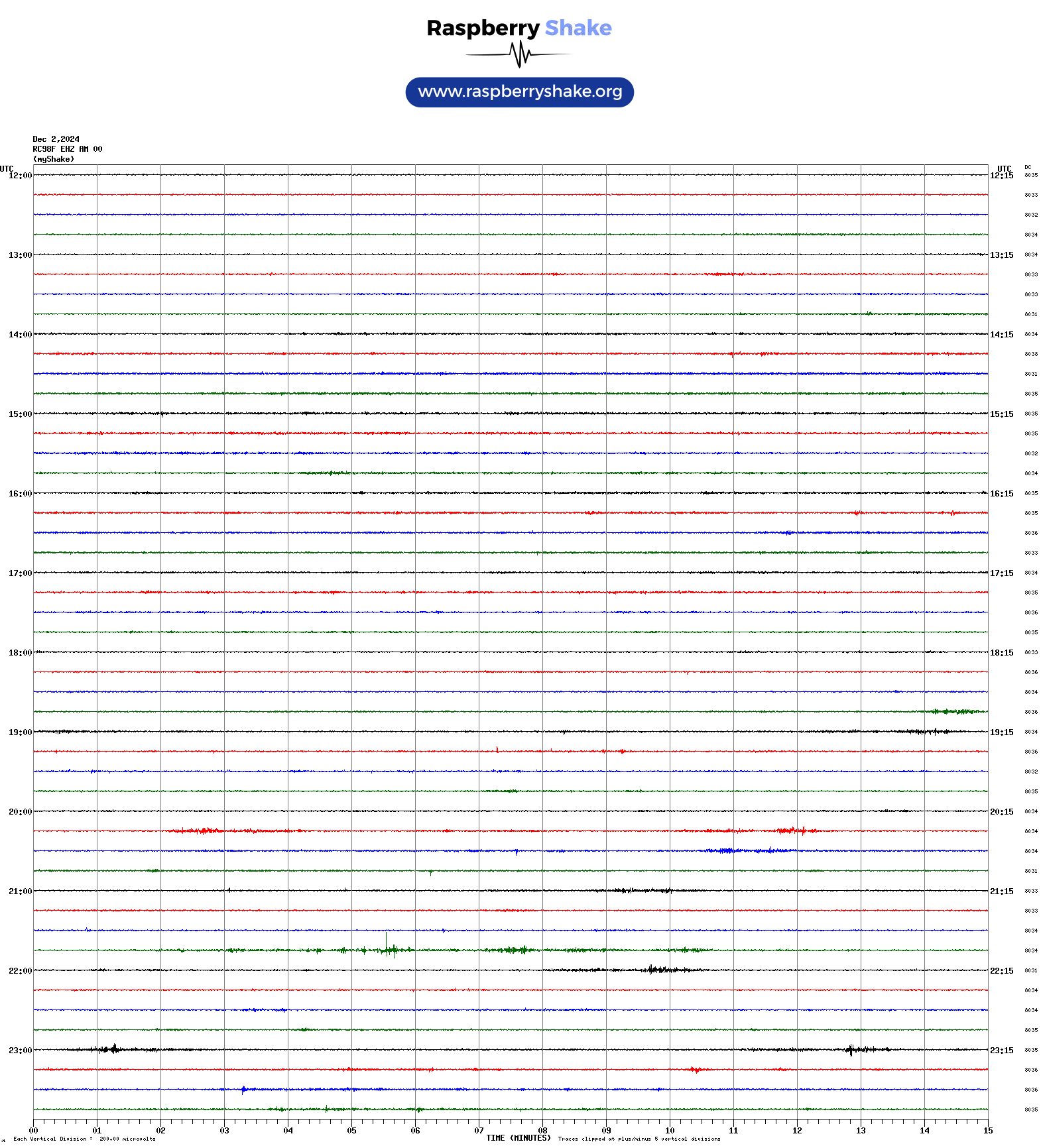
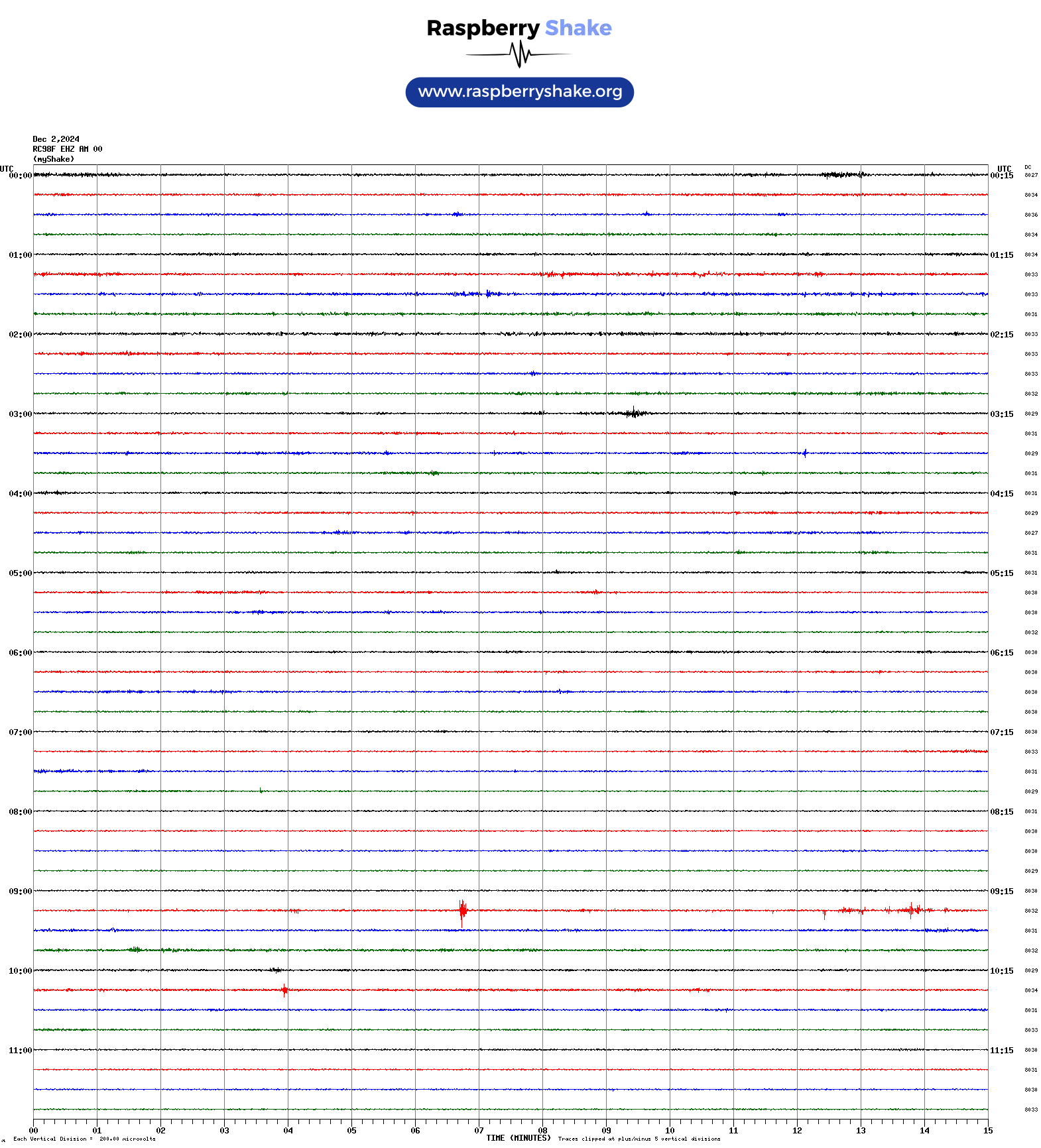
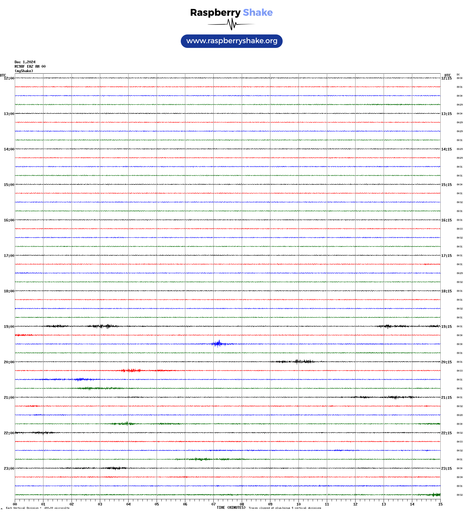
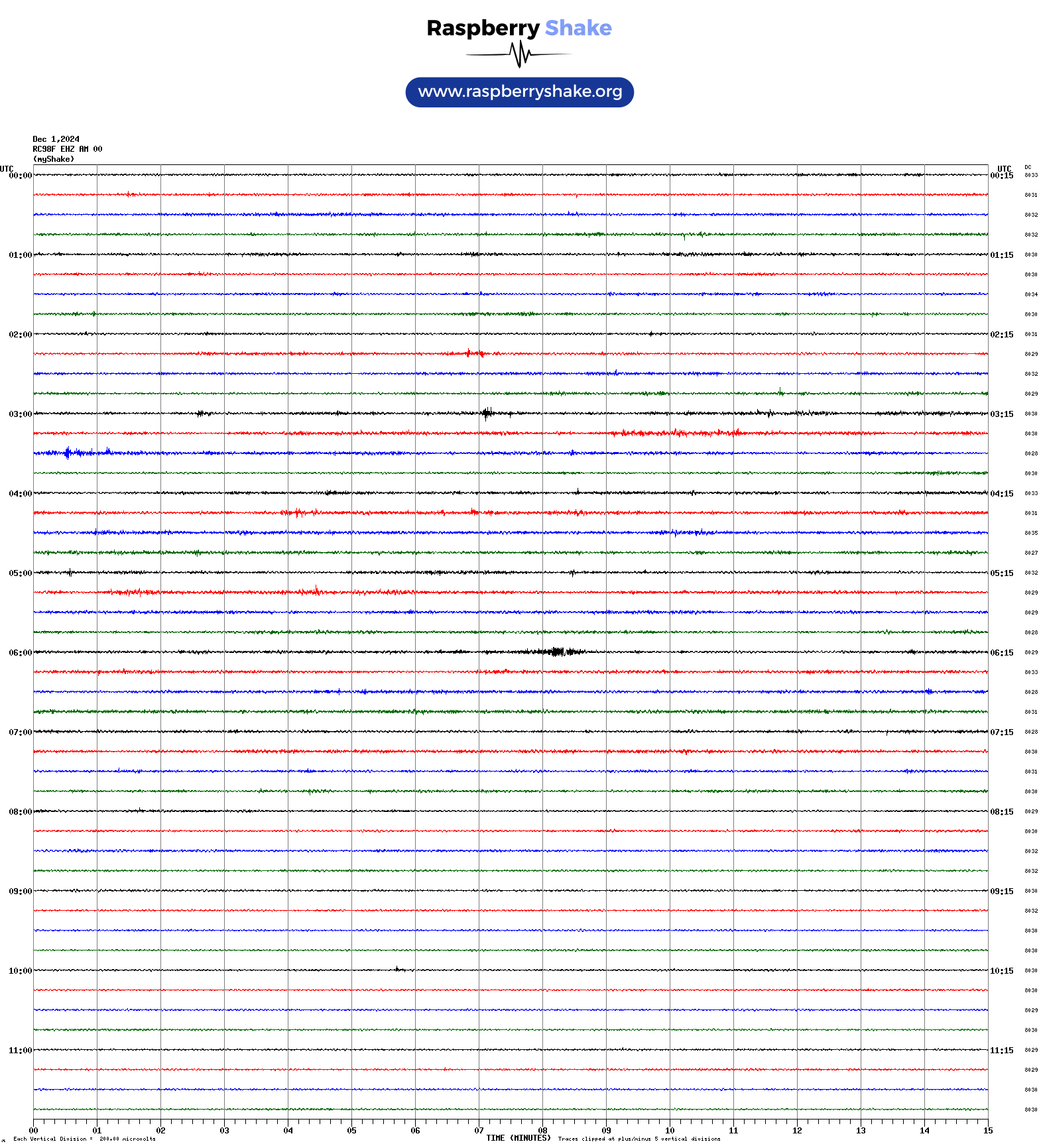
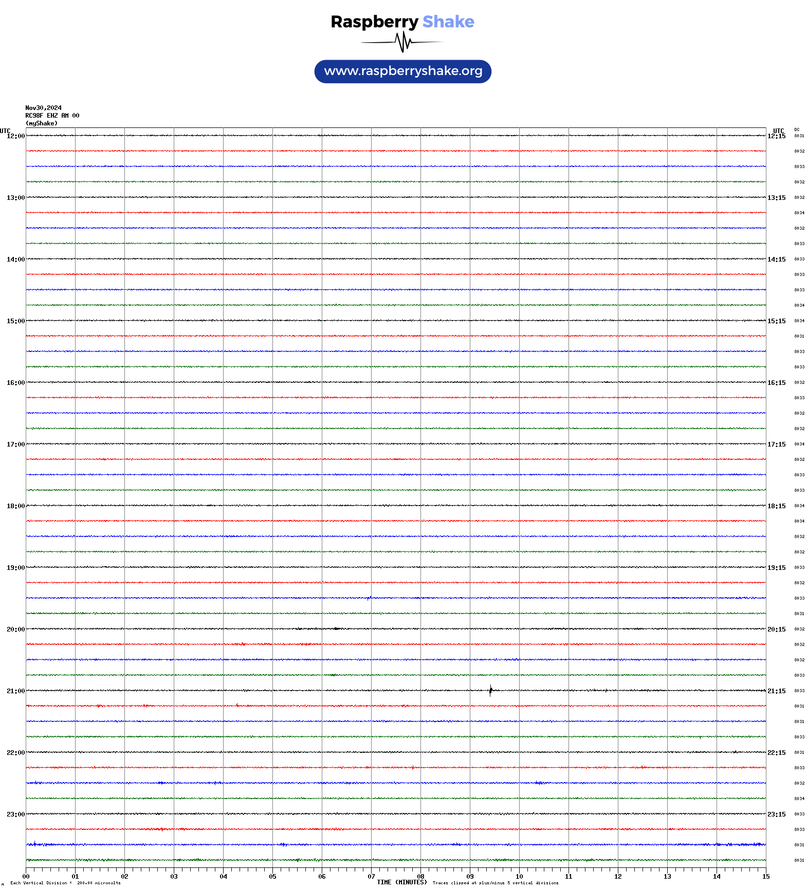
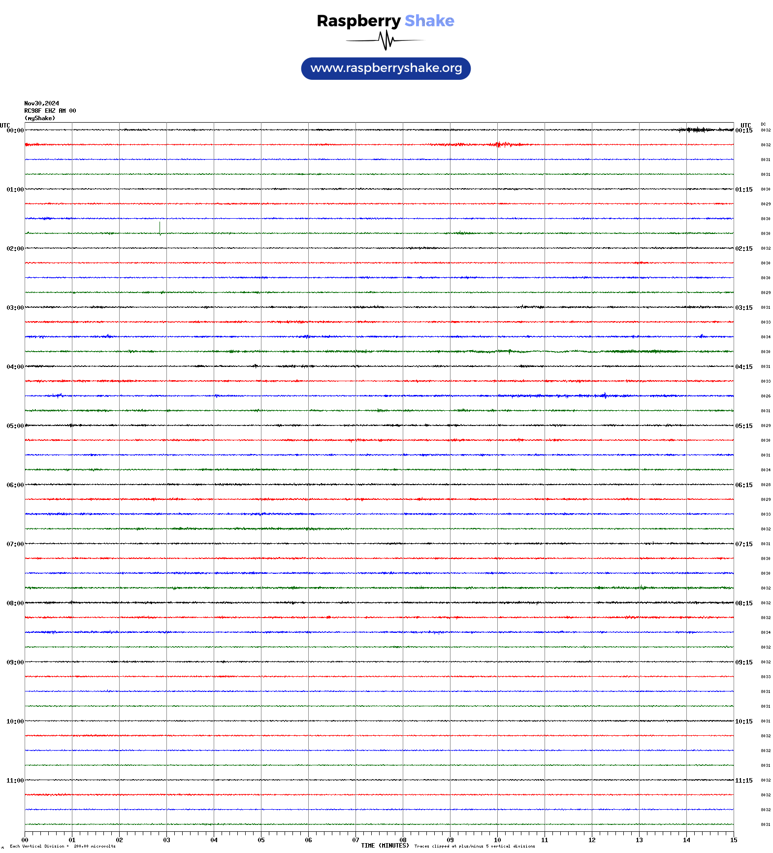
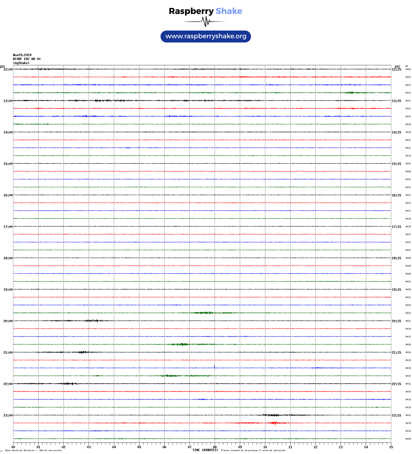
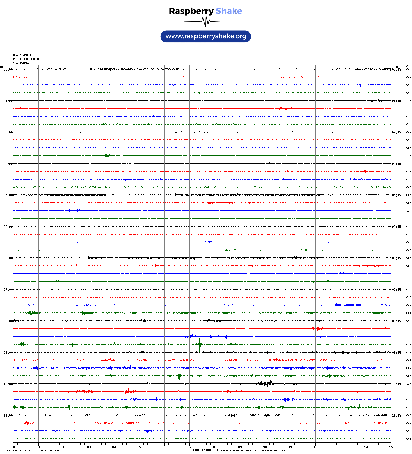
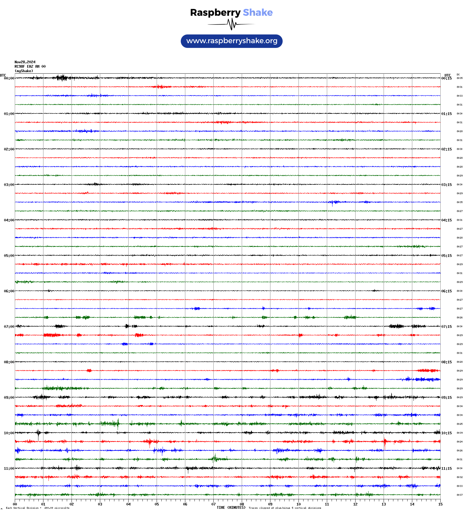
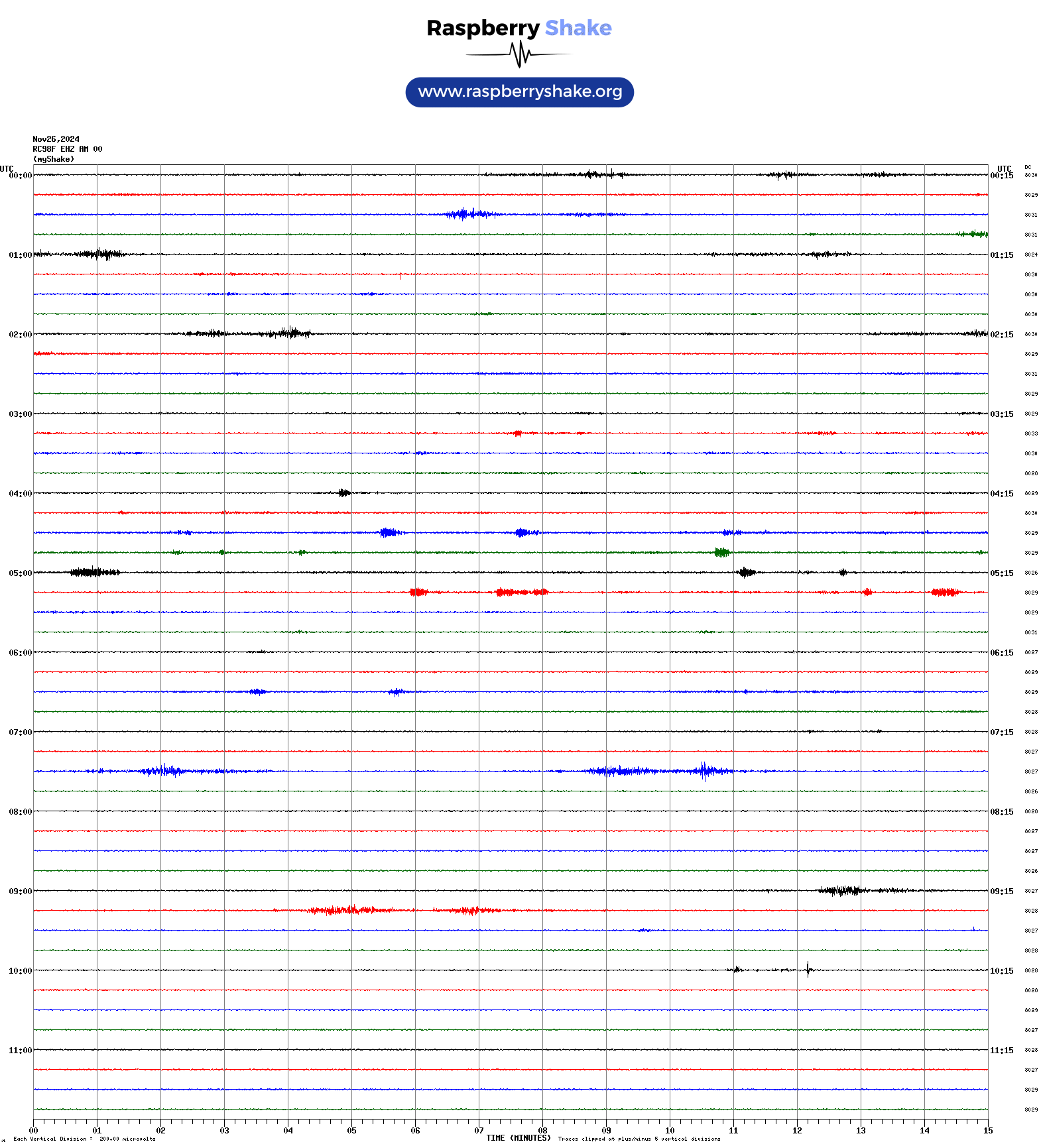
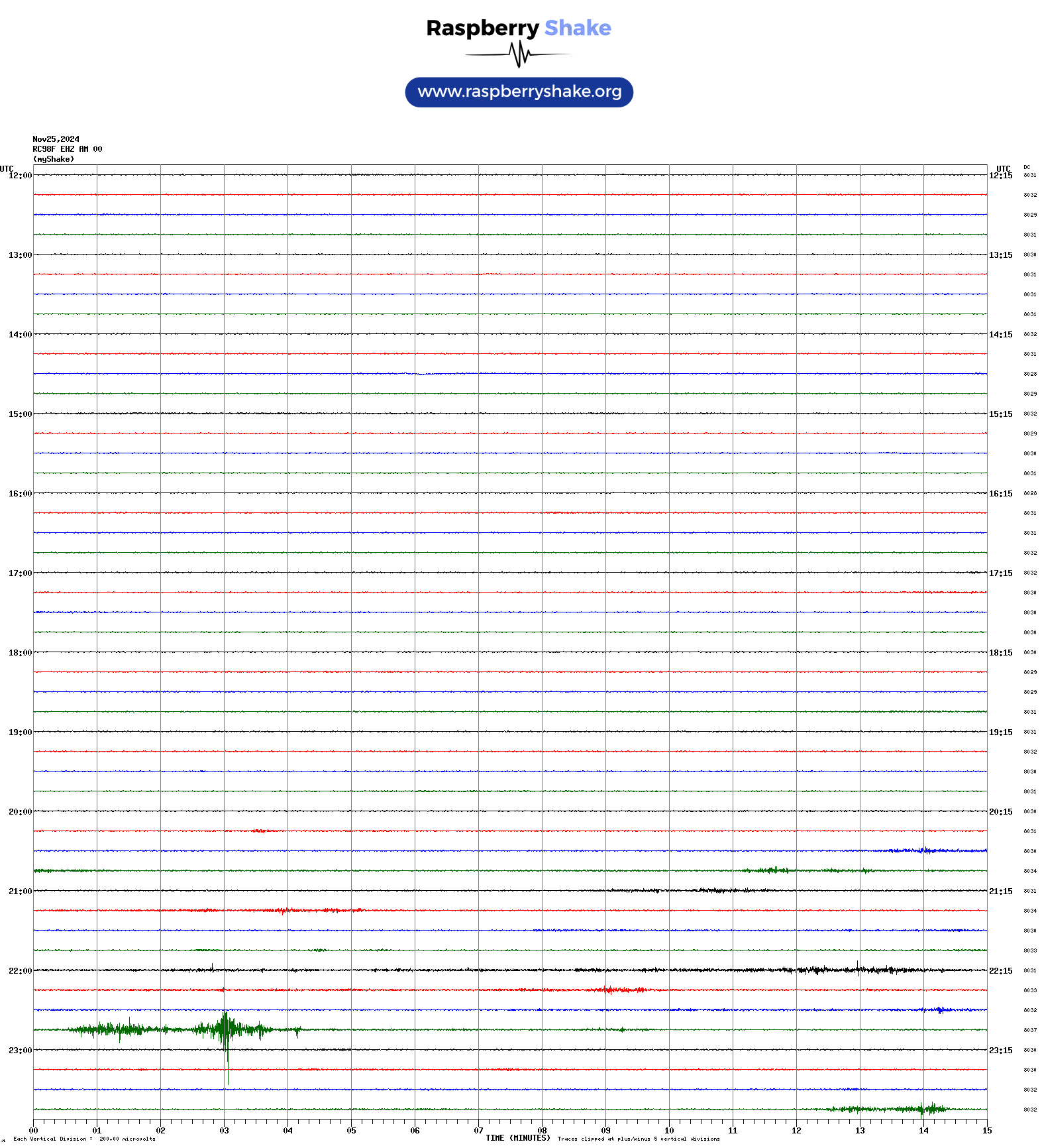
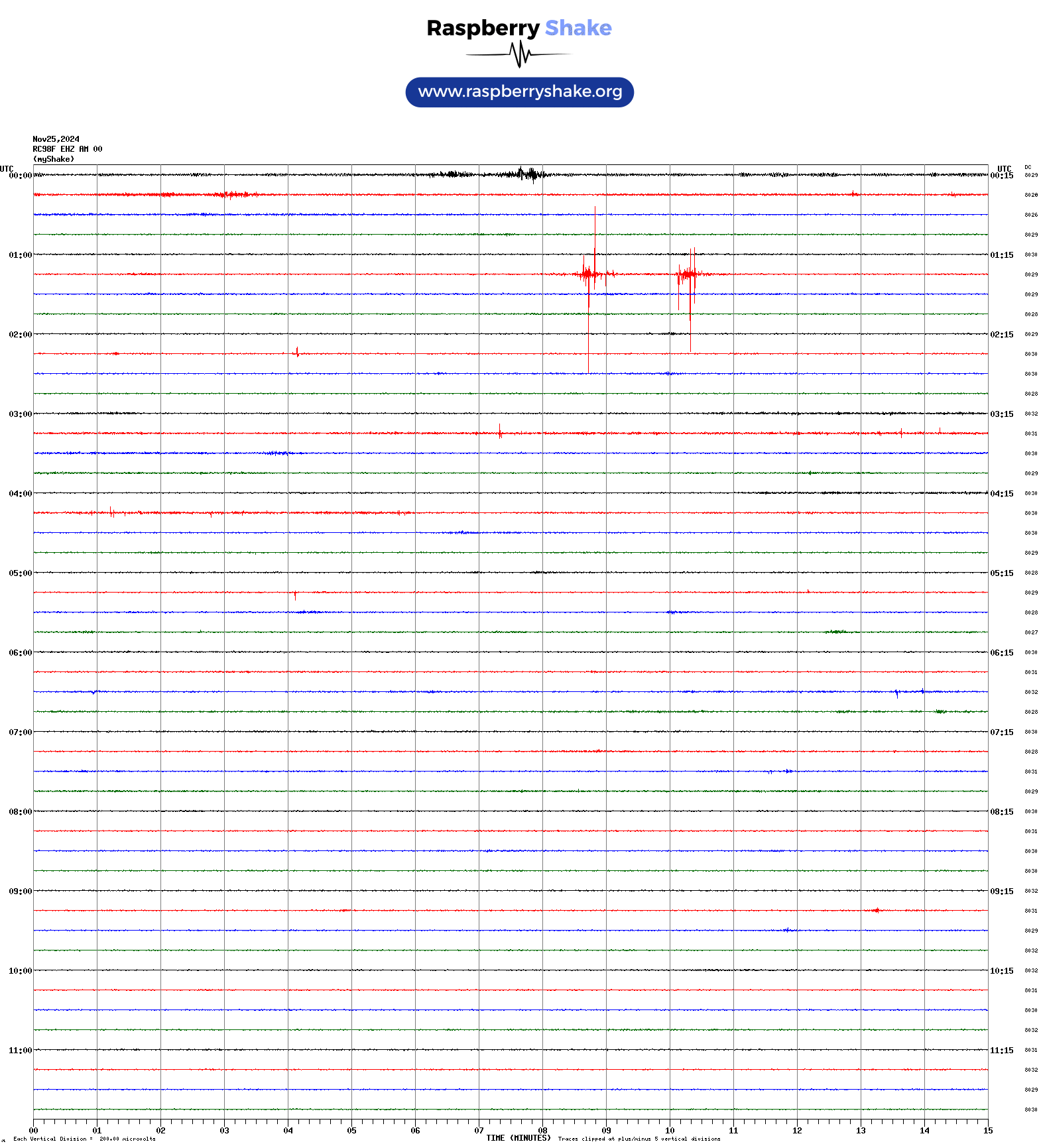
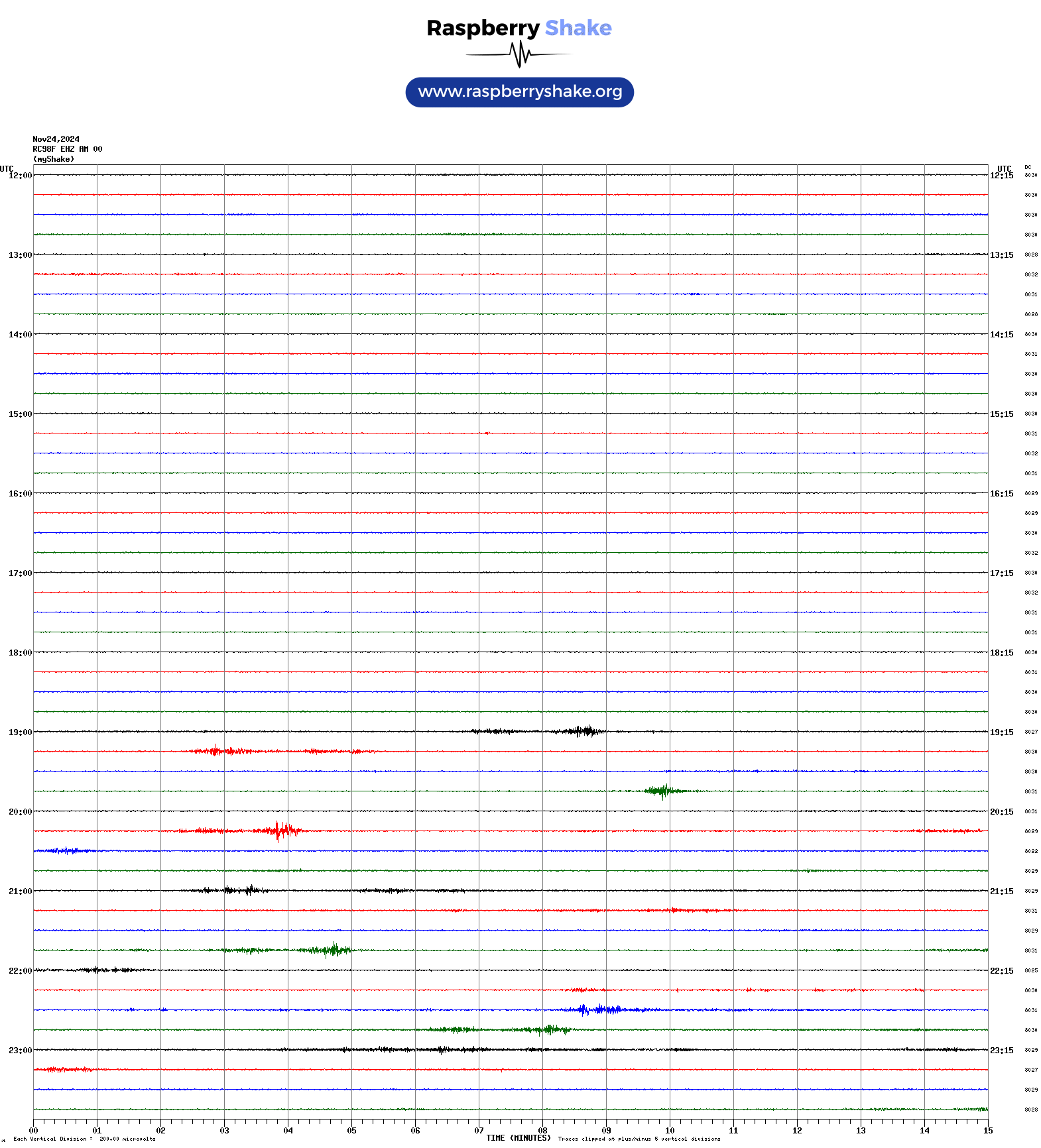
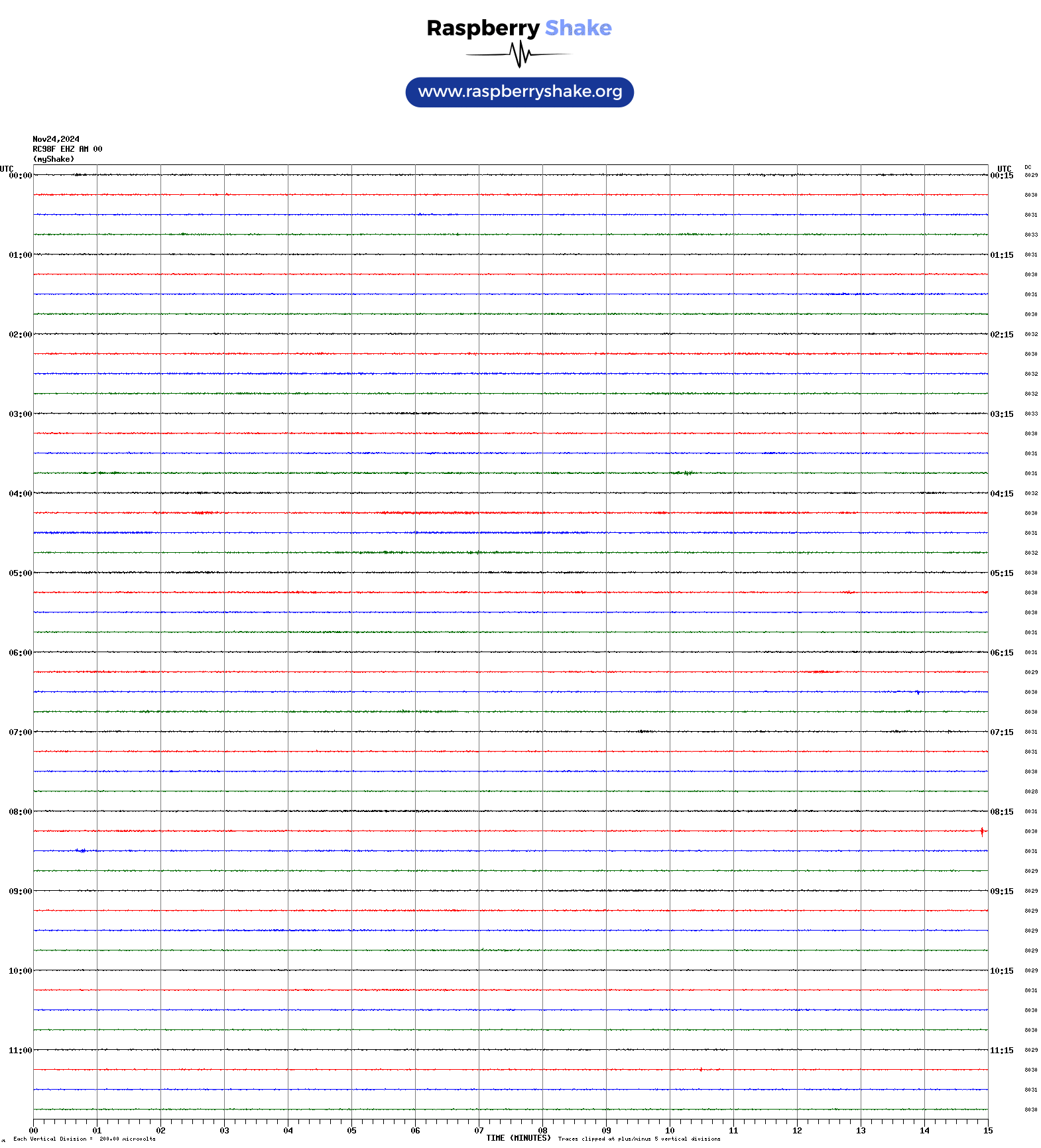
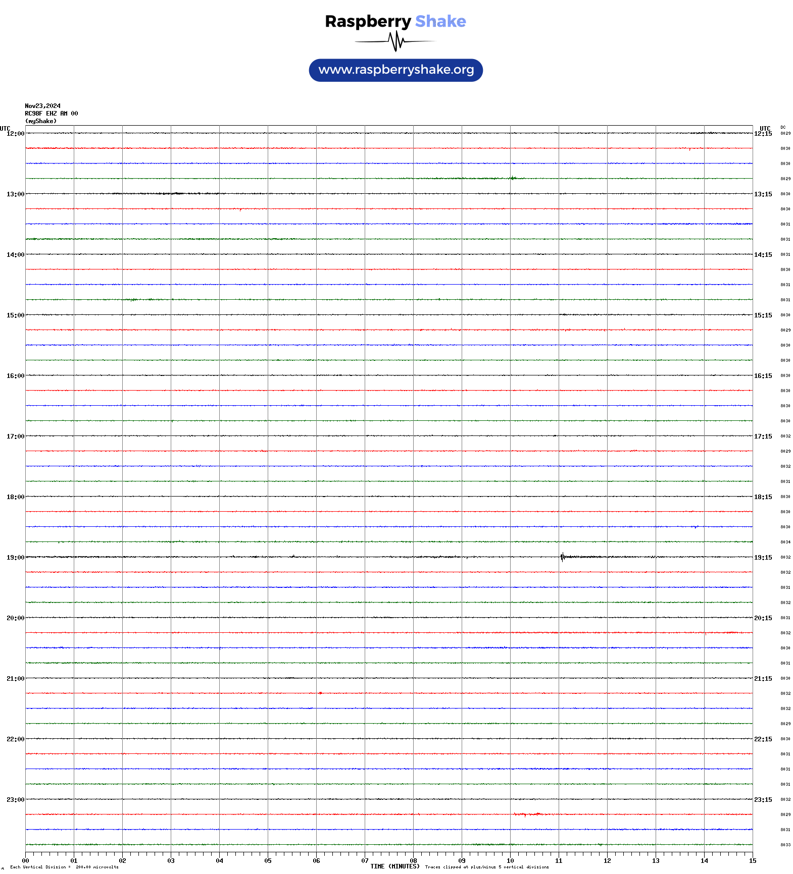
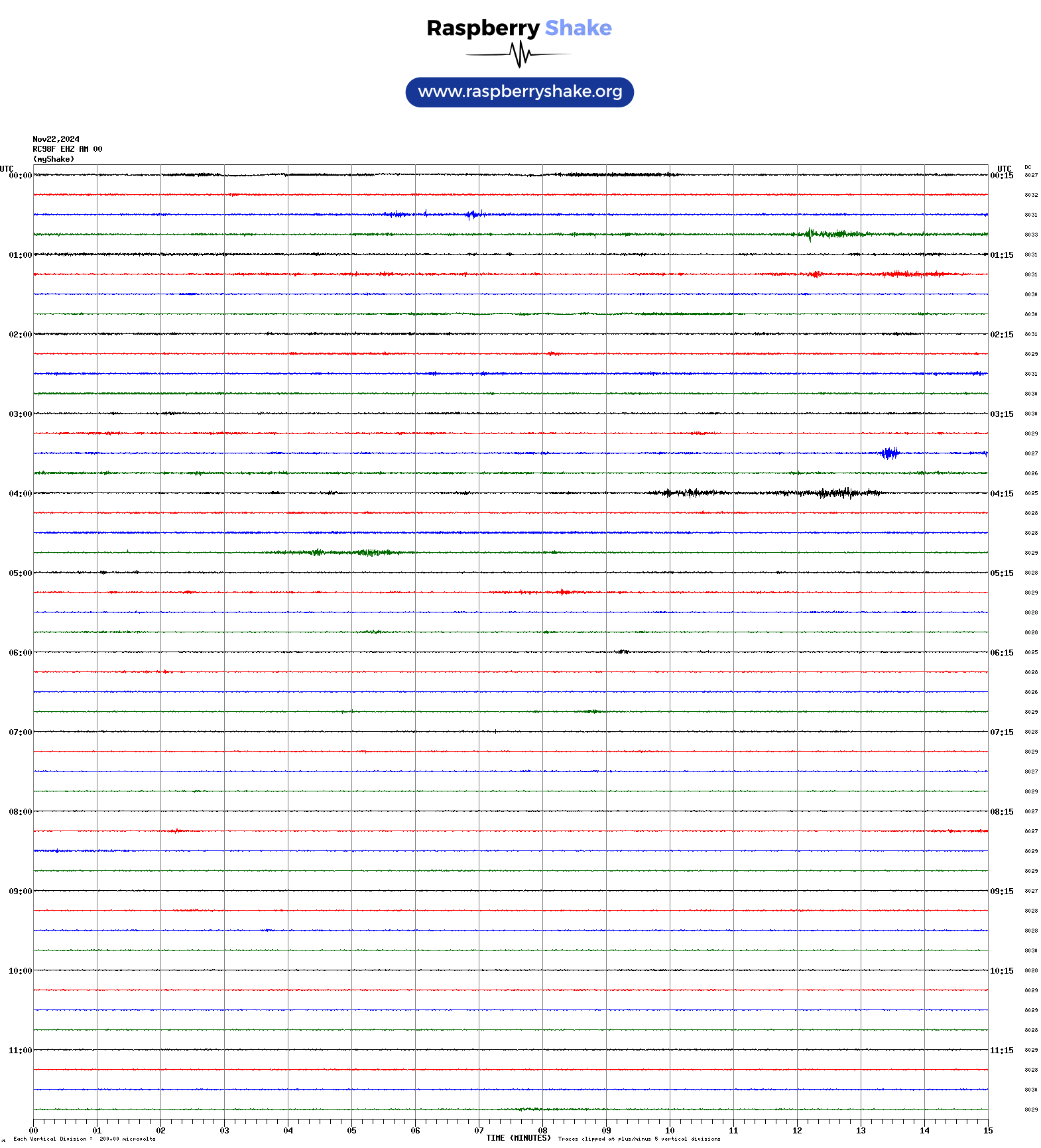
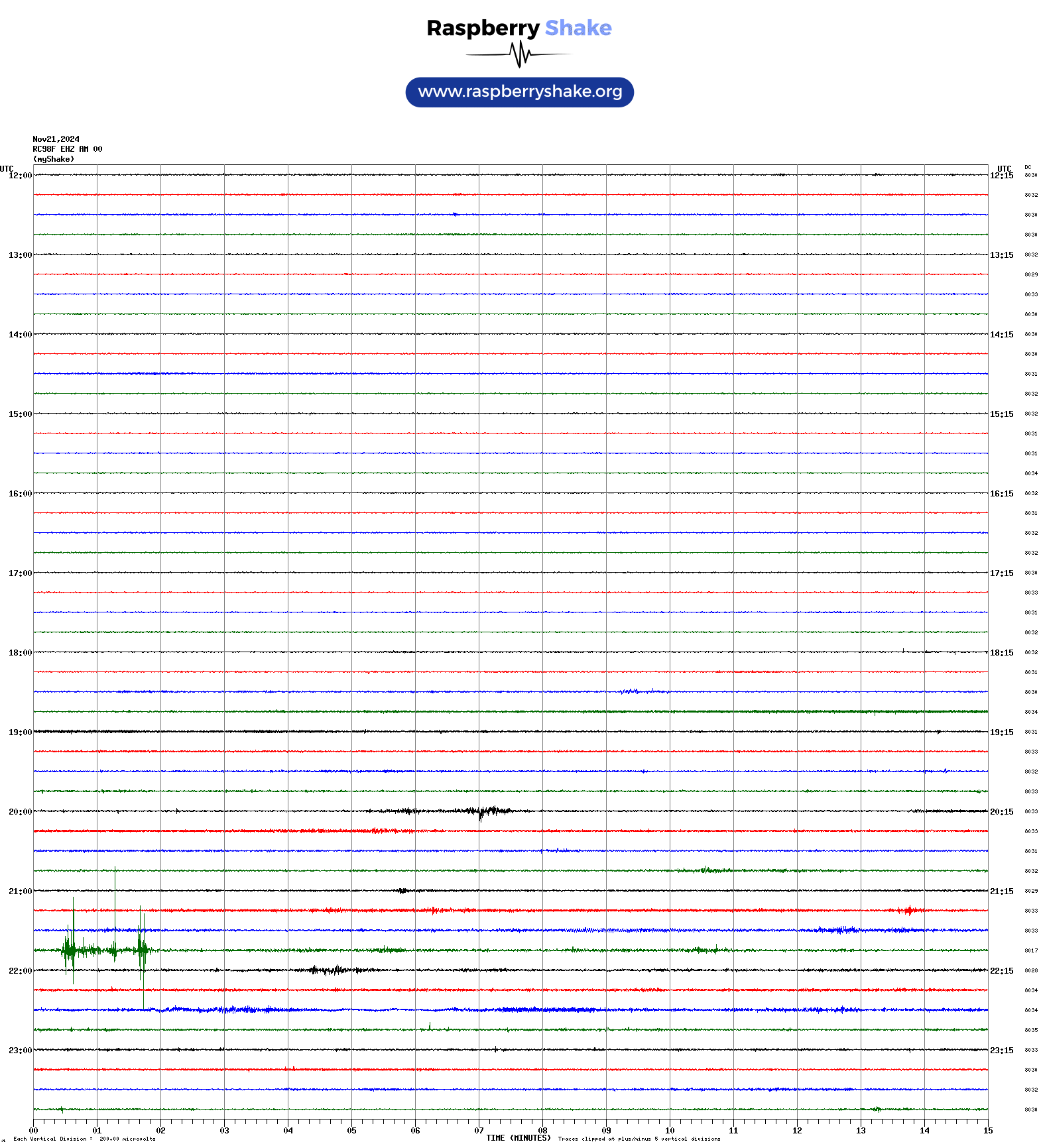
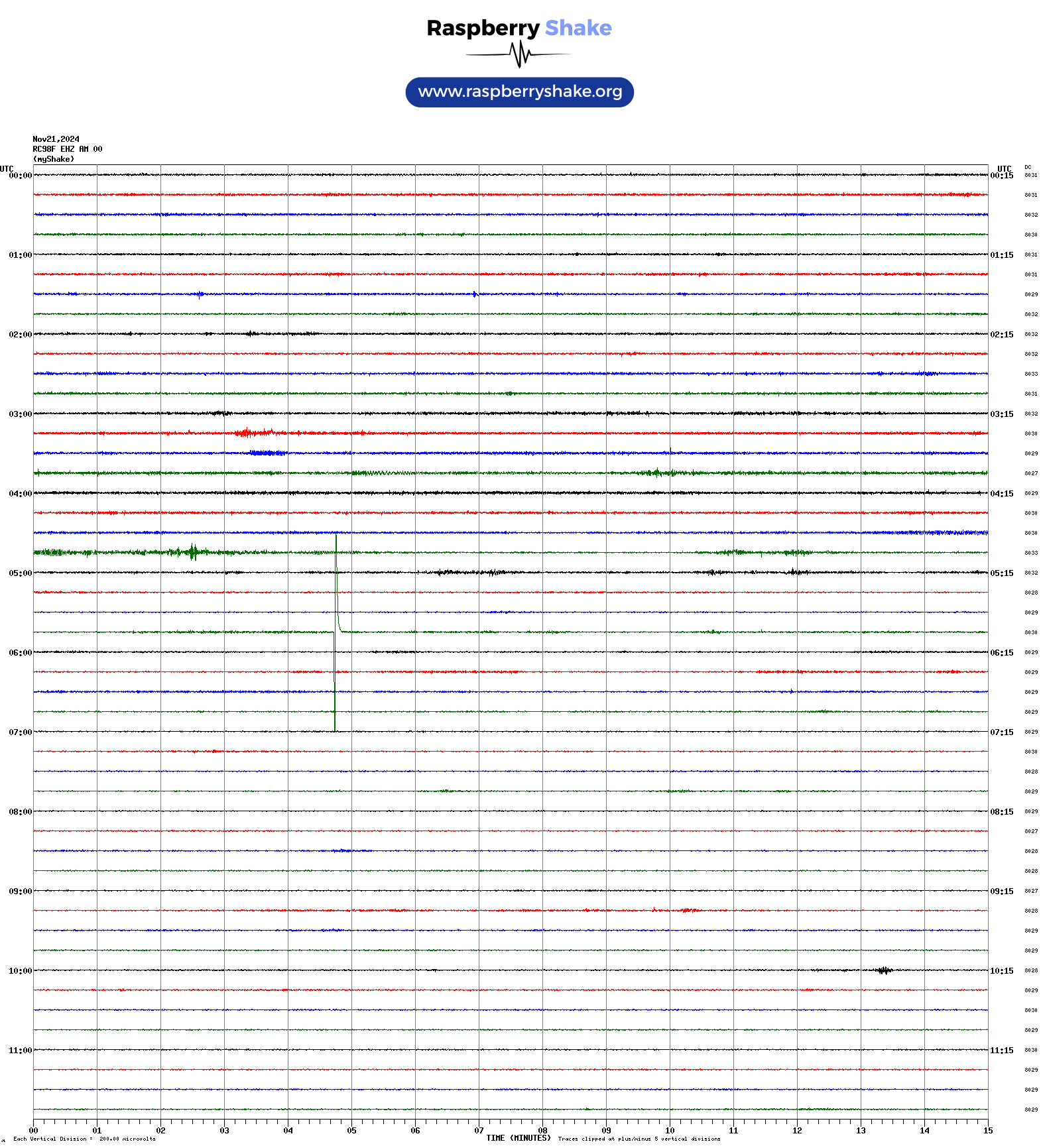
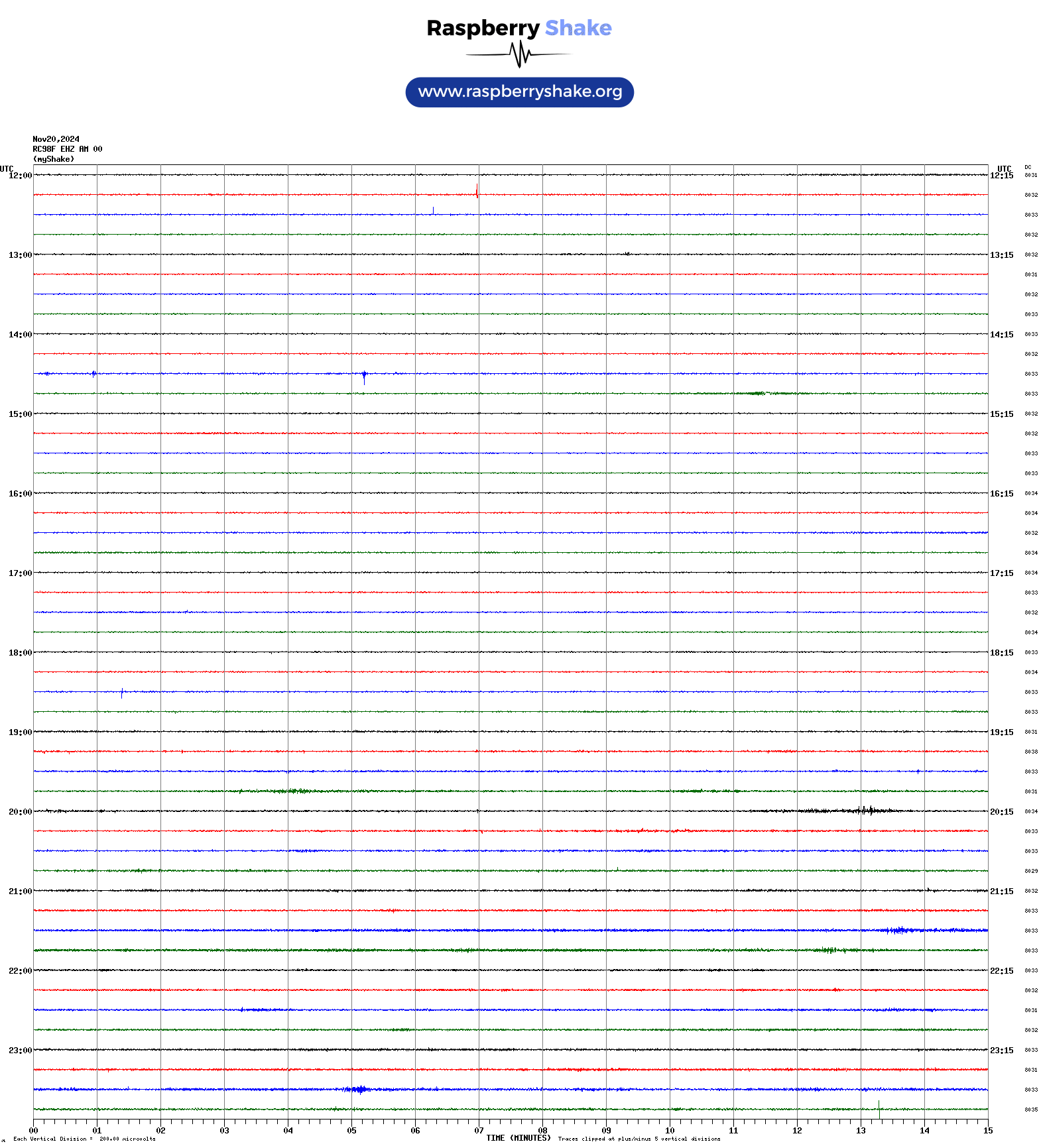
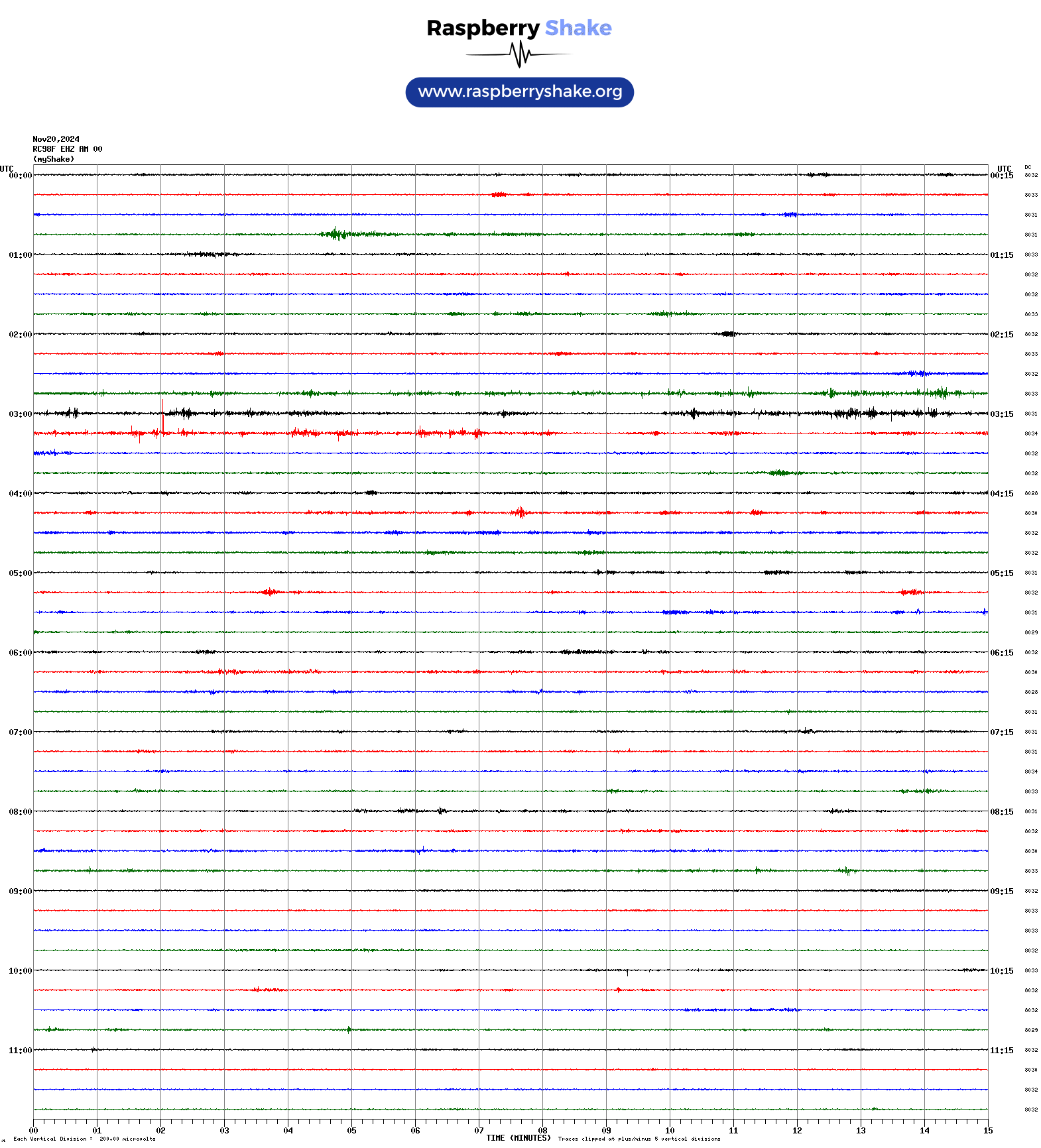
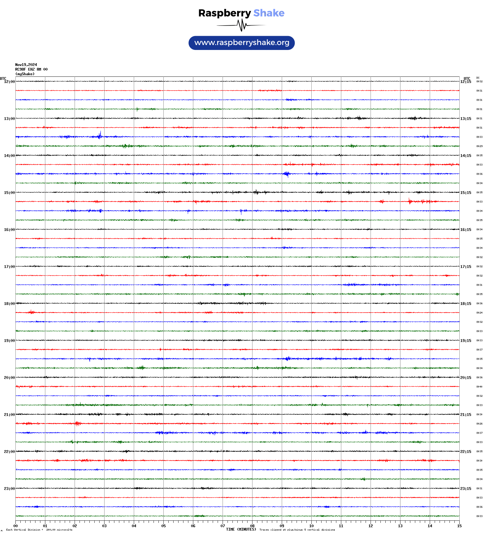
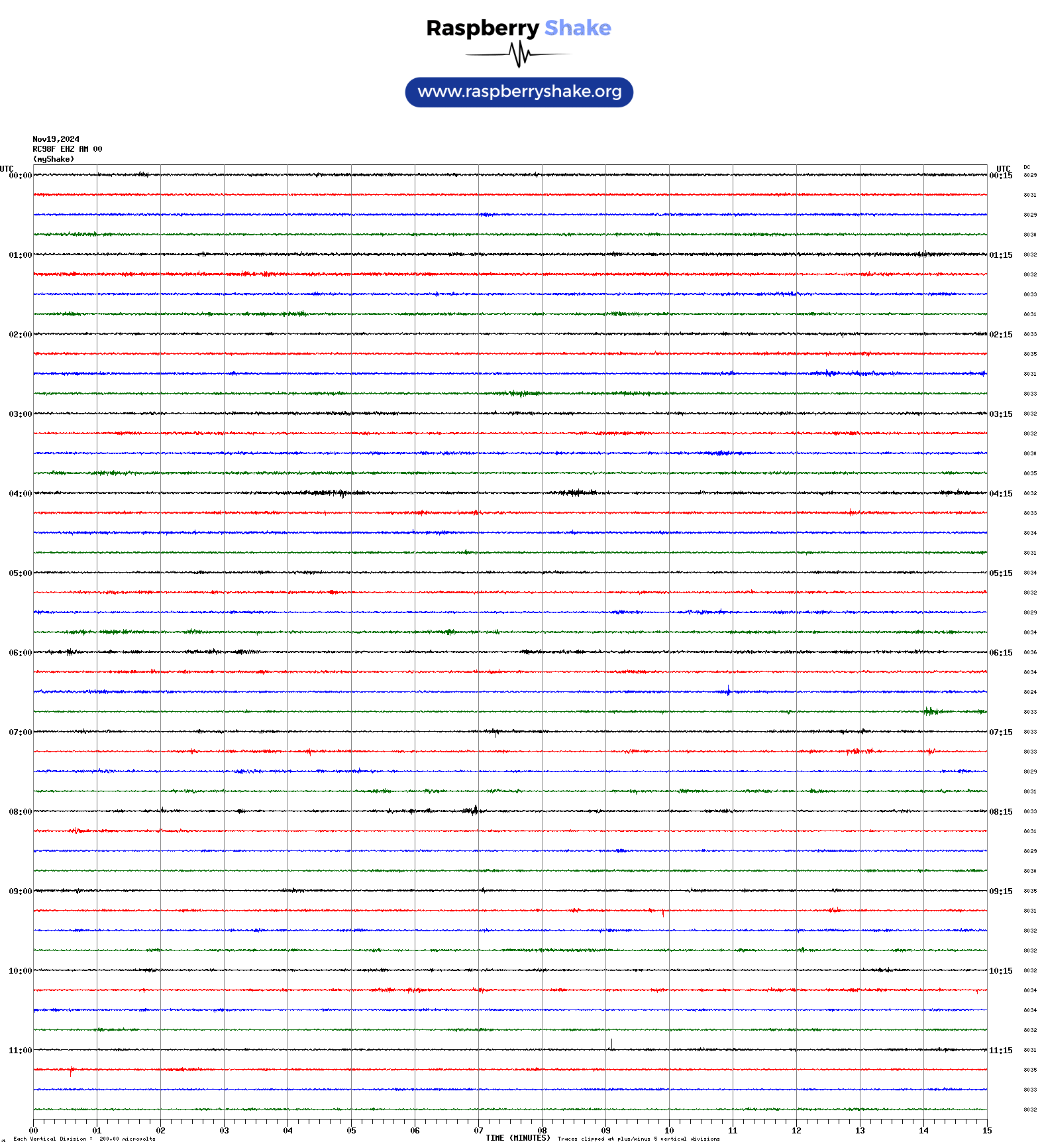
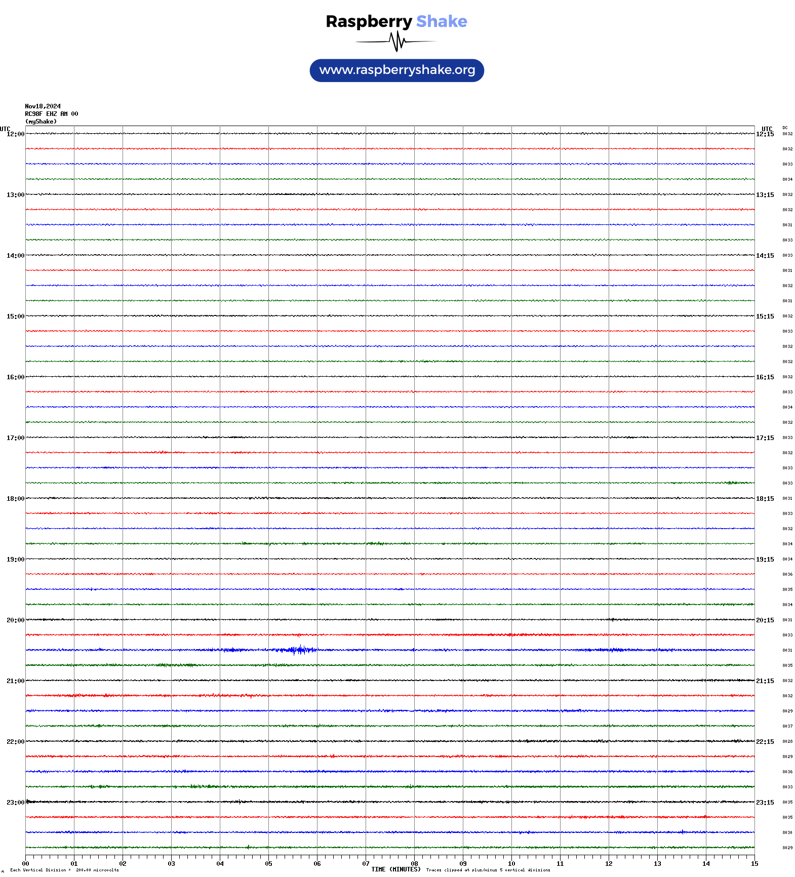
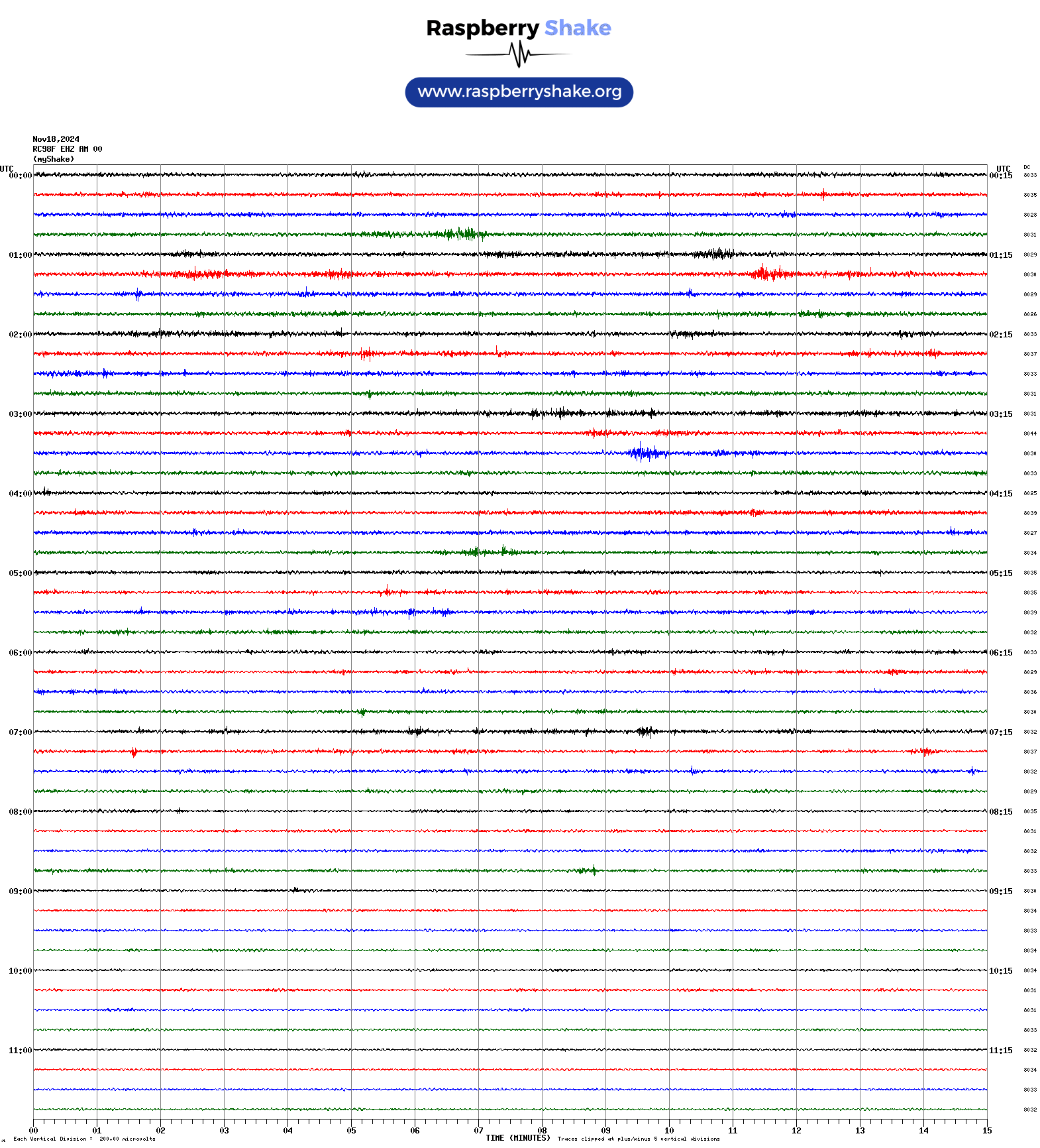
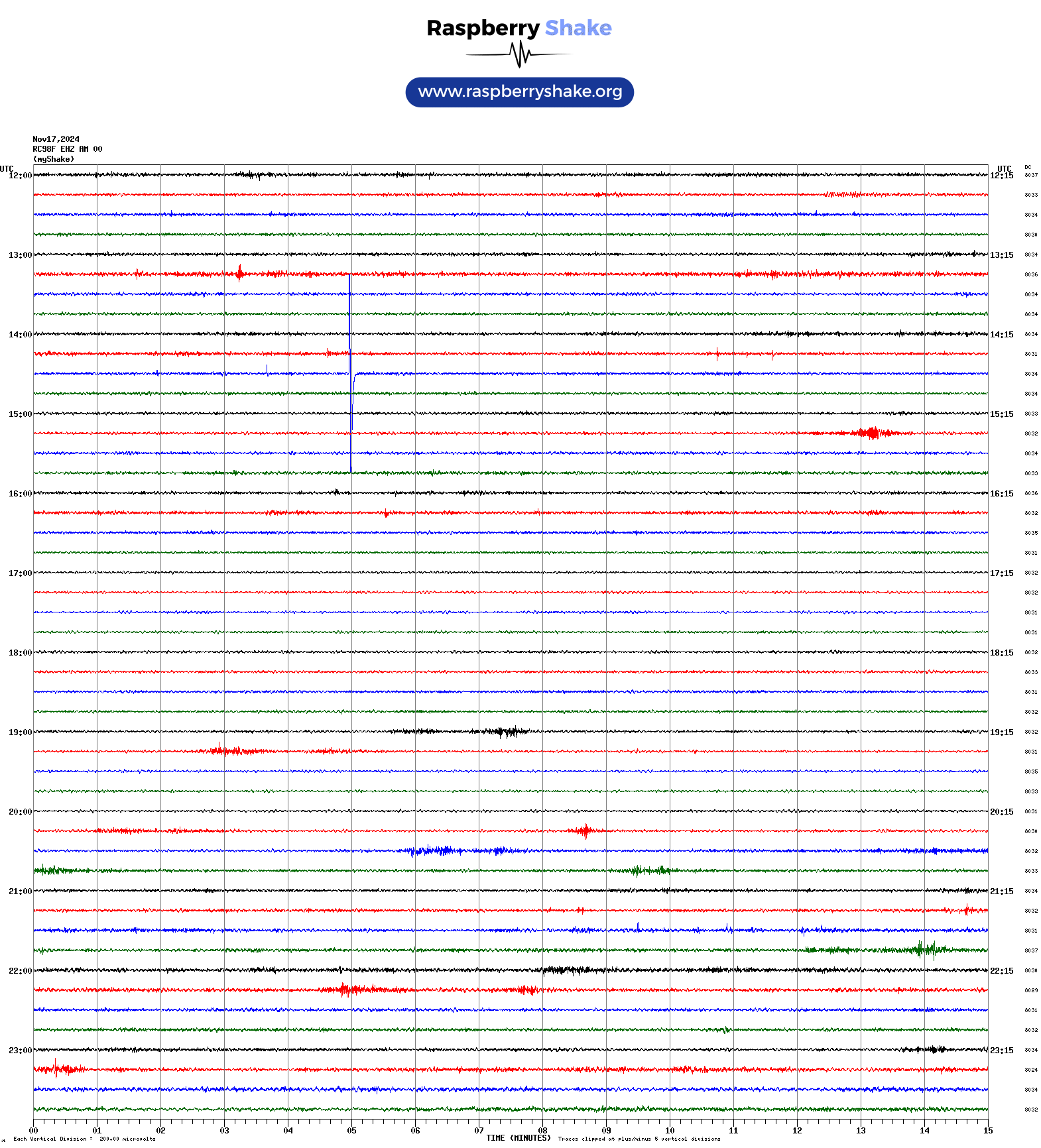
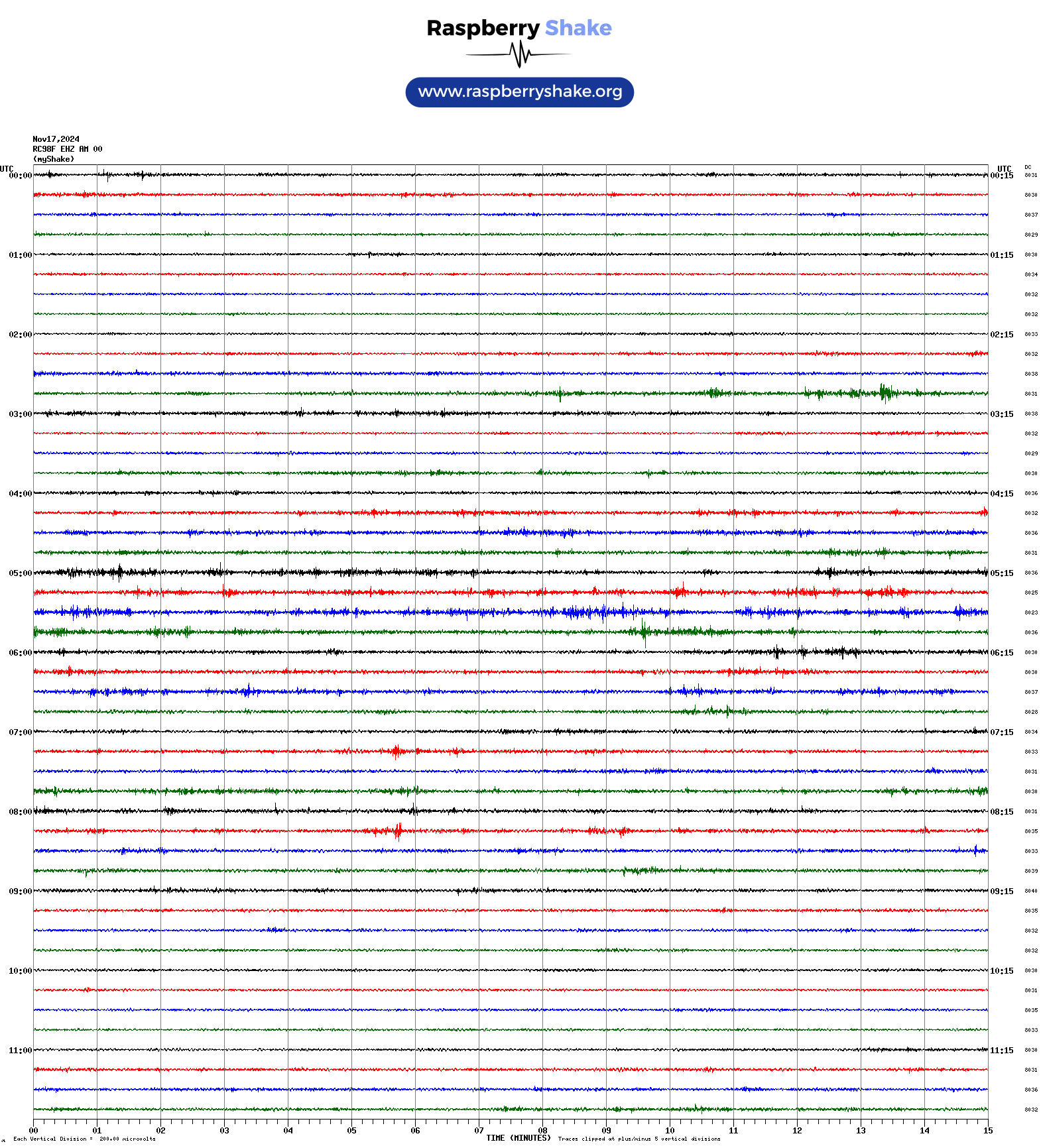
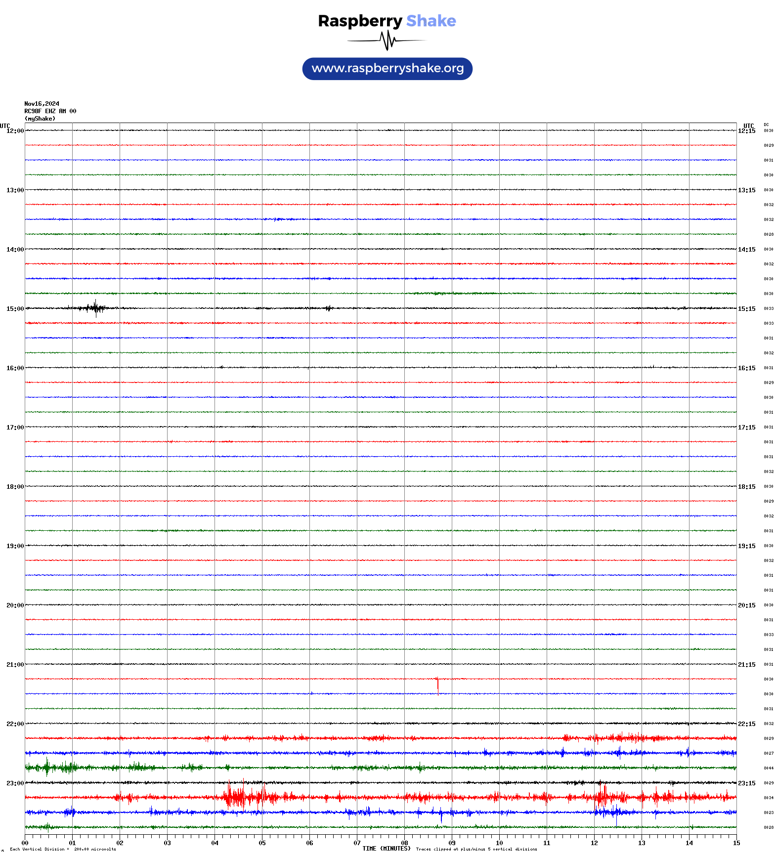
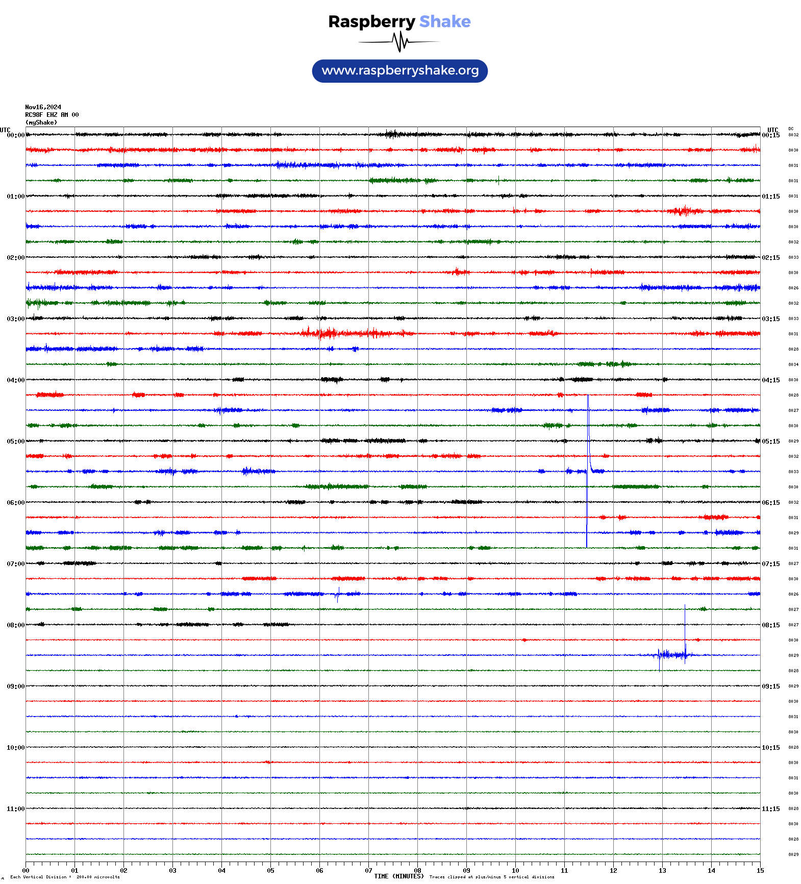
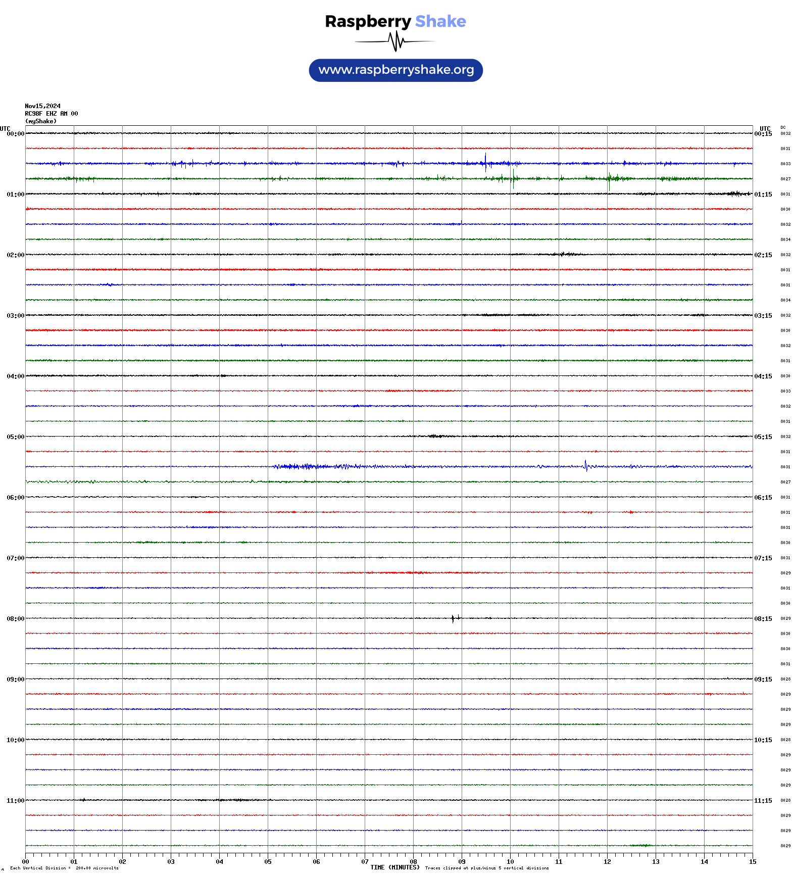
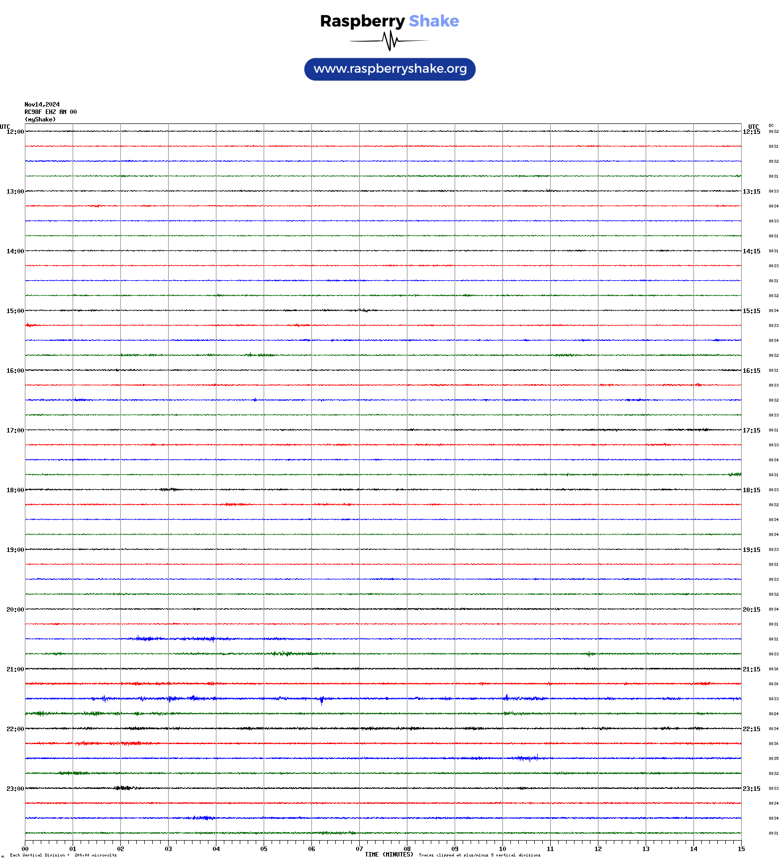
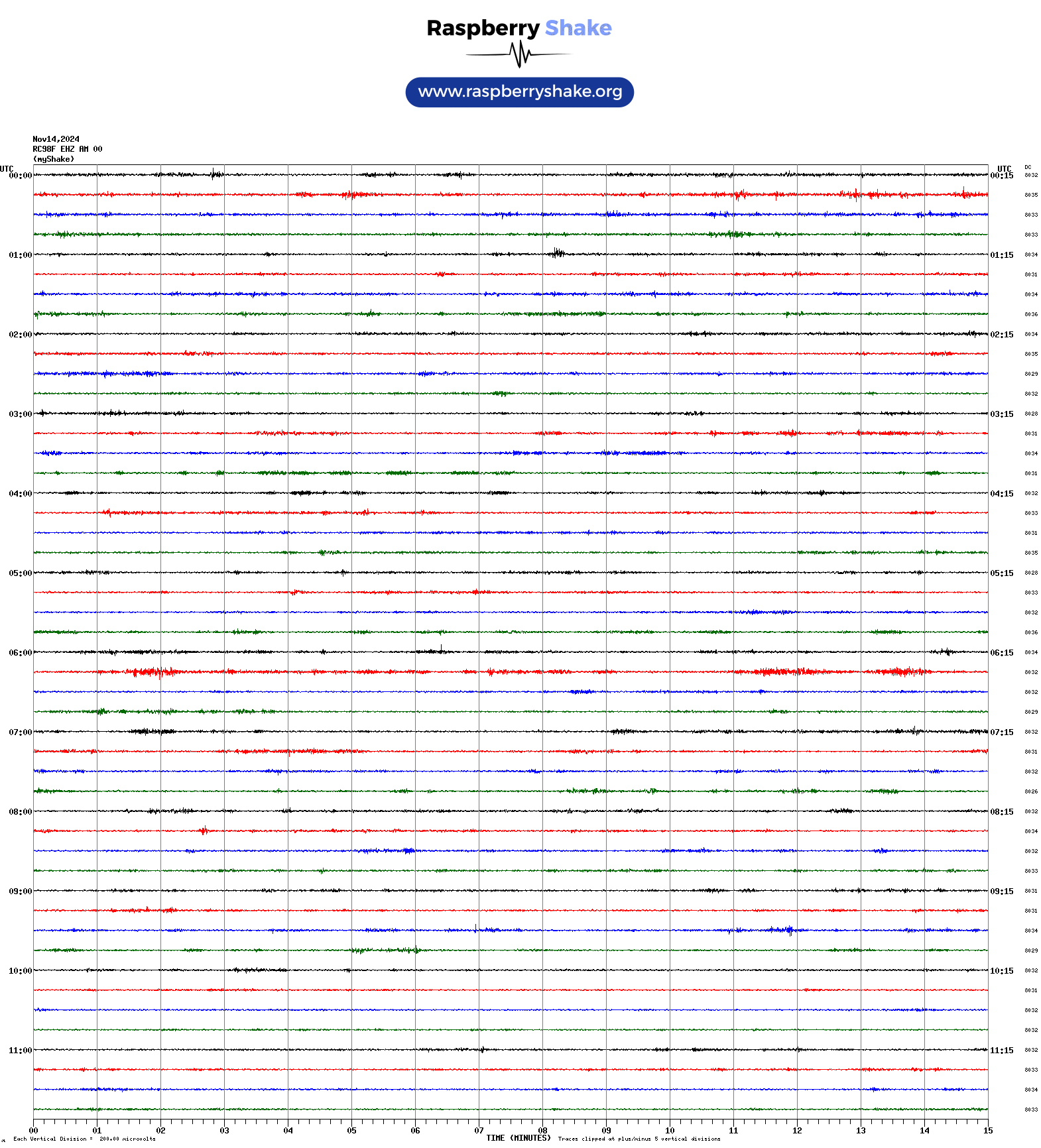
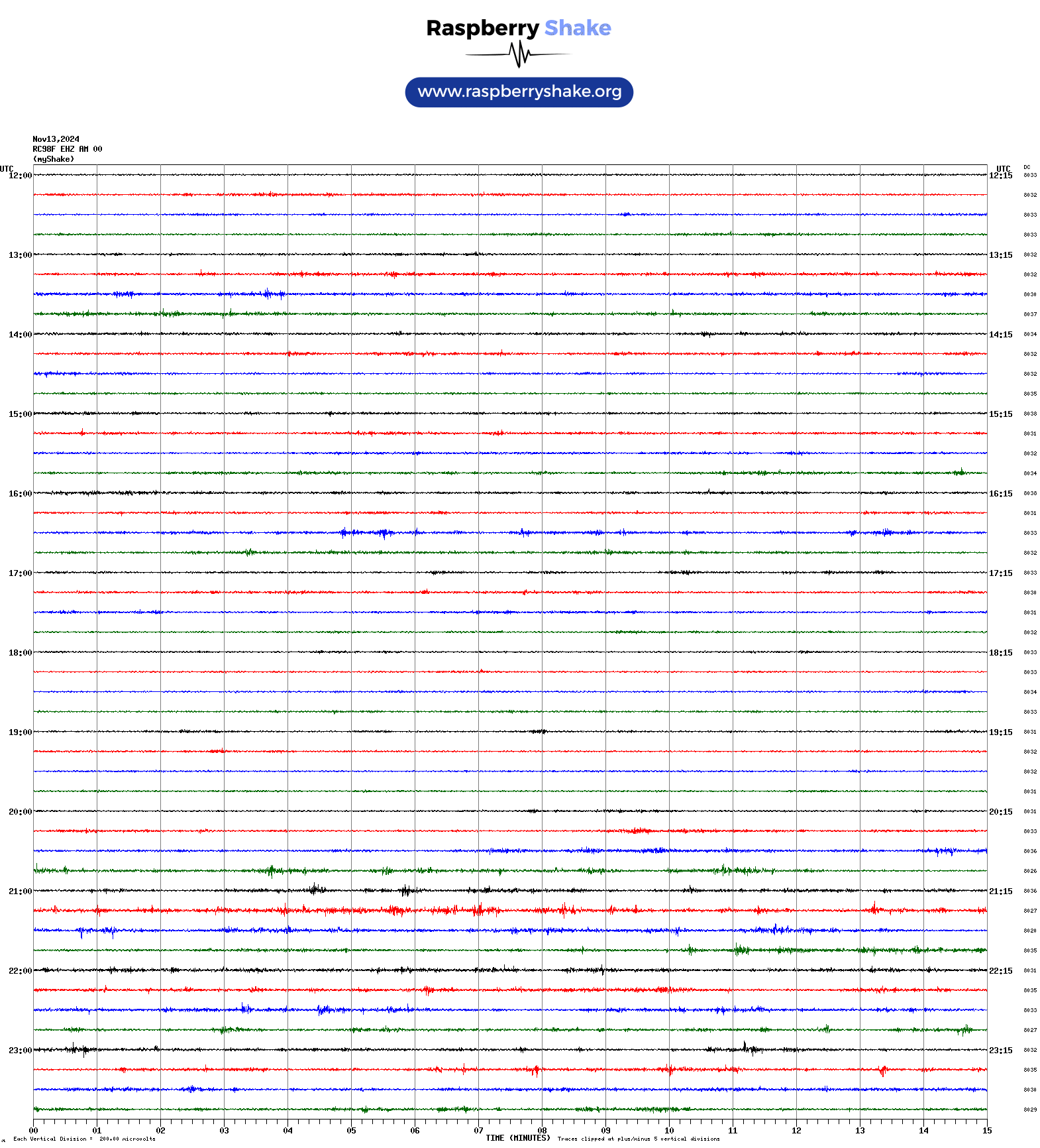
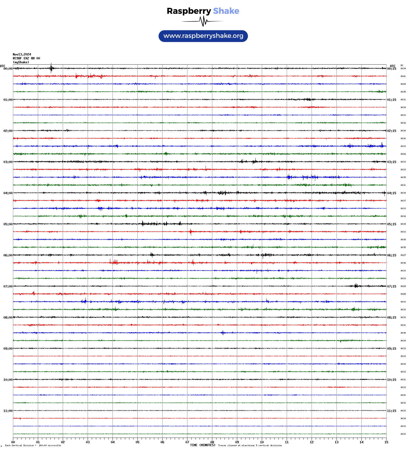
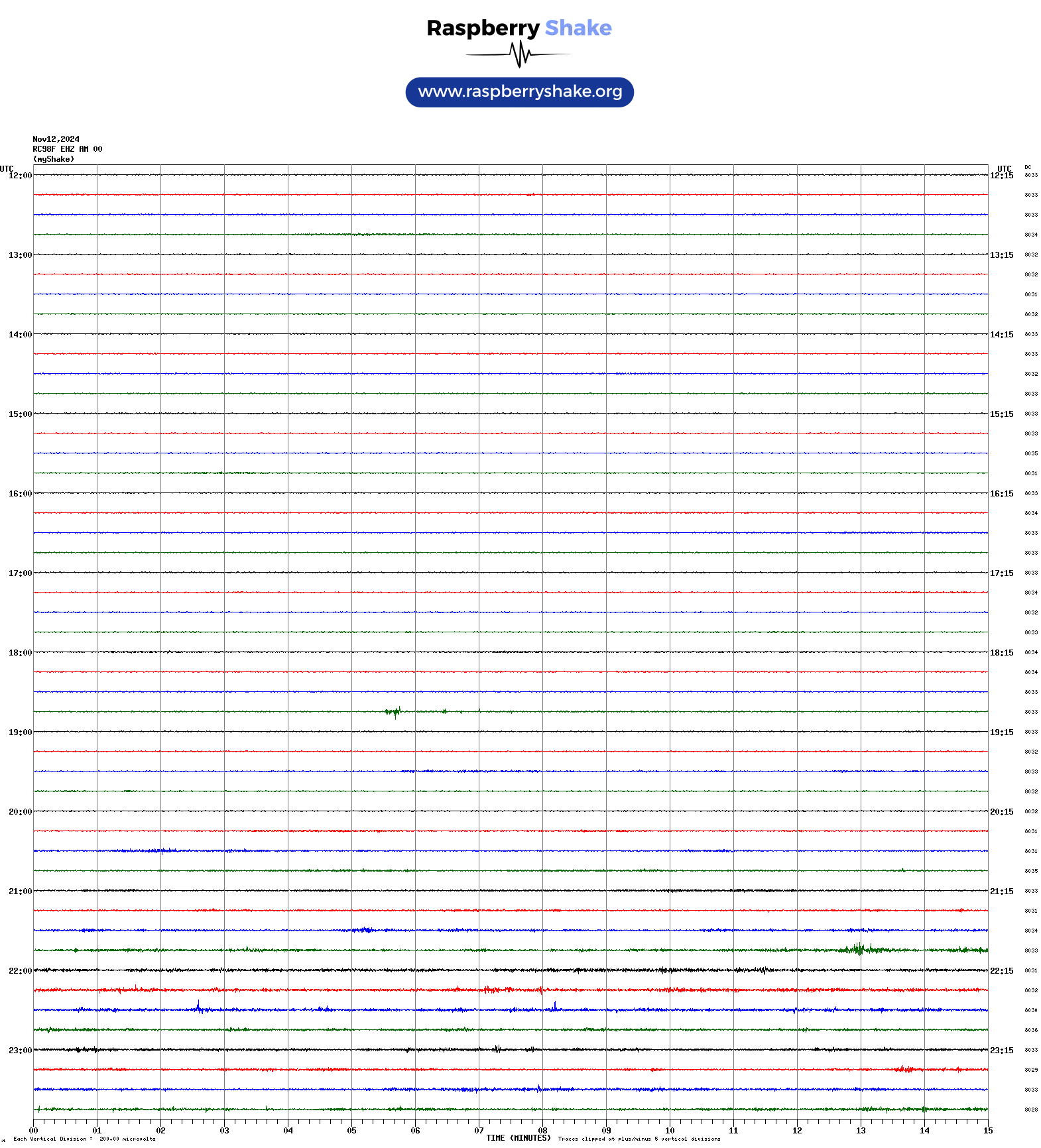
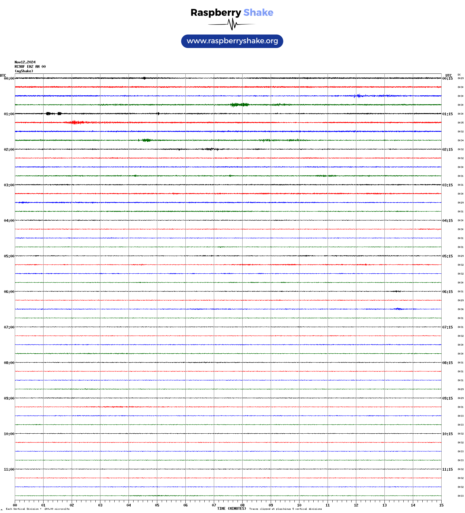
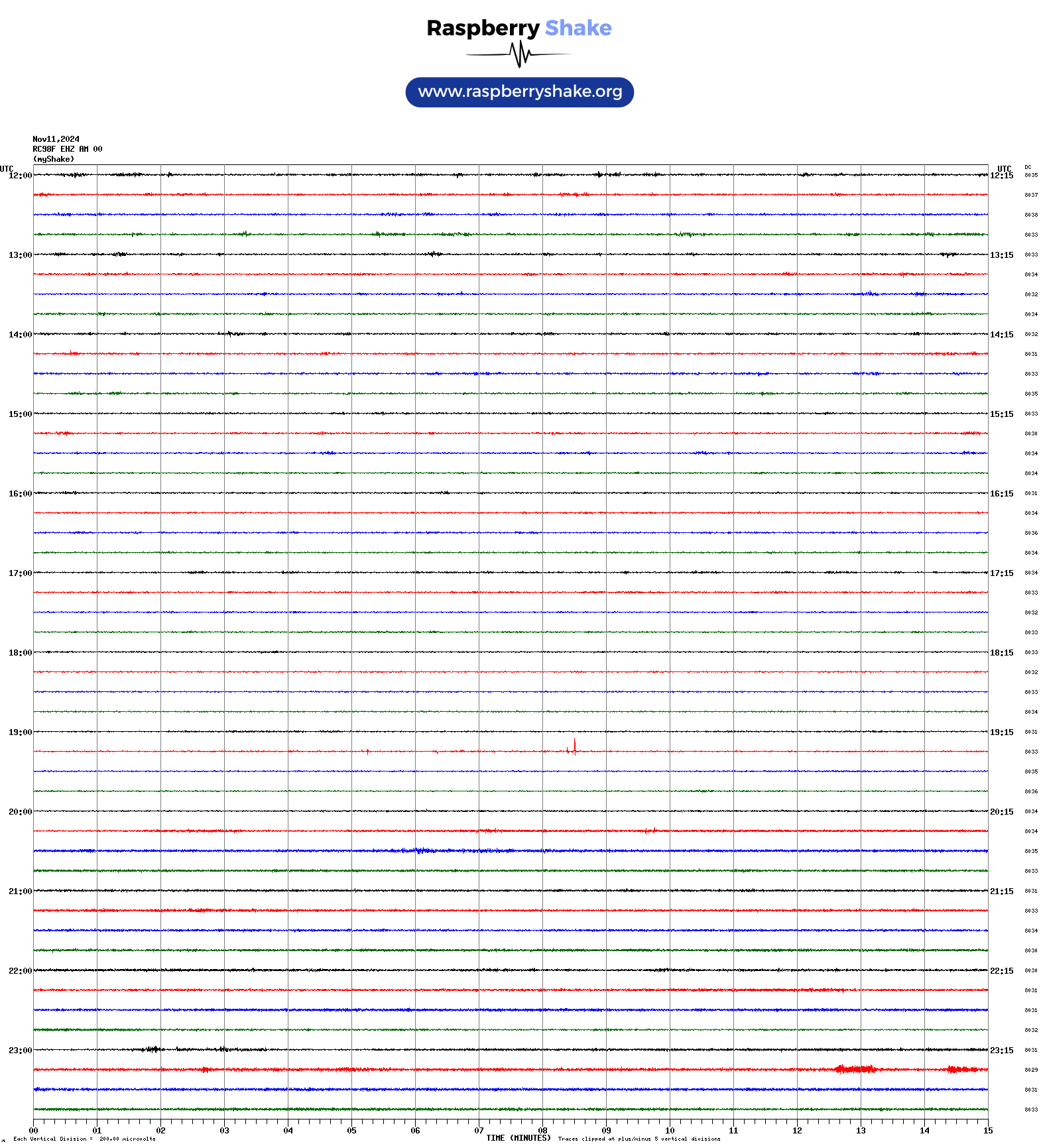
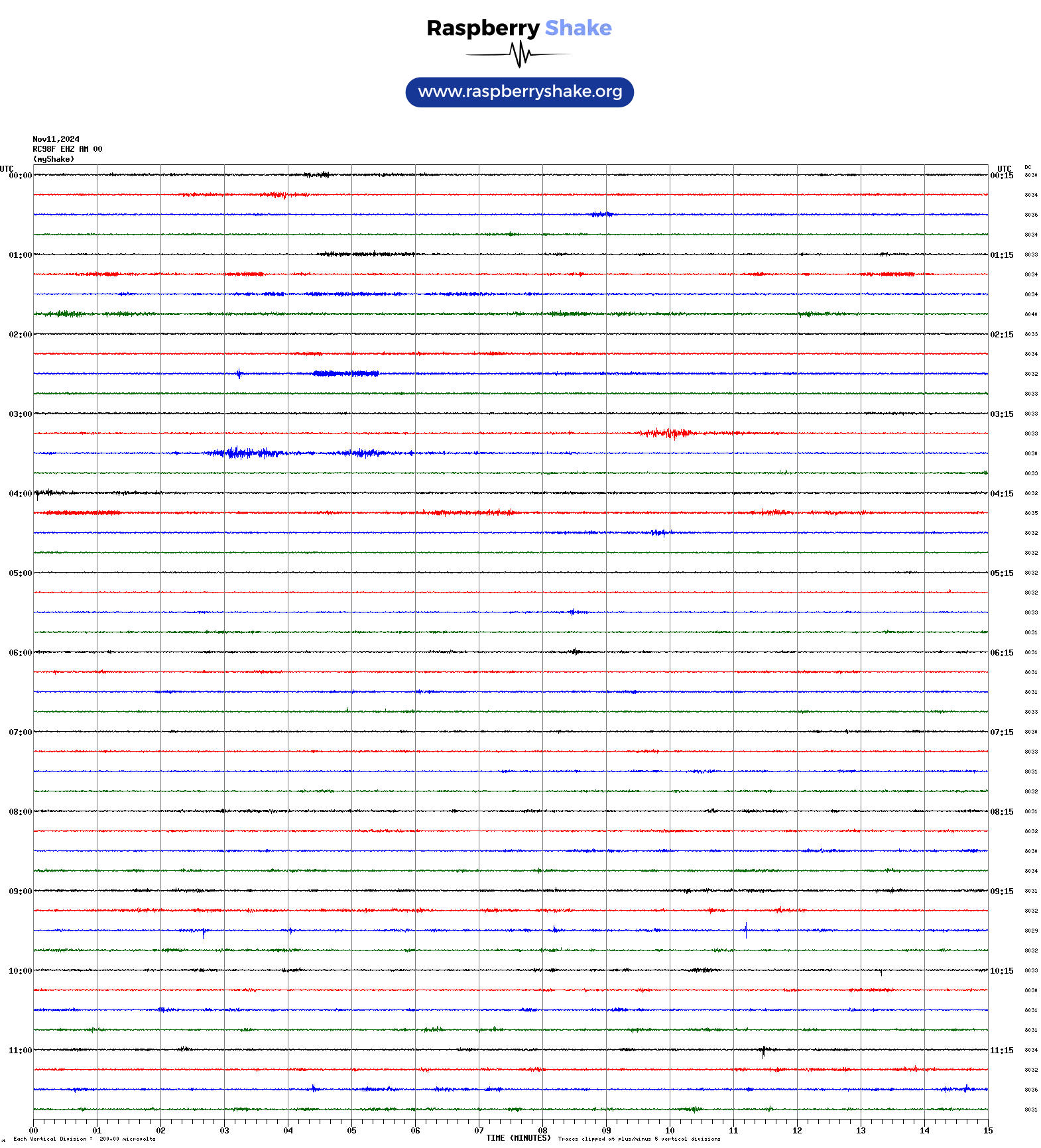
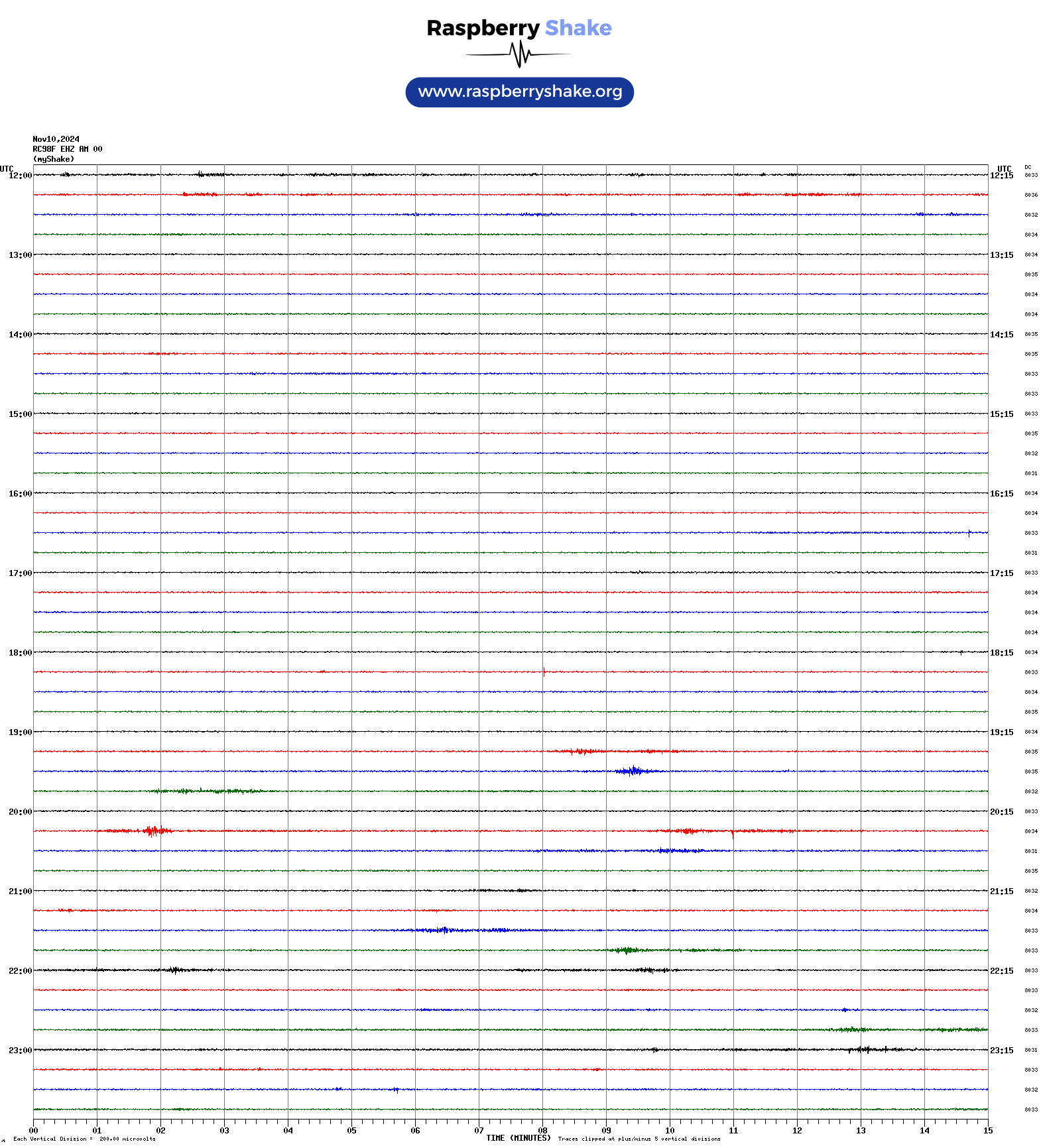
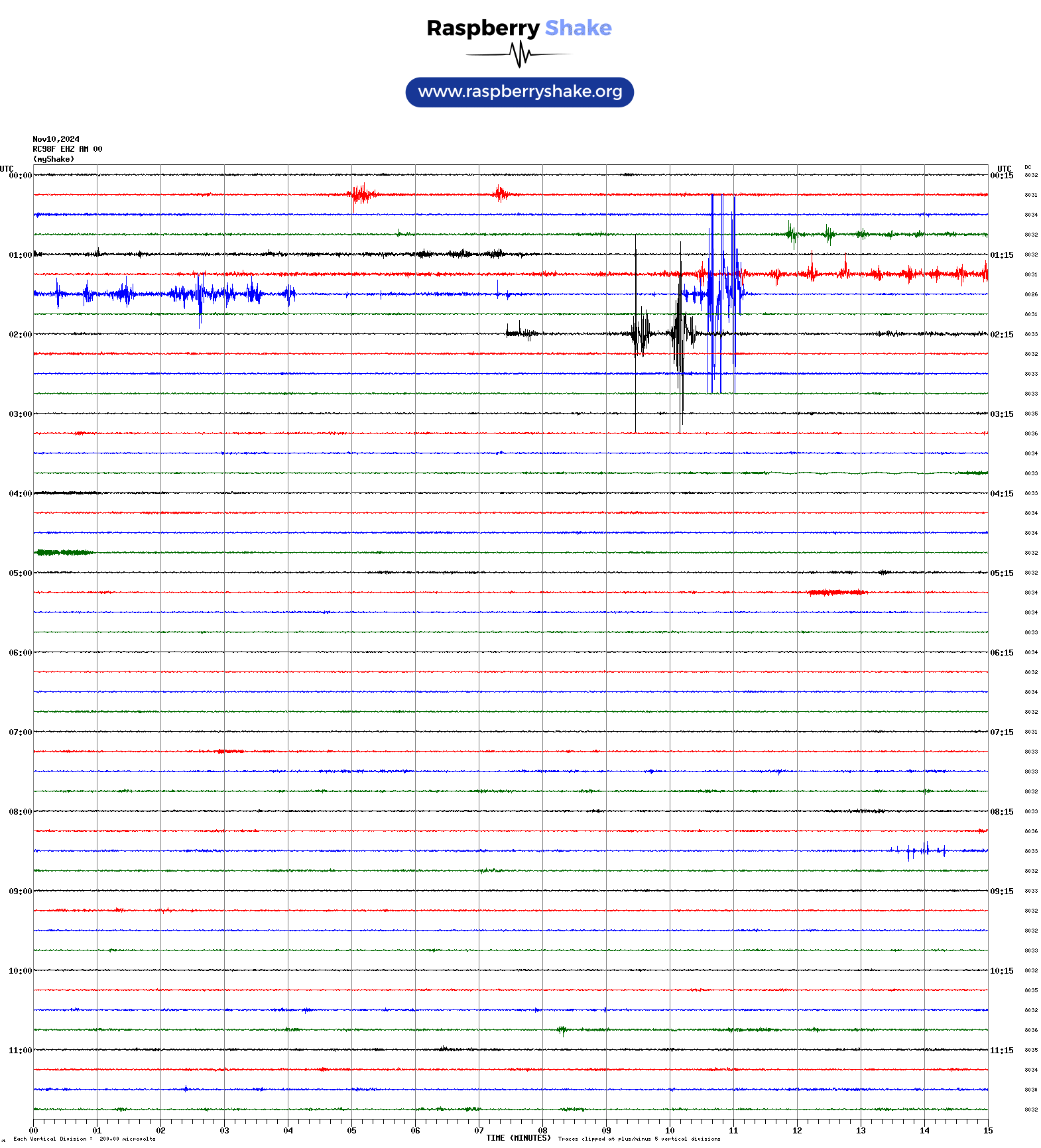
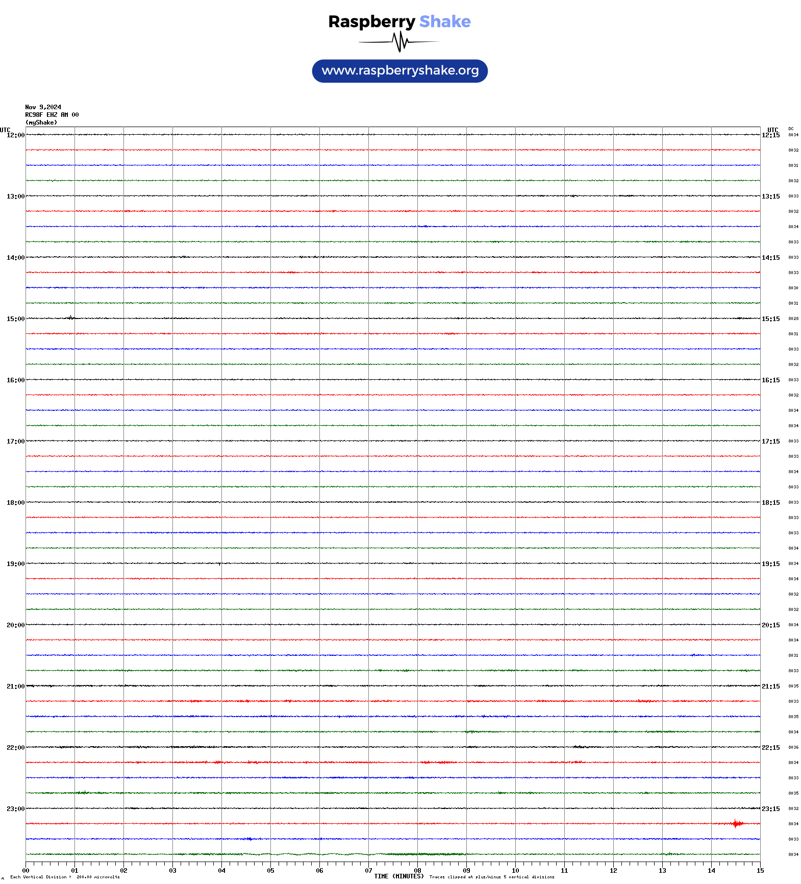
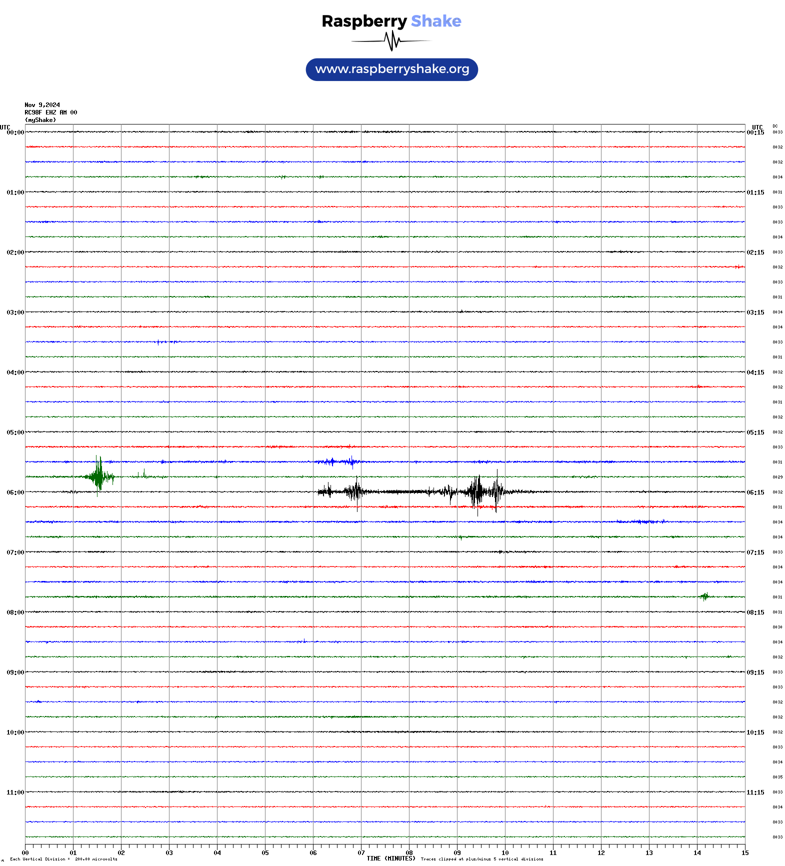
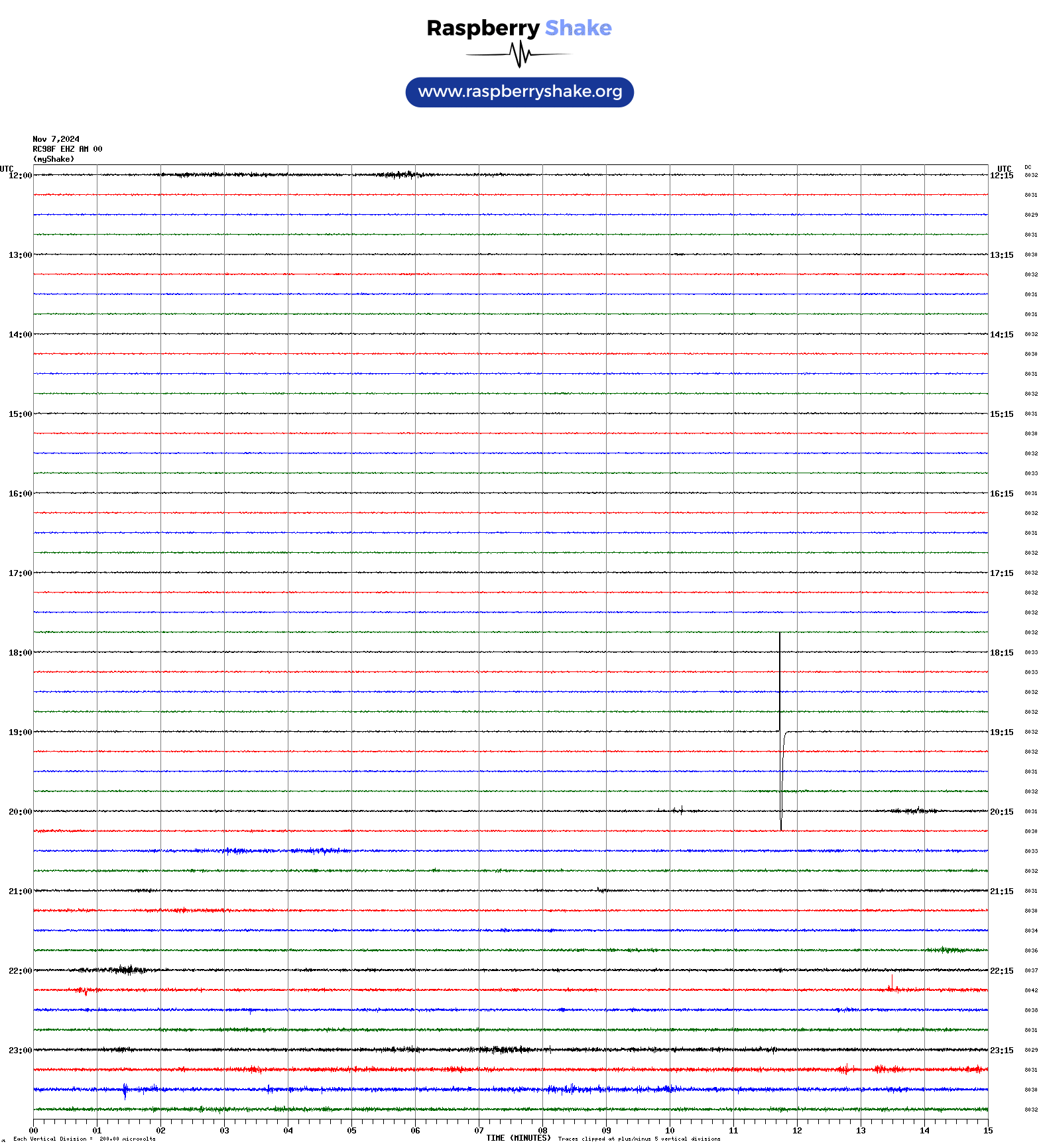
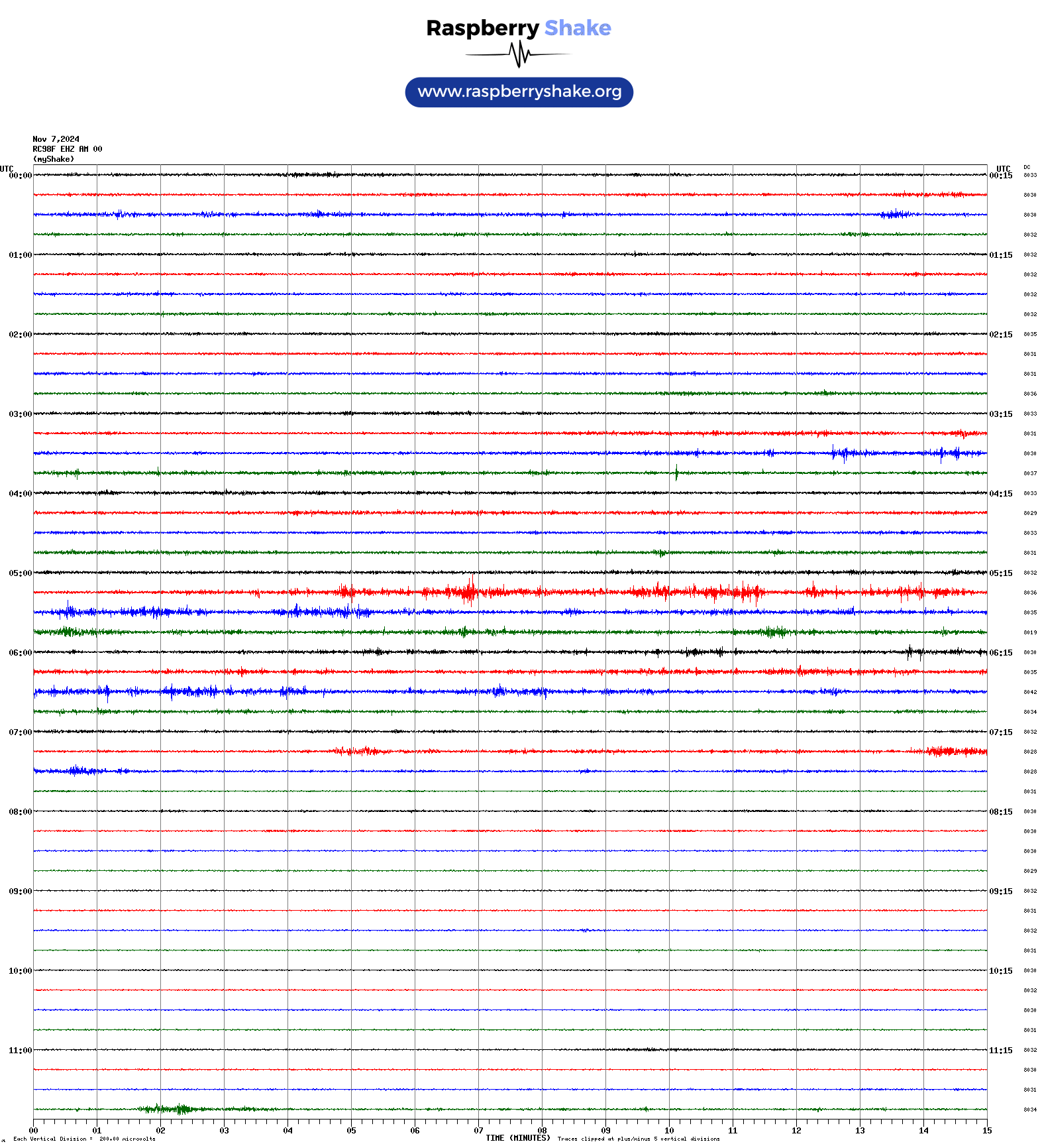
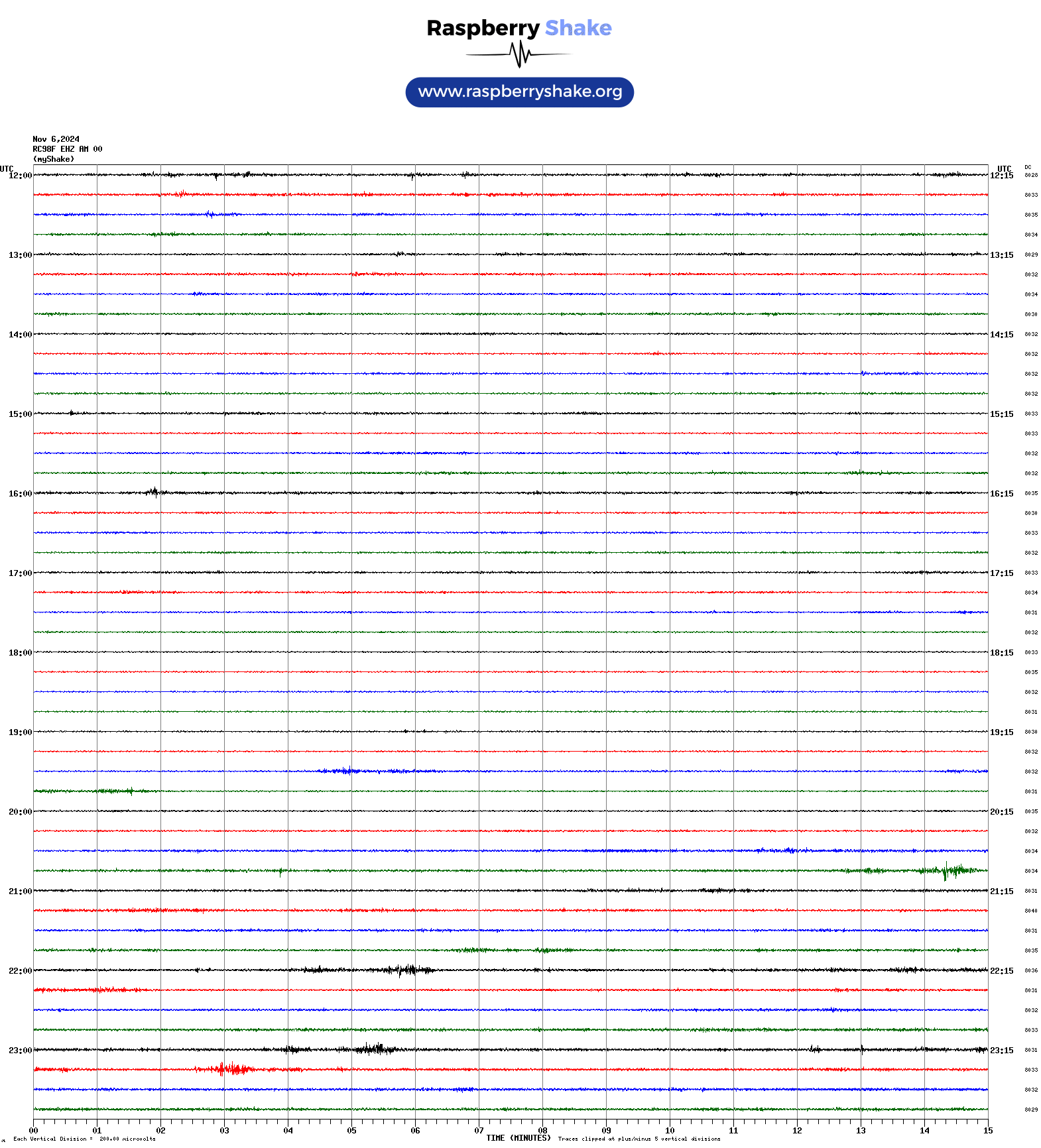
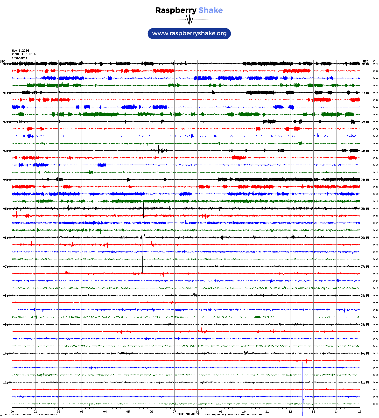
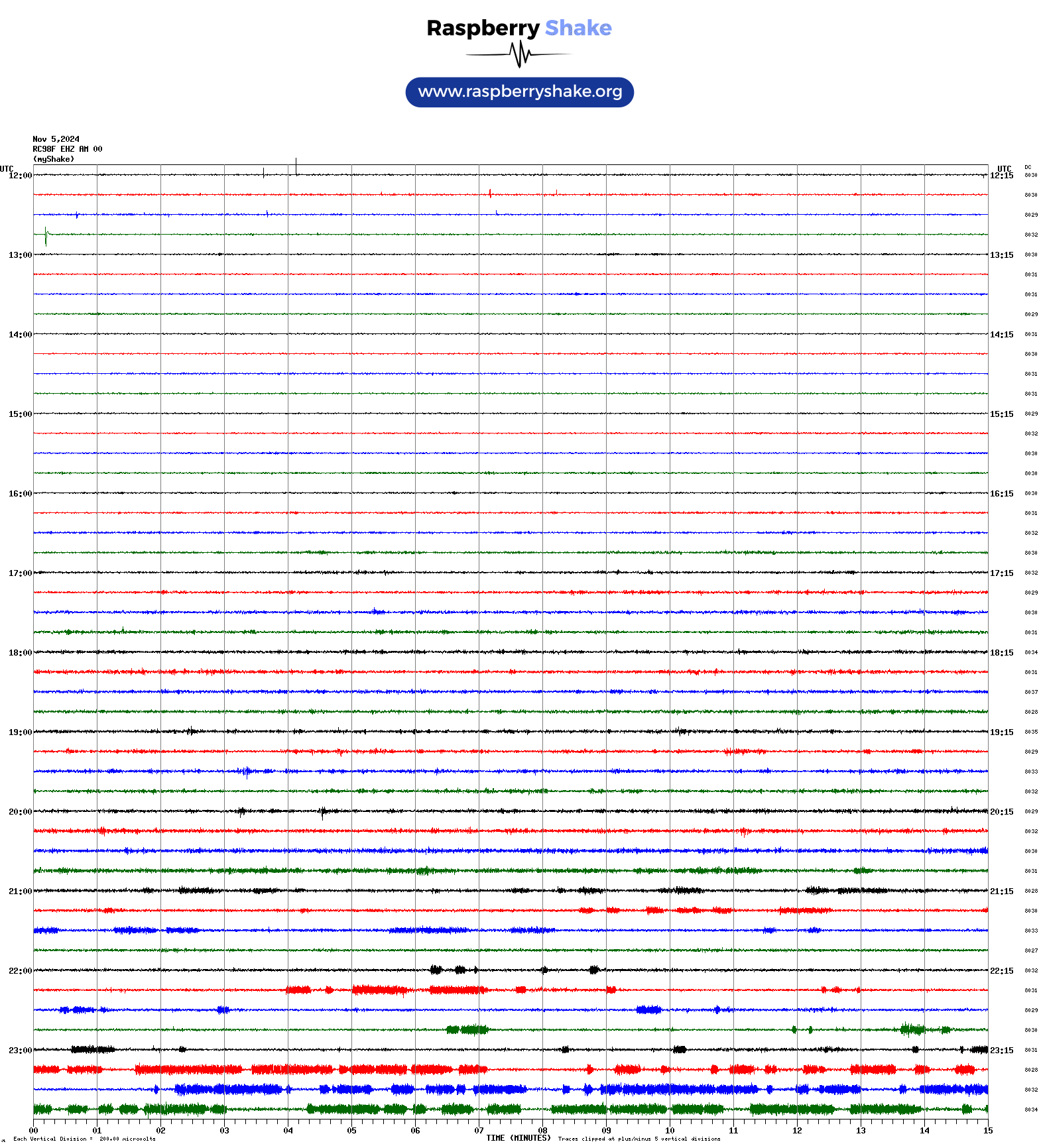
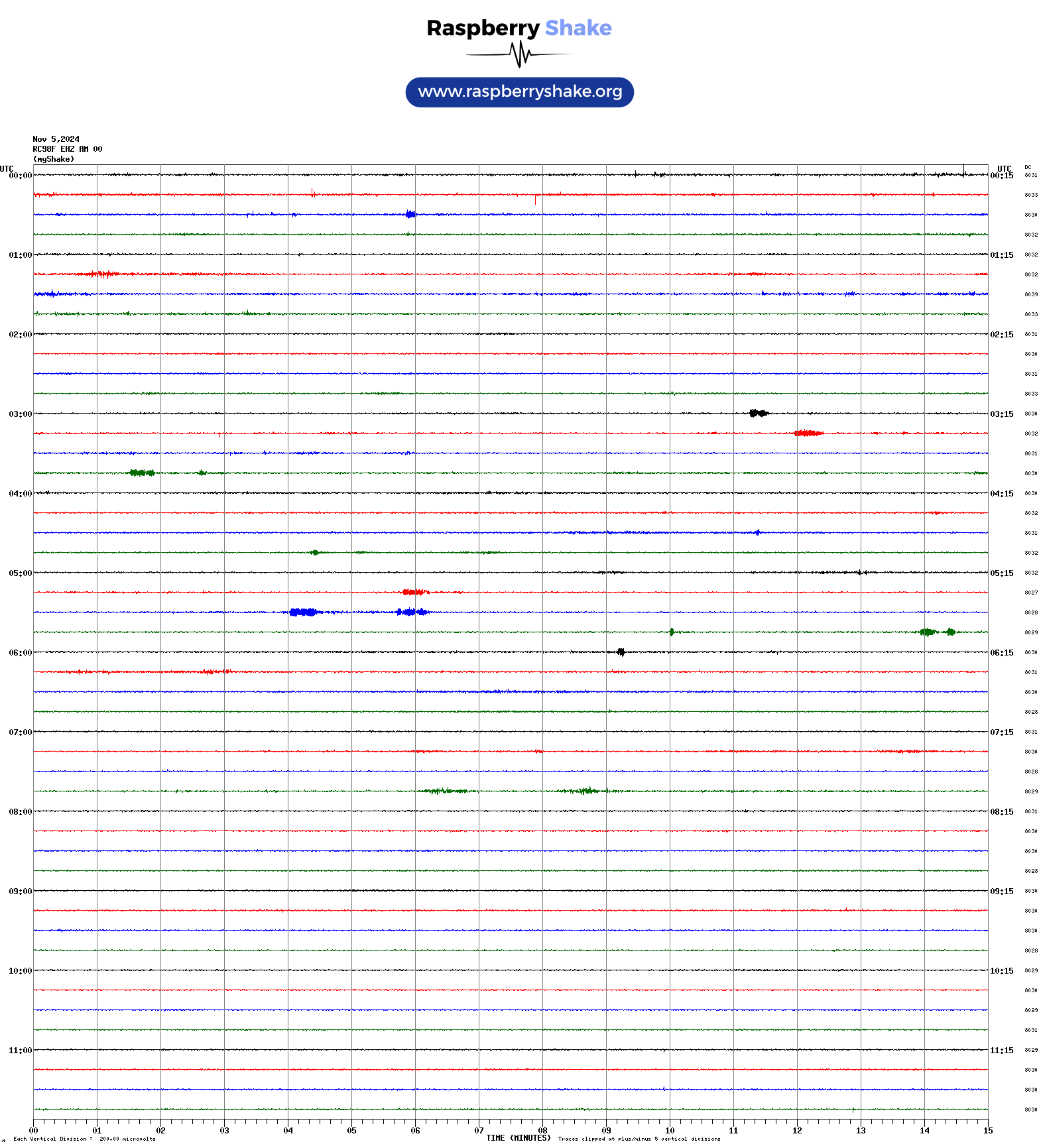
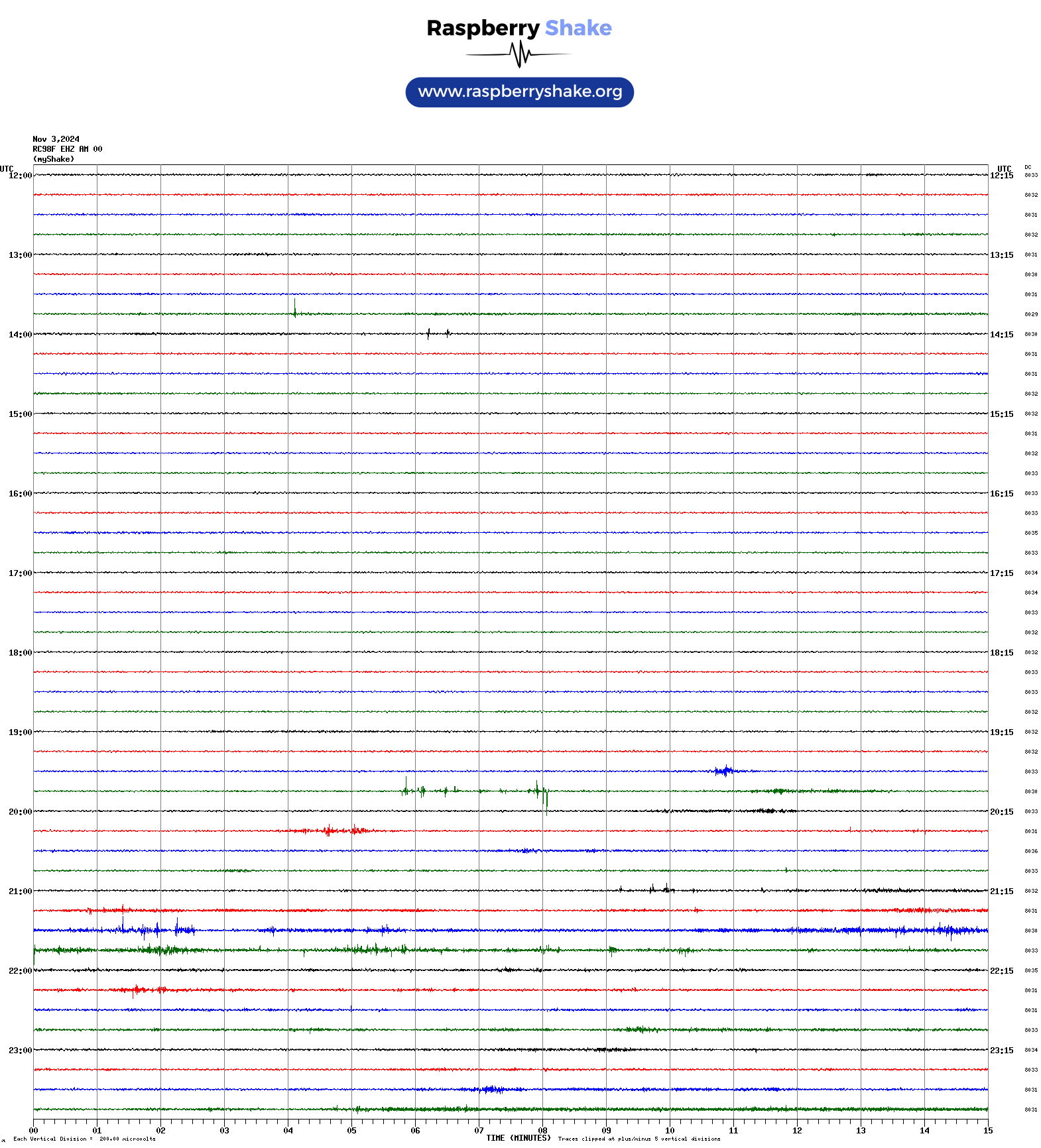
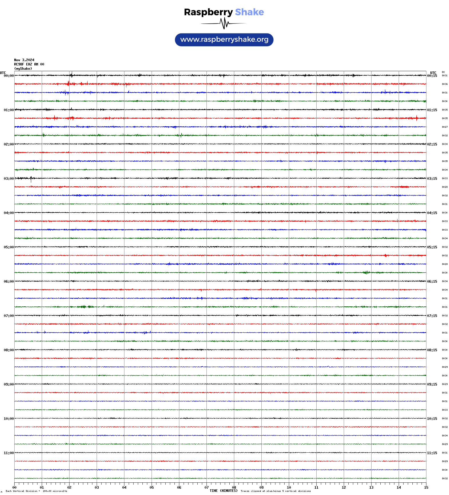
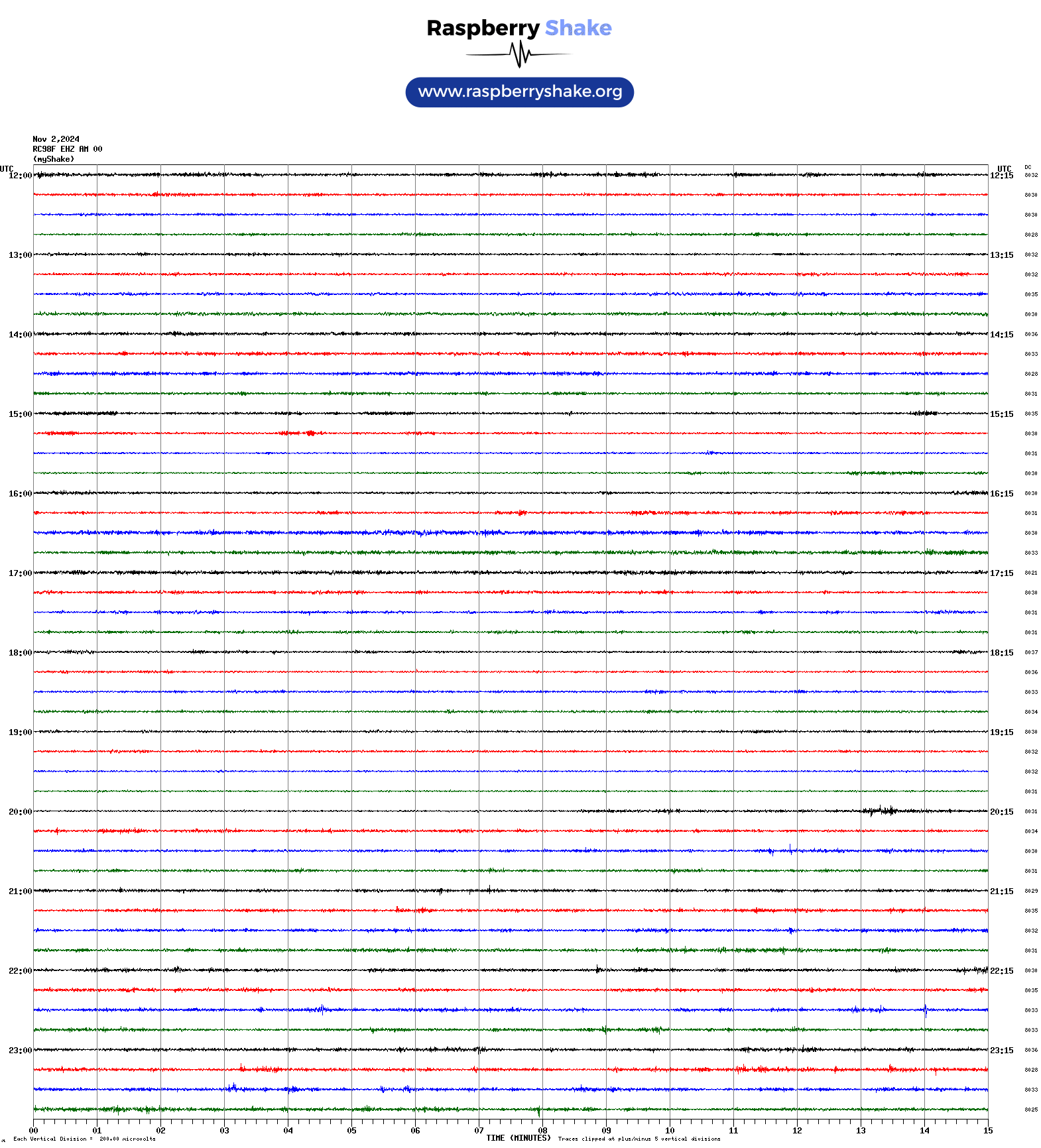
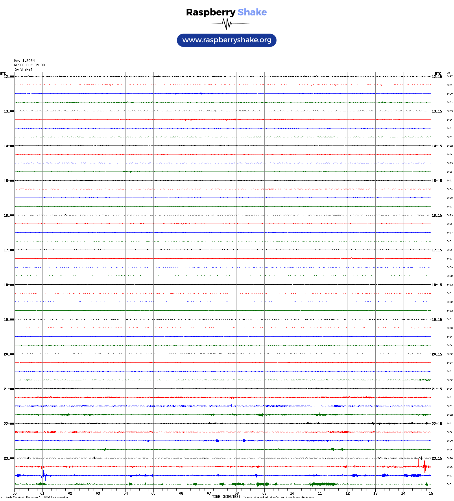
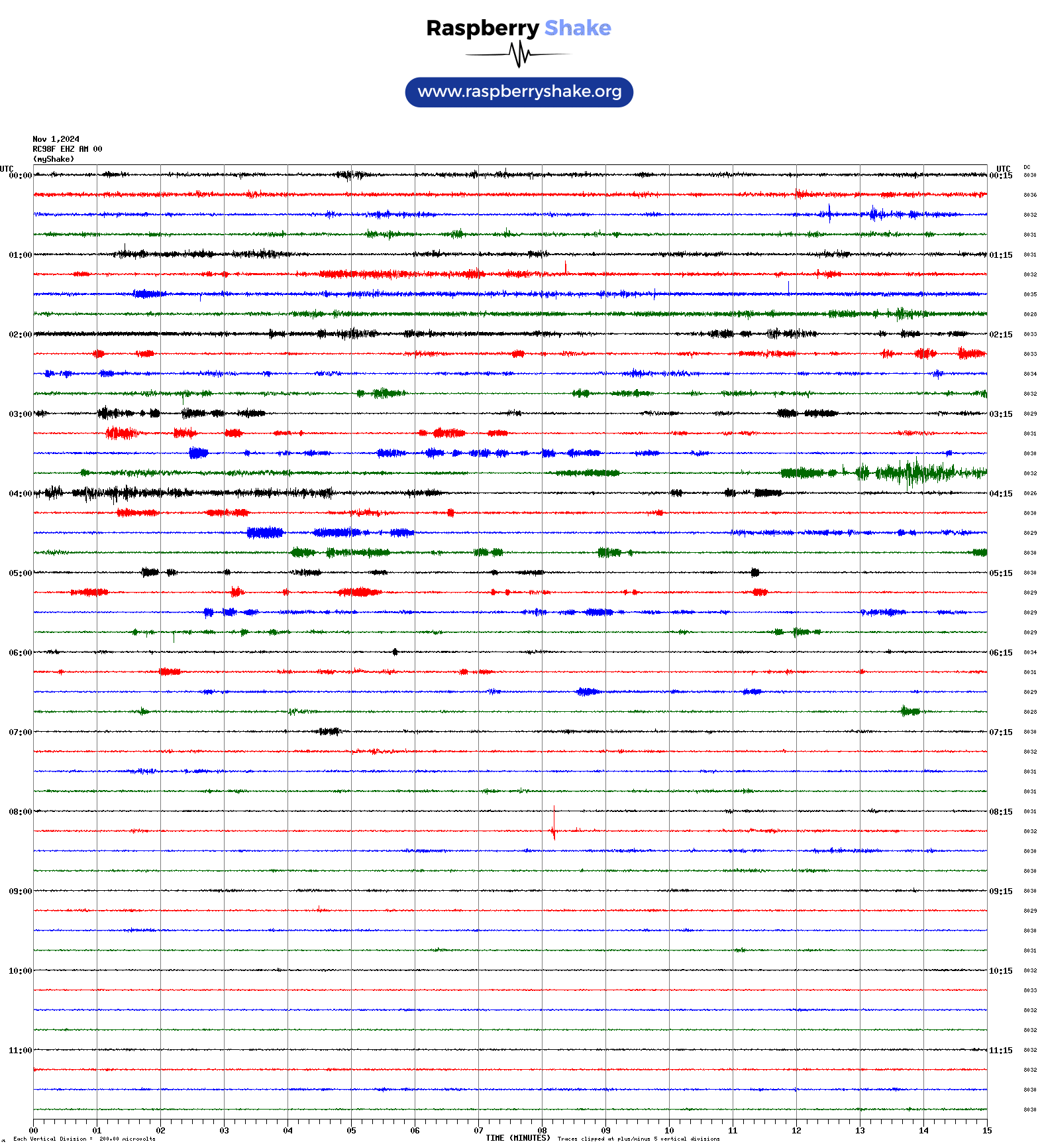
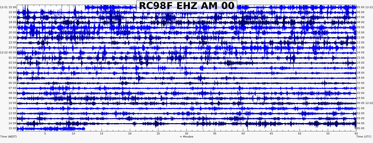
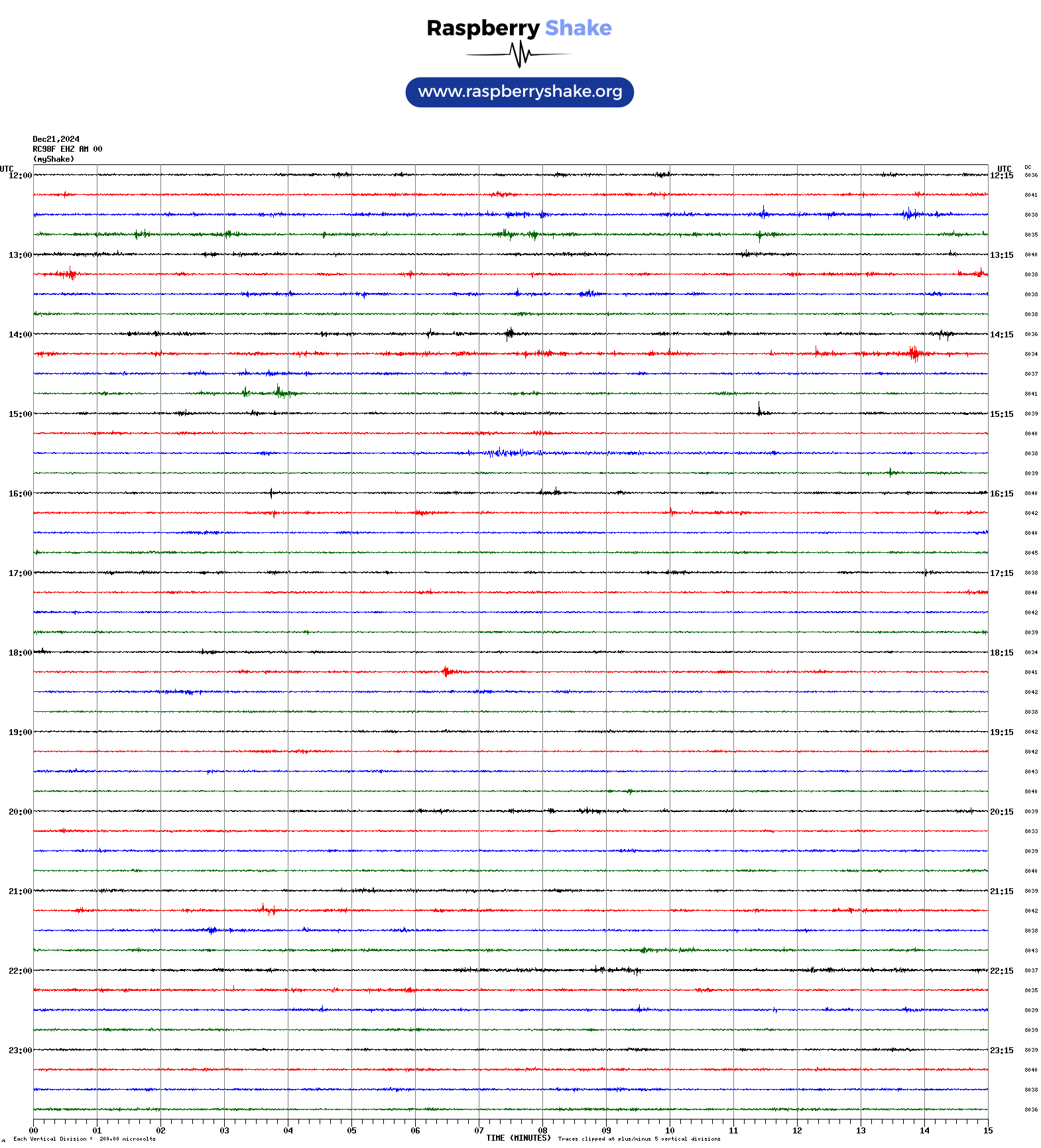
The following is the most recent helicorder image for the detector at this location - AM.RC98F
The first file (blue) is the generated swarm file and it shows both EDT and UTC time
The second image is direct from the Pi and only has the UTC time ( Sat 21 Dec 2024 17:06:01 UTC ), not as local time ( Sun 22 Dec 2024 04:06:01 AEDT ).
The images are updated every 2 minutes, although there will be a time lag as it needs to be fetched from the unit first.
Click on the images to enlarge them.
Raspberryshake.org is a project that encourages and assists with the deployment of personal seismographs.
These seismographs use the raspberrypi mini computer to monitor an attached digitizer and a super sensitive motion sensor(s).
The network consists of many stations scattered throughout the world that do their part to contribute to the data, and even the detection, of the seismic events that occur around the world.
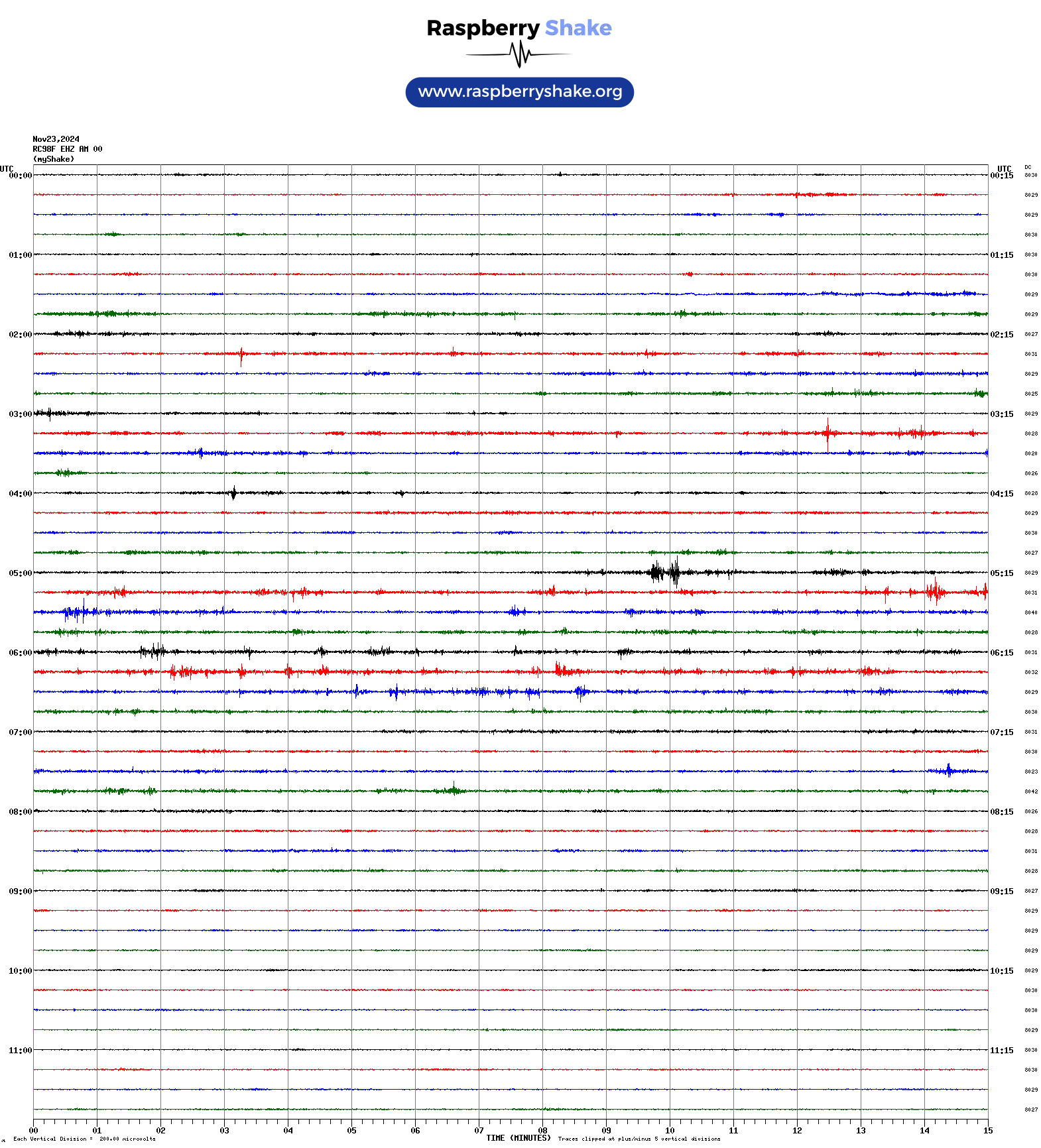
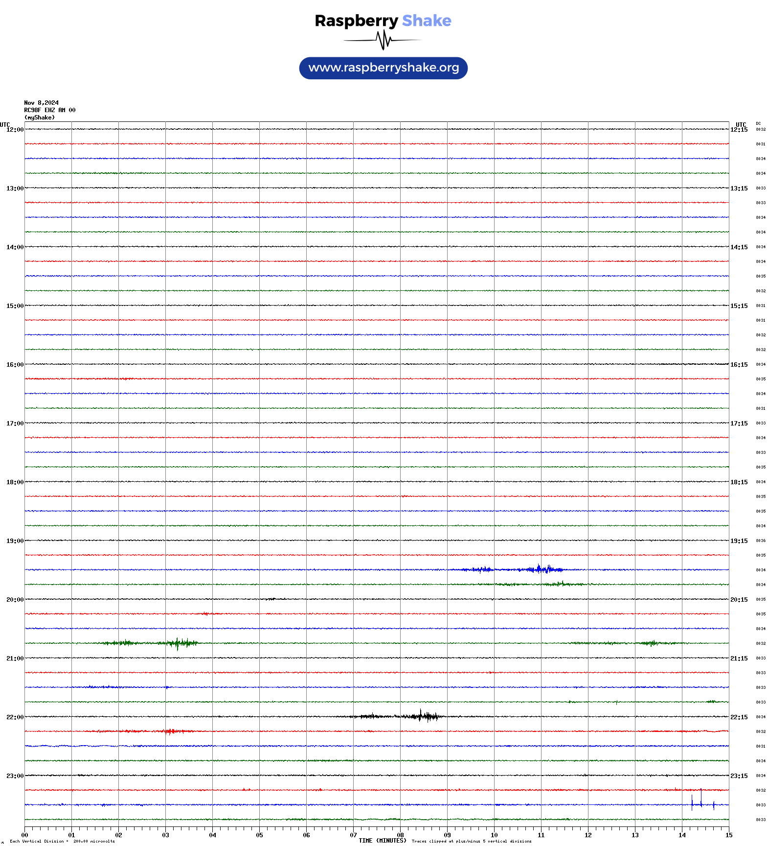
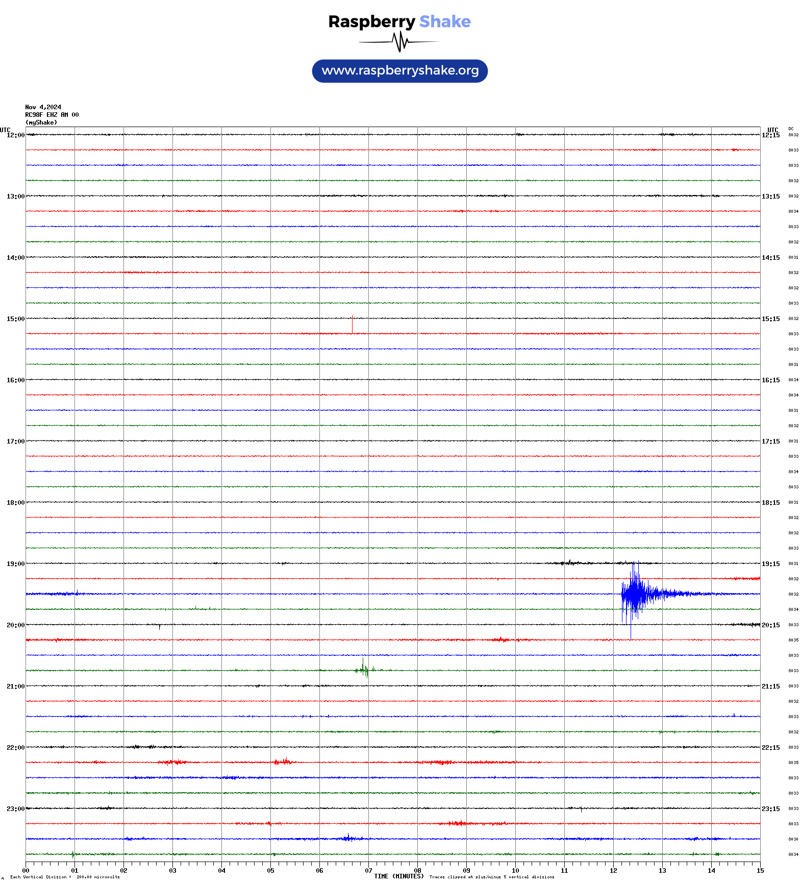
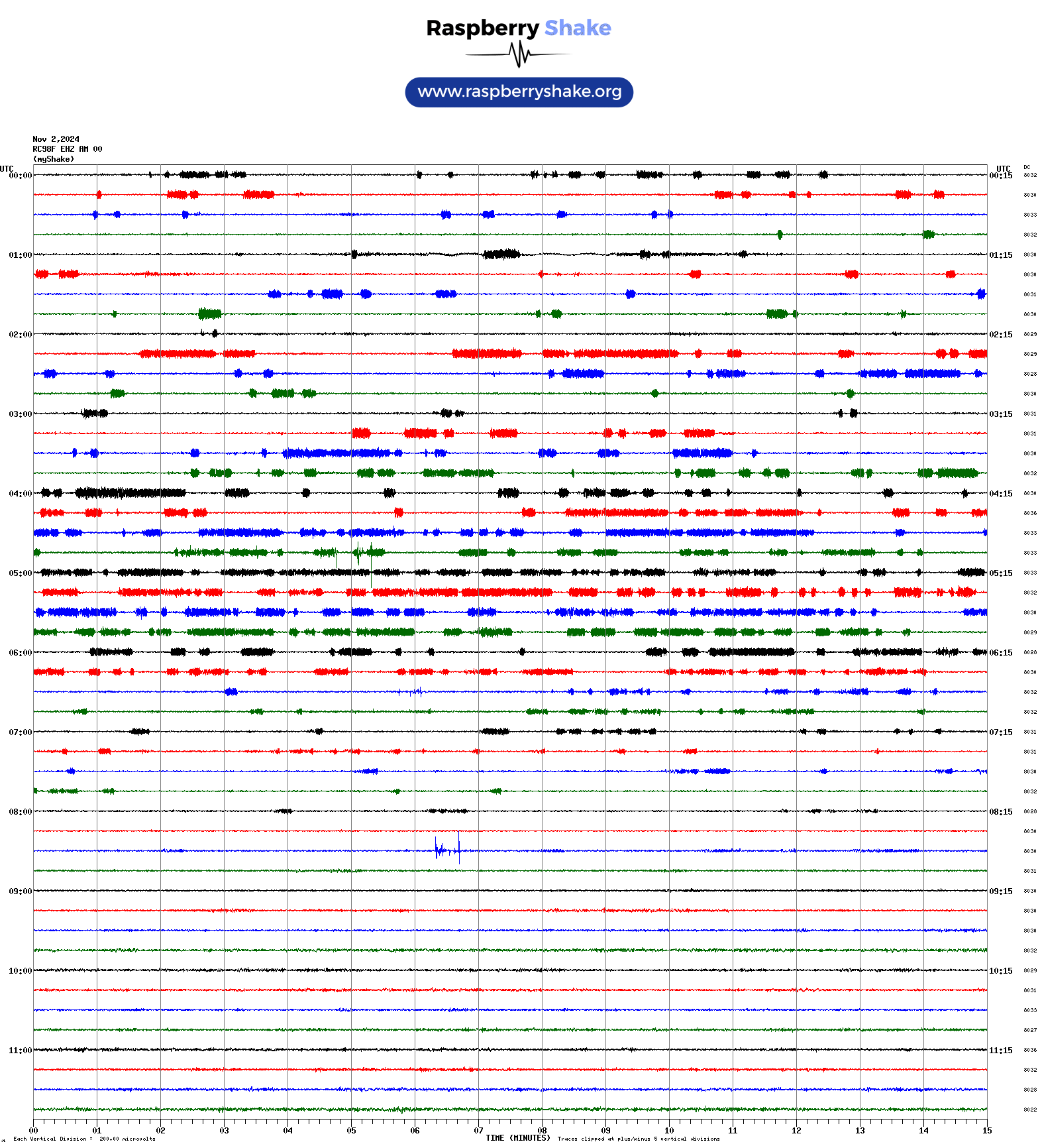
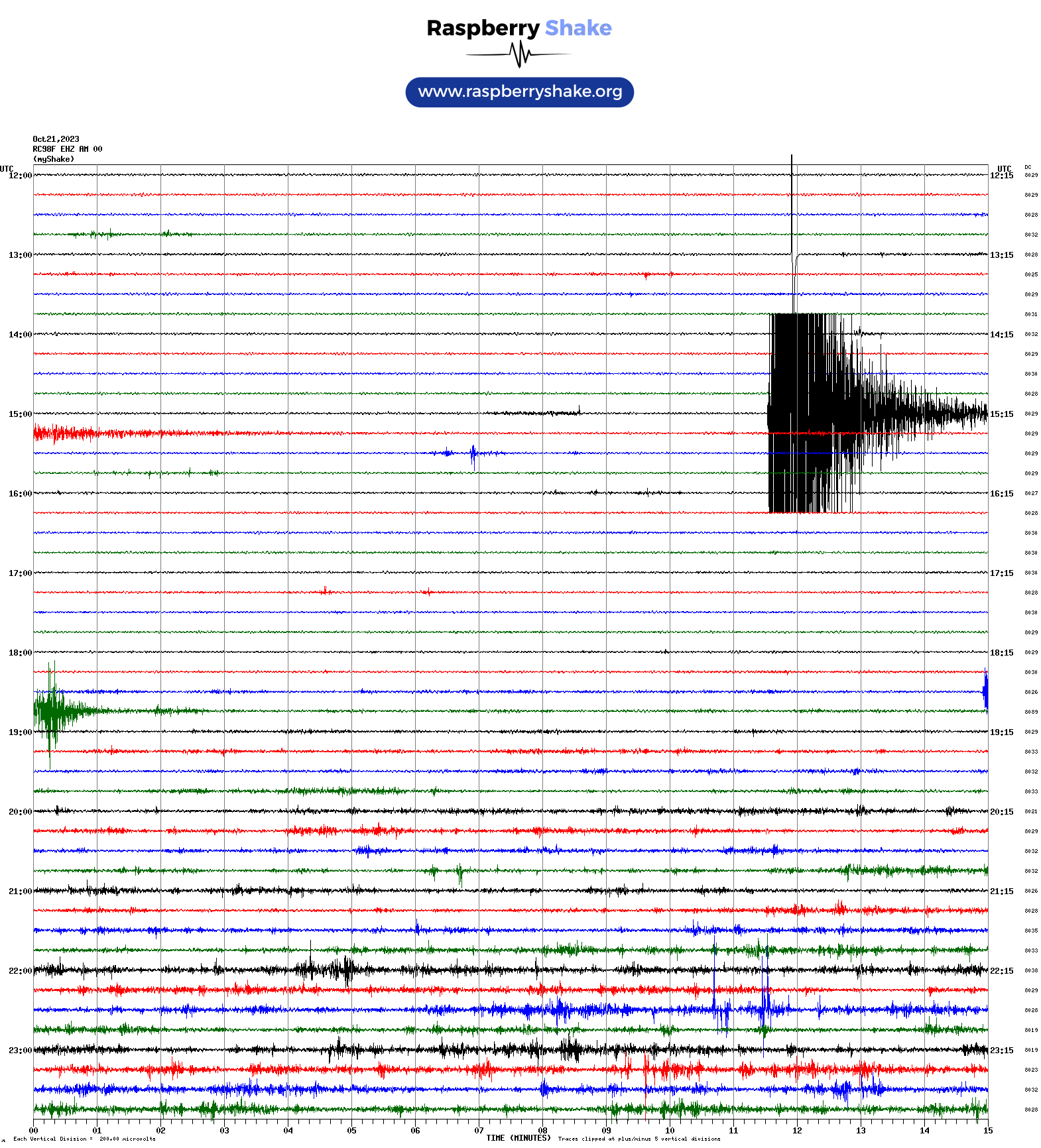
2:11am 22nd Oct 2023 Colac quake
Full details can be found at GeoScience Australia where it is listed as Colac, Victoria
The Helicorder and swarm images below are from this Raspberry Shake unit.
|
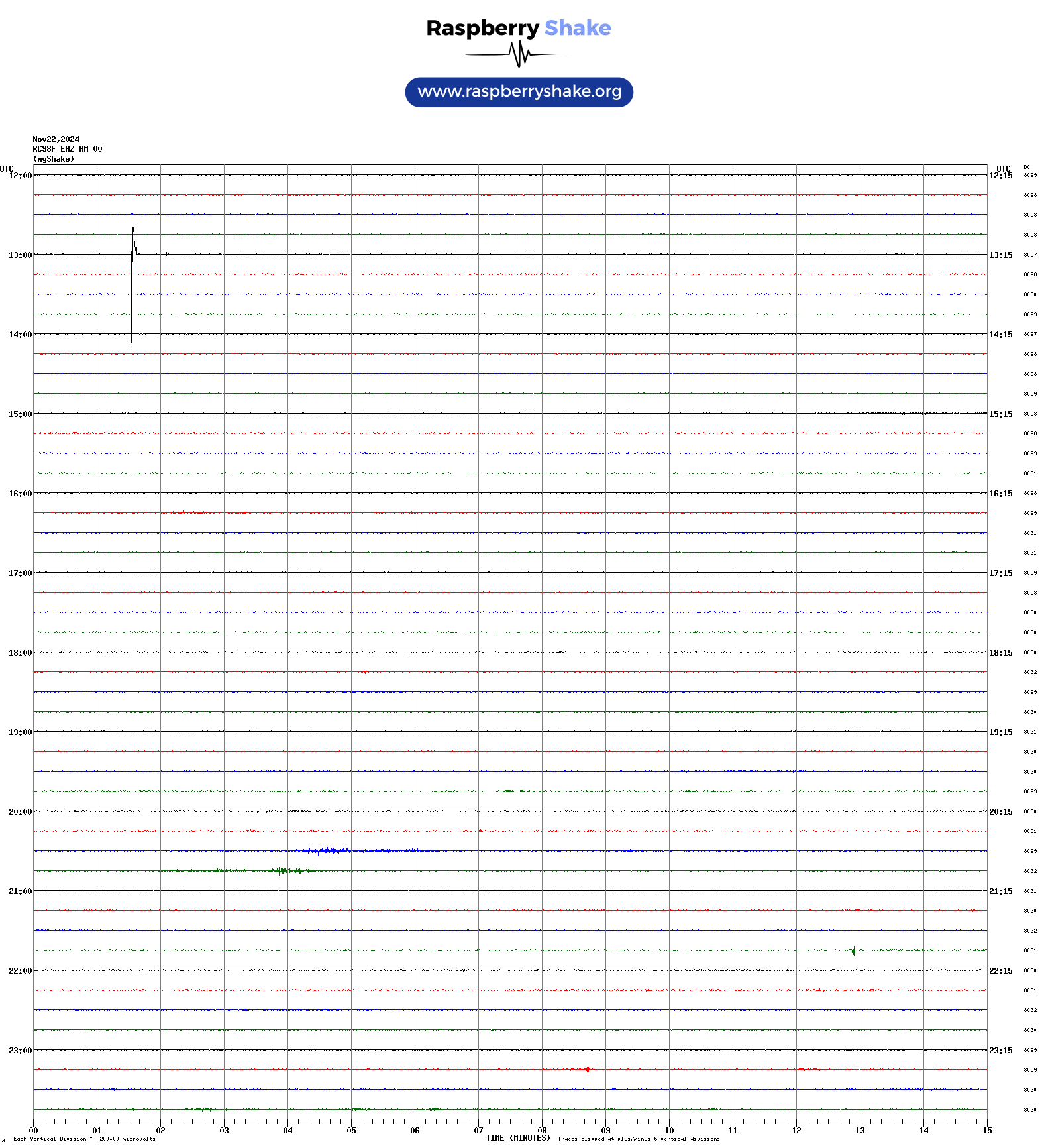
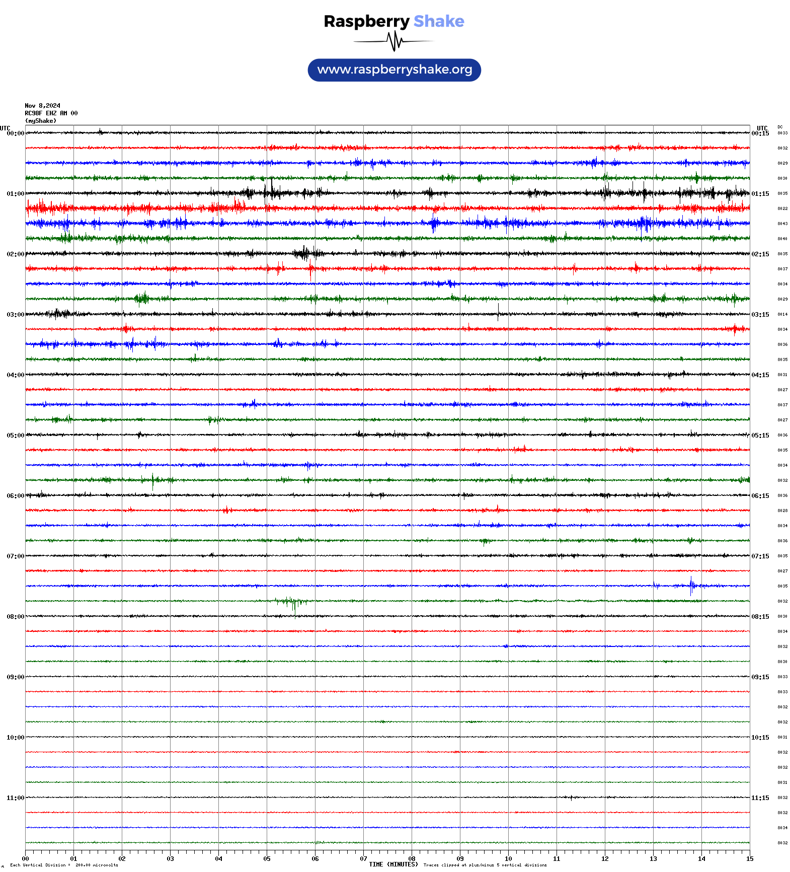
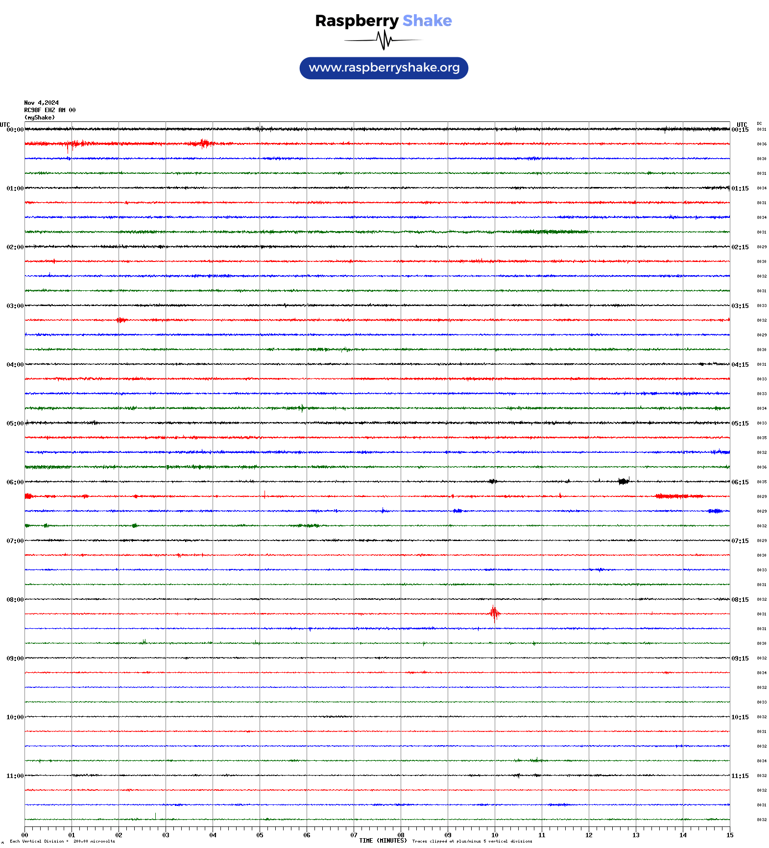
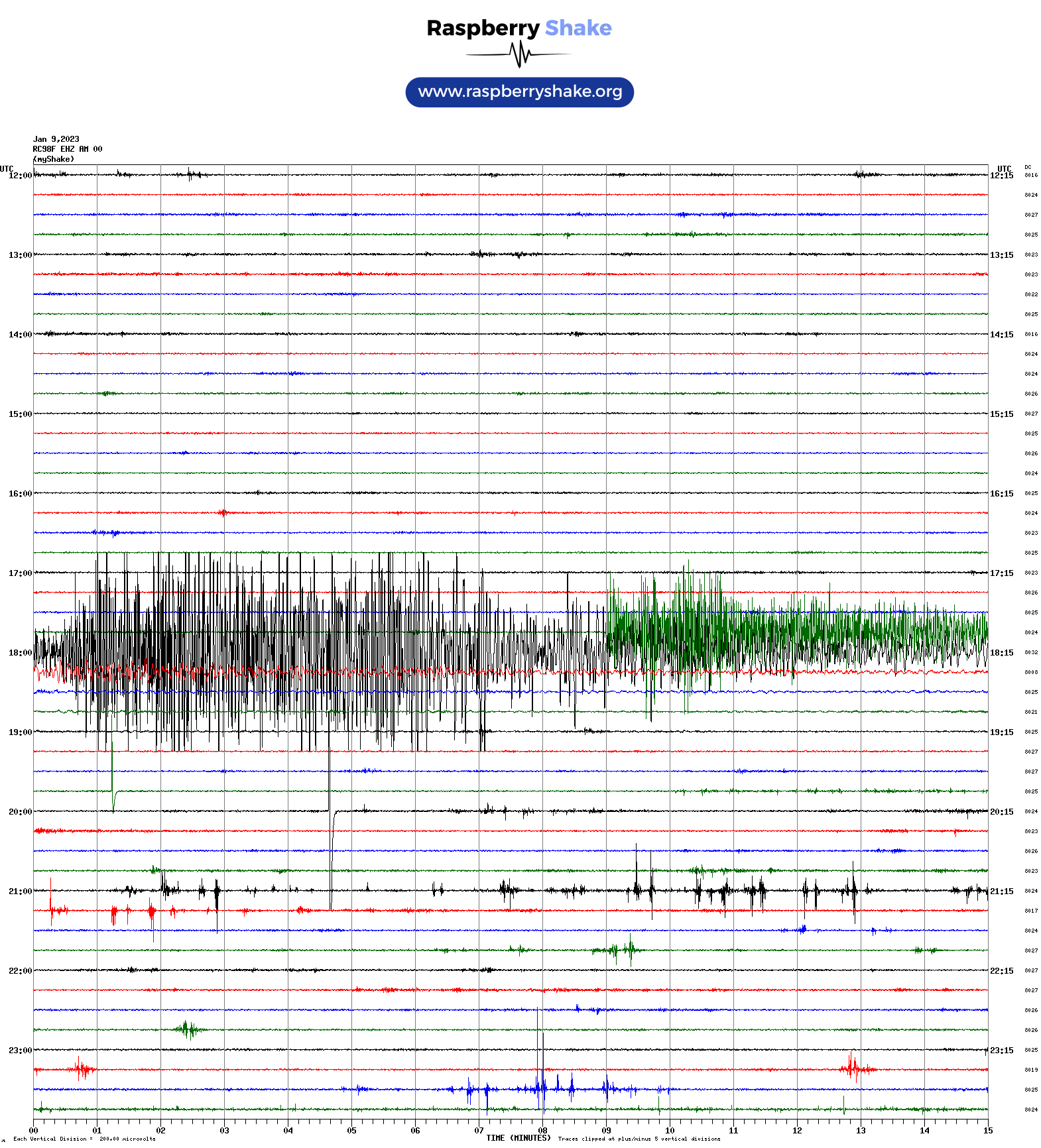
17:54 9th Jan 2023 Banda Sea quake
Full details can be found at GeoScience Australia where it is listed as Banda Sea
The Helicorder image below is from this Raspberry Shake unit.
|
9:17am 22nd Sept 2021 Mansfield quake
Full details can be found at GeoScience Australia where it is listed as N of Rawson, Victoria
The Helicorder image below is from this Raspberry Shake unit.

|
This station uses an OWFS to collect data from various one-wire sensors
that are connected to a raspberry Pi 2
micro computer.
This data is then collected and displayed by weeWX, an
experimental weather software system written in Python.
This raspberry pi runs with a read only filesystem
This location also participates in the Blitzortung lightning detection, the UradMon radiation and environment monitoring, and the RaspberryShake earthquake monitoring Networks.
Radar, satellite, and rain images are courtesy of the Australian Government Bureau of Meteorology, 2017.
Fire rating image is courtesy of CFA Victoria, 2017